Inverness City Zoning Code
Sec. 2.11
Resource Protection.
A.
Environmental Sensitive Lands.
1.0.
Purpose and intent. The purpose and intent of these regulations is to enhance the resource protection within the City of Inverness, to implement applicable goals, objectives and policies of the city's comprehensive plans, as mainly set forth in the Future Land Use Plan and the Conservation Plan elements.
1.1.
[Protection of the functions.] To provide for these regulations, the protection of beneficial functions of environmentally sensitive lands shall include the following:
a.
Maintaining recharge capacity of groundwater aquifers.
b.
The city shall not issue a permit to new development construction on water bodies until clearance has been granted by involved state agencies, such as Southwest Florida Water Management District, Department of Environmental Regulations and Army Corps of Engineering, or approved exemption.
c.
The city shall not issue a permit until all provisions of the Flood Damage Prevention Ordinance has been thoroughly considered. (Chapter 9.5, Code of Ordinances)
d.
A minimum setback of fifty (50) feet from water bodies shall be established for all new development.
e.
The city shall, in working with Department of Environmental Regulations and Southwest Florida Water Management District continue to monitor groundwater quality; work with the county to provide adequate sewer facilities in the lake areas to eliminate septic tanks and in conjunction with the county; provide protection for all public supply wells by restricting development activities detrimental to those areas.
f.
All new development in the city shall connect to the city sewer services.
2.0.
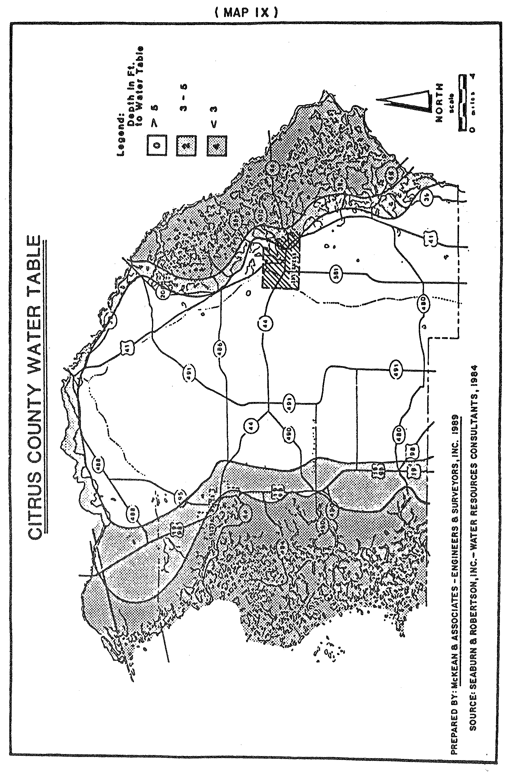
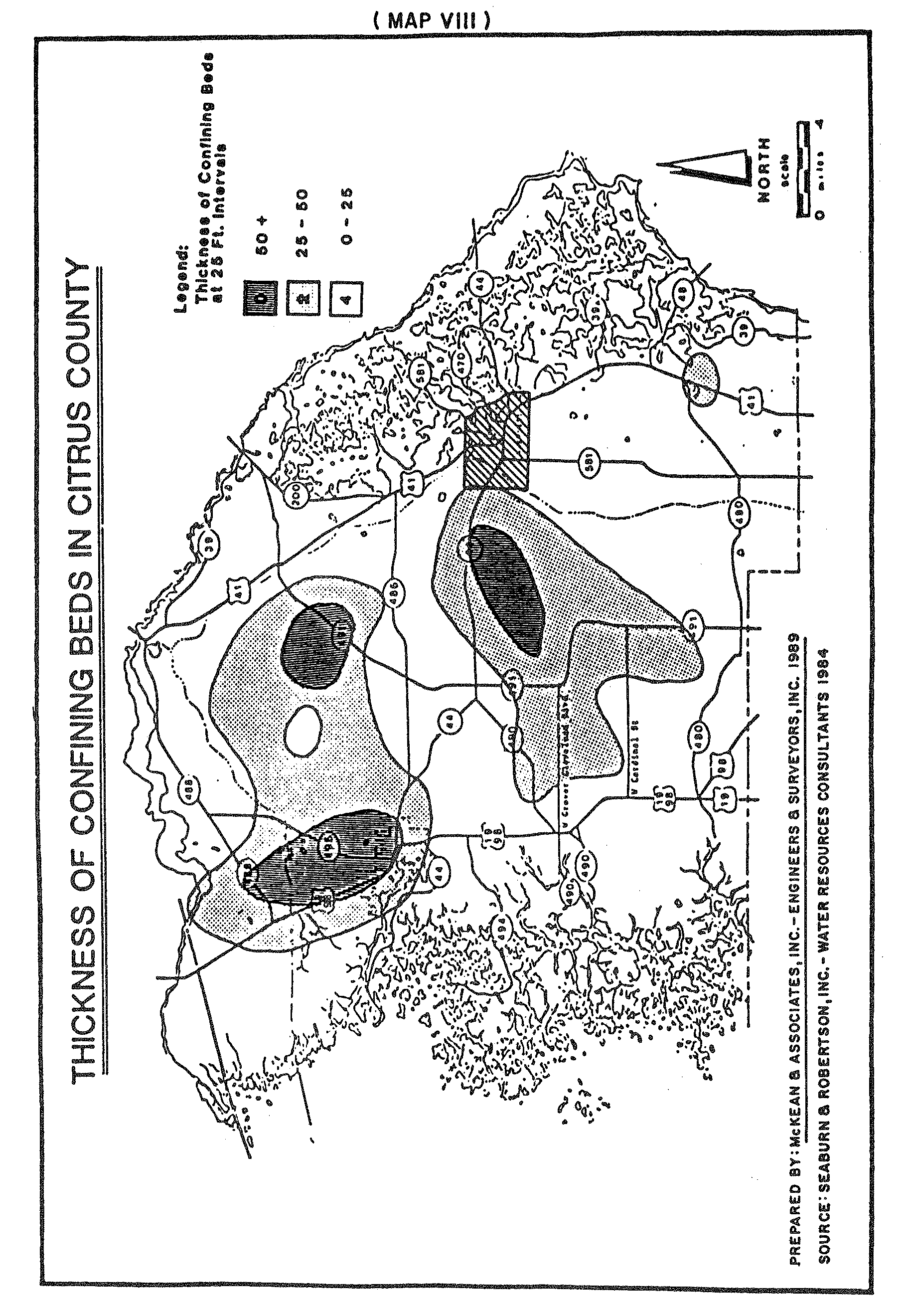
Applicability. These regulations shall apply to any use or alteration of a parcel which contains environmentally sensitive lands within the corporate limits of the City of Inverness. Environmentally sensitive lands include wetlands, soils with limited potential for certain manmade activities, flood-prone areas and areas with effective groundwater aquifer recharge characteristics.
a.
Wetlands: Wetlands are land and/or water areas where the water table is at, near or above the land surface for a significant part of most years. Wetlands shall include but not be limited to areas identified by the Southwest Florida Water Management District.
A copy of the Land Use and Vegetation Inventory Map Series that includes areas located within the City of Inverness shall be on file and available for public inspection at the office of the designated Administrative Official.
b.
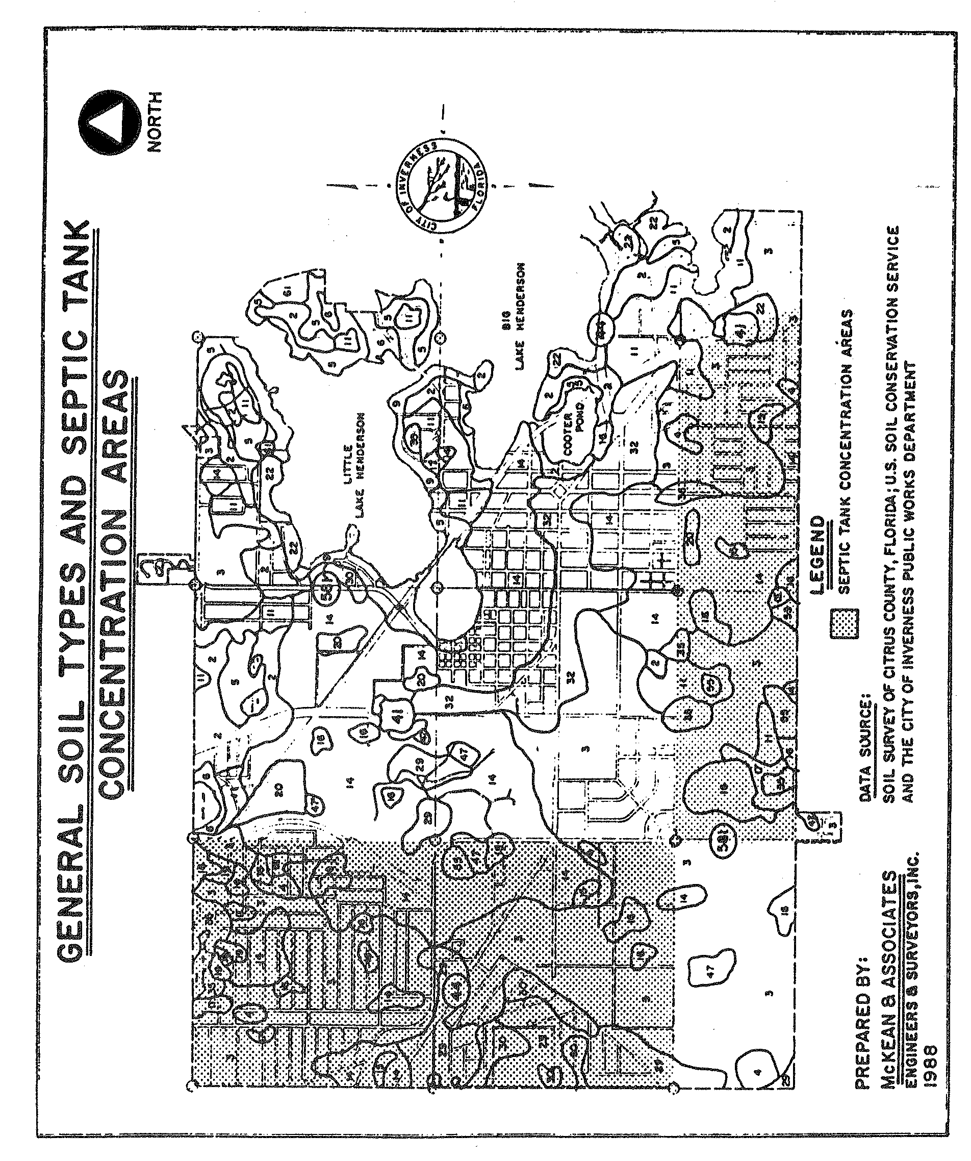
Soils: Environmentally sensitive lands include areas classified with the following soil types because such areas evidence significant limitations for the purpose of constructing local roads, streets, low commercial buildings and/or dwellings without basements.
There are a variety of soil types found in the City of Inverness. (See Map VI) The major soil types found in the City are described below according to the Soil Interim Report, 1984 by the Soil Conservation Service.
Clander-Lake-Astula are excessively drained soils that are sandy throughout. Some have a thin lamella of loamy sand and sandy loam at a depth of forty-eight (48) to eighty (80) inches. These areas are generally good for development due to the soils high infiltration rate which enhances site development and drainage conditions.
Tavares-Adamsville are moderately well drained, to somewhat poorly drained soils that are sandy to a depth of eighty (80) inches or more.
Basiger-Eau-Gallie-Myakka are poorly drained sandy soils. Some may have a dark organic stained layer at a depth of less than thirty (30) inches.
A copy of the Soil Survey of Citrus County, Florida and any supplements thereof depicting the location and extent of the above soil types in the City of Inverness as prepared by the United States Department of Agriculture and will be maintained by the Building and Zoning Department.
c.
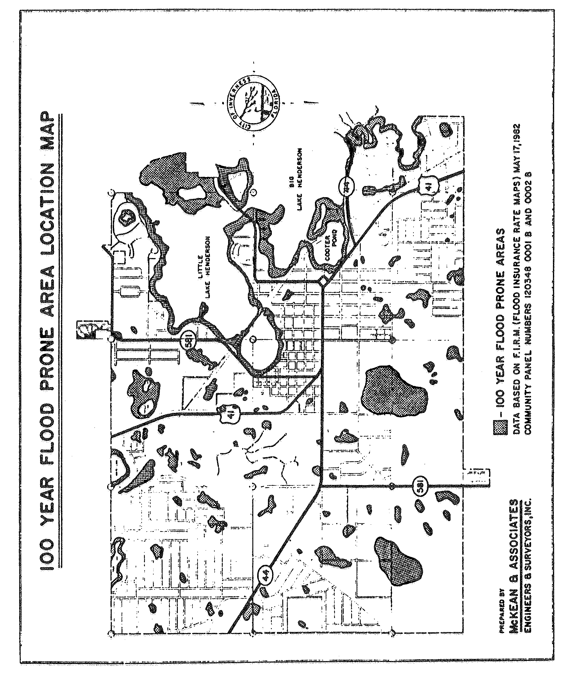
Flood-prone areas: Flood-prone areas include areas located in Floodways and Zone "A" of the Flood Insurance Rate Map prepared by the Federal Emergency Management Agency applicable to areas located in the City of Inverness. In addition to regulation of flood-prone areas contained in this schedule, (see Chapter 9.5, City Code of Ordinances). Flood damage prevention, as amended, for regulations applicable to construction in flood hazard areas and said map will be maintained in the Building and Zoning Department.
d.
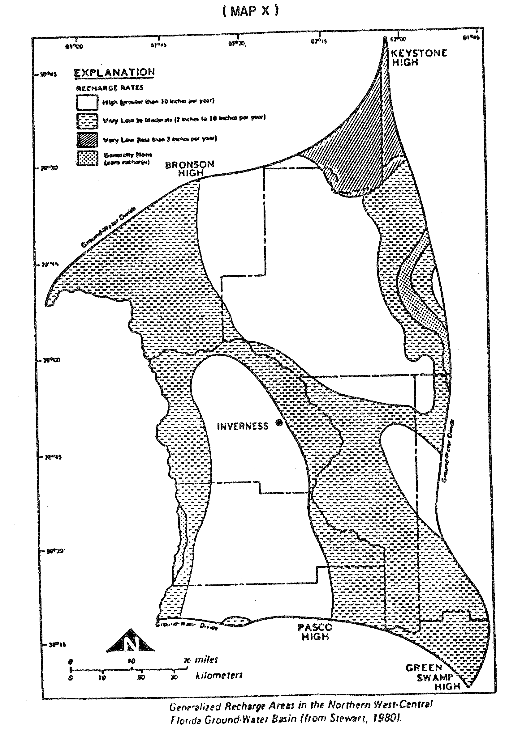
Groundwater aquifer recharge areas: Effective groundwater aquifer recharge areas shall include those areas identified as "most effective" and "moderately effective" by the Florida Department of Natural Resources. Such information shall be delineated on the Water Resource Map, 1″—1,000′, compiled by and available for public inspection at the office of the designated Administrative Official.
3.
Wetlands and soil limitation submittal requirements. When a lot or tract contains wetlands and/or soil types identified in subsection 2.0a and b above, applications for rezoning, (at the discretion of the Plan Review Committee) conditional use approval, proposed site plan, preliminary subdivision plan, planned development project approval and/or site development permits not preceded by the aforementioned approval requests shall include submittal requirements as set forth below:
a.
Environmental evaluation: A survey must be prepared by a qualified individual or agency for lands that are classified as wetlands. Such a survey shall determine the location, extent and viability of wetlands and significant habitat areas and shall identify agencies with jurisdiction for permitting and type of required permits/approval.
b.
Soil survey: Must be prepared by a qualified individual or agency. Such a survey shall determine the general feasibility of and/or methods to develop building sites or otherwise conduct the proposed or permitted use of the premises.
c.
Engineering analysis and design: Must be prepared by a professional engineer to determine, based on soil and environmental information, general location of potential building site(s), drainage concept and general statement that explains development feasibility and potential impact of potential development upon wetlands. Natural drainage flow and characteristics shall be identified. Hydrologic records of the area shall be provided. Design shall include the location and design of water retention/detention facilities, the extent of dredging and filling activity and the amount and extent of demucking necessary to achieve proposed development potential.
The above described environmentally sensitive lands submittal requirements shall be provided in report, chart, scaled drawing and other appropriate form acceptable to the designated Administrative Official and as otherwise required by this Code. Acreage and percentage of parcel area calculations shall be provided for the parcel and portions of the parcel with an identification or classification related to information required in paragraphs a, b and c above. Quantitative and qualitative data shall demonstrate compliance with design and performance criteria set forth in subsection 3.1 below.
3.1.
Wetland design and performance criteria. Uses and activities in wetlands shall comply with the following design and performance criteria:
a.
Retain natural drainage characteristics: Natural surface water patterns shall be maintained. Proposed drainage conditions shall approximate existing drainage conditions. The velocity of water flowing through wetlands shall remain approximately the same before and after development.
b.
Minimize alteration or modification: No land use or development shall be permitted that would result in the elimination of any beneficial function of a wetland. If permitted, any alteration or modification of wetlands shall be the minimum necessary to conduct the use or activity.
c.
Stormwater: The use of cypress, hardwood swamp, bayhead and hydric hammock wetlands for water retention shall be permitted when utilized to decompose dissolved organics and when such wetlands are not connected to surface waters. Stormwater detention basins shall screen, filter, trap and/or otherwise prevent sediment and debris and minimize the amount of chemicals entering wetlands. Channelization of water to or through a wetland shall not be permitted.
d.
Wetland buffer: A wetland buffer of fifteen (15) feet in width shall be provided adjacent to wetlands that are five (5) acres or less; a wetland buffer of fifty (50) feet in width shall be provided adjacent to wetlands that are greater than five (5) acres. The area of wetlands in question shall include all contiguous wetlands located on the site and adjacent to the site. The width of the wetland buffer shall be measured and provided parallel to the edge of the wetland in question. The required wetland buffer shall, unless otherwise provided for in this Code, be planted and maintained in landscaping materials including ground cover, shrubs, hedges or trees. The following uses shall be permissible within a wetland buffer:
1)
Walkways that maintain the integrity of the wetland;
2)
Required landscaped areas.
The following uses shall be prohibited within a wetland buffer:
1)
Vehicular use areas, offstreet parking and/or loading and service areas;
2)
Buildings.
In addition, all off-street parking spaces located adjacent to a wetland buffer shall be provided with appropriate tire stops, curbs or other vehicular bumper guards designed to prevent any encroachment of vehicle upon the required buffer.
3.2.
Floodprone area design and performance criteria. Use and activities in flood prone areas shall comply with the following design and performance criteria:
a.
Retention/detention facilities: Retention/detention ponds proposed to be located in flood prone areas shall:
1)
Ten-year flood plain: Be located above the ten-year flood elevation. No alteration shall be allowed within the ten-year flood line.
2)
Soil suitability: Be located in soils that are suitable for retention/detention ponds. Soils which have been identified by the Soil Conservation Service as having a very low potential for septic tank absorption fields shall be considered as unsuitable for retention/detention ponds.
3)
Floodway hazard: Not create a negative impact on existing flooding conditions. Construction of the retention/detention pond shall not constitute a net reduction in flood plain storage or limit the flow capacity of the floodway.
b.
Open space and recreational uses: Flood-prone areas may be used for open space and recreational uses. Recreation oriented structural improvements shall not impair the flood flow or flood storage capacity nor shall such structures contribute to the debris which may become swept up by flood waters. Open space and recreational uses include the following:
1)
Hiking and nature trails;
2)
Gazebos, picnic tables and resting benches;
3)
Boardwalks and observation decks;
4)
Open play areas;
5)
Canoe launches.
c.
Traversing works: Traversing works in flood-prone areas shall not create a net reduction in either flood flow or flood storage capabilities immediately upstream or downstream of the structure.
d.
Compensating storage: Reshaping and filling within flood-prone areas shall be balanced by providing an equal volume of compensating storage. Such compensation shall be located between the ordinary high water elevation and the 100-year elevation. Fill shall not be placed below the ten-year flood elevation and in no case shall fill in the flood plain extend beyond one hundred (100) feet of the original floodline. Reshaping the flood plain shall not create a rise in flood elevation, reduce flood storage capabilities, increase flood flow velocities or reduce flood flow capacity.
e.
Parking spaces and vehicular circulation areas: Required parking spaces and vehicular circulation areas located within flood-prone areas shall not cause a net decrease in flood storage or a change in flood flow capacity. Flood free emergency access must be maintained. Required parking spaces shall not be located within the ten-year flood elevation.
f.
Utilities: Utilities shall be located outside of flood prone areas wherever feasible. When it is not feasible to avoid placing utilities within a flood plain, such utilities shall comply with the following provisions:
1)
Materials: Materials and equipment shall be resistant to flood damage.
2)
Construction methods: Construction methods and practices shall minimize flood damage.
3)
Potable water supply: Potable water supply systems shall be designed and constructed to prevent damage by flood waters.
4)
Sanitary sewage system: Sanitary sewage systems shall be designed and constructed to eliminate infiltration of flood waters. Discharges shall be located to avoid impairment or contamination during flooding.
g.
Other: All proposed uses and activities to be located in flood prone areas that are not otherwise indicated in the Flood Damage Prevention section of Chapter 9.5, City Code of Ordinances, shall be subject to review and recommendation by the designated Administrative Official on an individual basis.
3.3.
Protecting environmentally sensitive lands during construction. When construction is proposed on or adjacent to environmentally sensitive lands, clearly identified and documented methods and techniques to protect such environmentally sensitive lands shall be submitted to and approved by the designated Administrative Official as a condition of issuance of a site development permit. Such methods and techniques shall include but not be limited to storage and removal of materials, equipment and debris; erosion control measures; measures to insure revegetation and/or stabilization of disturbed areas; measures to protect existing natural vegetation and habitat and methods to prevent pollution of wetlands and groundwater.
4.0.
Effective recharge areas/prohibited uses. The following uses and activities are prohibited in areas identified as effective recharge areas: mining; resource extraction including but not limited to excavation of sand and peat; junkyards and outdoor storage of hazardous materials and waste.
5.0.
Exemptions. Any applicant may request that required submittal information described in this schedule be omitted from the application in question, provided however, that such request shall be subject to the following requirements:
a.
The request shall be in written form and shall be submitted to the designated Administrative Official.
b.
The request shall identify the information, item or data that is proposed to be omitted from the application and shall fully explain the reasons that such information, item or data does not apply to such application.
c.
The designated Administrative Official has the authority to accept or reject such request.
6.0.
Land unsuitable for development. If, in the review of any land use or development located on environmentally sensitive lands, it is found that the land proposed to be developed is unsuitable for such development due to frequent flooding, bad drainage, unstable soil, topographic formations, wetland vegetation, sinkholes or other such conditions that may unduly increase the danger of health, life or property or aggravate erosion or flood hazards; and, if from adequate investigations conducted by the appropriate public official involved, it has been determined that in the best interest of the public the land should not be developed for the purpose proposed, the proposed use or development shall not be approved unless acceptable methods are formulated by the developer for meeting the problems that such development and land use will create. If there is any alleged error in any order, requirement, decision or determination related to the failure to approve a proposed land use or development due to the fact the proposed land area is unsuitable for development, the aggrieved applicant or other interested person, including any officer, department or agency of the city, may make an administrative appeal to the Zoning Board of Adjustments as provided in this Code.
B.
Historical and/or Archaeological Area Protection.
1.
Purpose and intent. The purpose of this section is to describe those requirements necessary to promote the educational, cultural and economic welfare of the public by preserving and protecting historical structures, sites, monuments, areas, neighborhoods, and as well as areas of archaeological significance. Furthermore, it is the purpose of this section to strengthen the economy of the city by stabilizing and improving property values in historical areas, encouraging new development which is harmonious with existing historical and archaeological resources in the area, and preserving and enhancing areas that reflect the city's cultural, social, economic, political and architectural history.
2.
Applicability. The requirements of this section apply to all sites identified through survey, study or other evidence as being of potential historical or archaeological significance to the city.
3.
Development requirements.
a.
The site shall be presumed to have historical or archaeological significance if it meets one of the following criteria:
1)
The site is listed on the National Register of Historic Places;
2)
The site is within a district listed on the National Register of Historic Places;
3)
The site has been identified and designated by the city, following a professionally conducted survey or study, to be of local importance (whether or not it is to be submitted for inclusion of the Florida Master Site File or for consideration for the National Register of Historic Places).
b.
Sites that are required to comply with this section shall submit a Historical/Archaeological Impact/Mitigation Report which report is to provide evidence of probable or potential impact of the proposed development upon the historical and/or archaeological significance of the site, and further, to provide details on proposed mitigation procedures to be used during and after development. The report will be reviewed by the Architectural/Aesthetics Review Committee for compliance with the code.
1)
The proposed use of an existing historically significant structure shall be compatible with the property and the surrounding district. Permitted uses in addition to those allowed in the district in which the historic property exists shall be permitted if approved as a Special Exception Use. In consideration of the Special Exception Use, the use shall be restricted to limit the intensity of the use on surrounding property and to maintain the character of the neighborhood.
2)
The distinguishing original qualities or character of a building, structure or site and its environment shall not be destroyed. Removal or alteration of any historic material or distinctive architectural features should be avoided when possible. However, archaeological sites may be excavated and studied by an archaeologist listed by the Division of Historic Resources, Florida Department of State.
3)
All buildings, structures and sites shall be recognized as products of their own time. Alterations that have no historical basis and which seek to create an earlier appearance shall be discouraged.
4)
Changes that may have taken place in the course of time are evidence of the history and development of a building, structure or site and its environment. These changes may have acquired significance in their own right and this significance shall be recognized and respected.
5)
Distinctive stylistic features or examples of skilled craftsmanship that characterize a building, structure or site shall be treated with sensitivity.
6)
Deteriorated architectural features shall be repaired rather than replaced wherever possible. In the event replacement is necessary, the new material should match the material being replaced in composition, design, color, texture and other visual qualities. Repair or replacement of missing architectural features should be based on accurate duplications of features as substantiated by historic, physical or pictorial evidence rather than on conjectural designs or the availability of different architectural elements from other buildings or structures.
7)
The surface cleaning of structures shall be undertaken with the gentlest means possible. Sandblasting and other cleaning methods that could damage historic building materials shall be discouraged.
8)
Every reasonable effort shall be made to protect and preserve archaeological resources affected by or adjacent to any project.
9)
Wherever possible, new additions or alterations to structures shall be done in such a manner that, if such additions or alterations were to be removed in the future, the essential form and integrity of the structure would be unimpaired.
10)
Where application of site development regulations of this code would result in significant alteration of the historically distinguishing qualities or character of a building, structure, or site and its environment, a Special Exception Use permit for the property may be granted, if justified, with conditions alleviating any or all of the site development requirements.
c.
Historic structures may be demolished following appropriate documentation and approval by the Architectural/Aesthetic Review Committee and/or other appropriate agencies.
d.
Historically significant housing: The proposed widening of U.S. 41 required that a study be done to determine if any potential historic places exist where right-of-way taking would occur. The Florida Department of Transportation determined that eleven (11) structures are eligible for inclusion on the National Register of Historic Places. Of the eleven (11), seven (7) are houses; they are located at:
1)
301 W. Main Street (Realty World)
2)
311 W. Main Street (Inverness Women's Club)
3)
312 W. Main Street (Caldwell Banker Real Estate)
4)
410 W. Main Street (Single Family Residence)
5)
412 W. Main Street (Single Family Residence)
6)
414 W. Main Street (Single Family Residence)
7)
401 Tompkins Street (Single Family Residence)
Since the study was completed, House No. 6 above has been relocated to a site outside of the city limits. Two (2) other houses, numbers 1 and 3, have been refurbished and are being used commercially. None, to date, have been placed on the National Register of Historic Places.*
The remaining structures that are eligible for inclusion on the National Register of Historic Places* have the following locations:
Old Courthouse — Main and Apopka
Ocala Star Banner — Main, between Pine and Apopka
Masonic Building — Corner of Pine and Main
1911 Building — 107 West Main
e.
Conservation of historic housing: The preservation of historically or architecturally valuable structures within the city is actively implemented through private investment and the City's enforcement of the Historic Preservation Ordinance and accompanying Historical, Architectural, and Archaeological Survey. While these efforts should be continued, the federal programs available to complement the private preservation efforts (Historical Preservation Grants-in-Aid; National Register of Historical Places in conjunction with provisions of the Tax Reform Act of 1976; Urban Development Action Grant, etc.) should be pursued by the city and appropriate organizations.
The downtown area of Inverness continues to experience private revitalization efforts in residential rehabilitation. The formulation of a preservation district to work in conjunction with the Citrus County Historical Society, would promote continued historical buildings rather than demolition.
*Citrus County Historical Society
4.
Architectural/Aesthetic Review Committee.
a.
Purpose: The purpose of this subsection is to promote the educational, cultural, economic, and general welfare of the community by:
1)
Providing a mechanism to identify and preserve the distinctive historic and architectural characteristics of Inverness which represent elements of the city's cultural, social, economic, political, and architectural history;
2)
Fostering civic pride in the beauty and noble accomplishments of the past as represented in Inverness landmarks and historic areas;
3)
Conserving and improving the value of property designated as historic or within historic areas;
4)
Protecting and enhancing the attractiveness of the city to home buyers, tourists, visitors, and shoppers, and thereby supporting and promoting business, commerce, industry, and providing economic benefit to the city.
5)
Fostering and encouraging preservation, restoration, and rehabilitation of structures, areas, and neighborhoods and thereby preventing future urban deterioration.
b.
Definitions: Unless specifically defined below, words or phrases in this section shall be interpreted so as to give them the same meaning as they have in common usage and so as to give this section its most reasonable application.
1)
Alteration means any act or process that changes one (1) or more of the exterior architectural features of a structure, including, but not limited to, the painting, erection, construction, reconstruction, or removal of any structure.
2)
Architectural/Aesthetic Review Committee means a nine-member committee appointed by City Council to review and make recommendations concerning historic and archaeological properties.
3)
Area means a specific geographic division of the City of Inverness used to identify historic properties.
4)
Central Business District means the downtown area of Inverness as designated by the Inverness Land Development Code which has been established as an historic district.
5)
Certificate of appropriateness means a certificate issued by the Architectural/Aesthetic Review Committee indicating its approval of plans for alteration, construction, removal, or demolition of an historic structure.
6)
Certificate of economic hardship means a certificate issued by the Architectural/Aesthetic Review Committee indicating that a property owner will be deprived of reasonable use or economic return on their property thereby authorizing an alteration, construction, removal, or demolition, even though a certificate of appropriateness has previously been denied.
7)
Construction means the act of adding an addition to an existing structure or the erection of a new principal or accessory structure on a lot or property.
8)
Council means the City Council of the City of Inverness.
9)
Demolition means any act or process that destroys in part or in whole a structure.
10)
Design guideline means a standard of appropriate activity that will preserve the historic and architectural character of a structure or area.
11)
Exterior architectural appearance means the architectural character and general composition of the exterior of a structure, including but not limited to the kind, color, and texture of the building material and the type, design, and character of all windows, doors, light fixtures, signs, and appurtenant elements.
12)
Historic district means the area designated as the Central Business District (CBD) by ordinance of the City Council and which may contain within definable geographic boundaries one or more historic properties and which may have within its boundaries other properties or structures that, while not of such historic and/or architectural significance to be designated as historic, nevertheless contribute to the overall visual characteristics of historic properties located within the historic district.
13)
Owner of record means the person, corporation, or other legal entity listed as owner in the public records of Citrus County.
14)
Removal means any relocation of a structure on its site or to another site.
15)
Repair means any change that is not construction, removal, or alternation.
16)
Structure means anything constructed or erected, the use of which requires permanent or temporary location on or in the ground, including, but without limiting the generality of the foregoing, buildings, fences, gazebos, advertising signs, billboards, backstops for tennis courts, radio and television antennae, including supporting towers, and swimming pools.
c.
Composition of Architectural/Aesthetic Review Committee: The Architectural/Aesthetic Review Committee shall consist of seven (7) regular and two (2) alternate members appointed by the City Council. All members shall serve without compensation, but may be reimbursed for actual expenses incurred in connection with their official duties. Members shall be residents of Inverness or own property in the city or be engaged in a business in the city, which means owning a business, practicing a profession, or performing a service for compensation, or serving as an officer or director of a corporation or other business entity so engaged, within the City of Inverness. The City Council shall make every reasonable effort to appoint persons with a demonstrated interest in the history or architecture of the City of Inverness, and shall attempt to include an architect, attorney, building contractor, real estate professional, banker, and a resident or owner of a historic structure.
d.
Terms: The term of office of the members of the committee shall be for four (4) years, excepting that the membership of the first committee appointed shall serve respectively for terms of two (2) for one (1) year; two (2) for two (2) years; two (2) for three (3) years; three (3) for four (4) years. Alternate members shall serve for a period of one (1) year. Alternate members shall be appointed to serve in the absence of or the disqualification of the regular members. Absence from more than fifty (50) percent of scheduled regular committee meetings, from the date of appointment and during any twelve-month period thereafter, shall make the committee member ineligible for reappointment. Vacancies shall be filled for the unexpired term only. Members may be removed for cause by the city council upon written charges and after public hearing.
e.
Officers: Officers shall consist of a chairman and a vice-chairman elected by the committee who shall each serve a term of one (1) year and shall be eligible for re-election. The chairman shall preside over meetings. In the absence of the chairman, the vice-chairman shall perform the duties of the chairman. If both are absent, a temporary chairman shall be elected by those present. A secretary to the committee shall be assigned from city staff to provide administrative support to the committee.
f.
Meetings: A quorum shall consist of four (4) of the members. All decisions or actions of the committee shall be made by a majority vote of those members present and voting at any meeting where a quorum exists. Meetings shall be held at regularly scheduled times to be established by the committee at the beginning of each calendar year or at any time upon the call of the chairman. No member of the committee shall vote on any matter that may materially or apparently affect the property, income, or business interest of that member. No action shall be taken by the committee that could in any manner deprive or restrict the owner of a property in its use, modification, maintenance, disposition, or demolition until such owner shall first have had the opportunity to be heard at a public meeting of the committee, as provided herein. The chairman, and in his absence the acting chairman, may administer oaths and request the attendance of witnesses. All meetings of the committee shall be open to the public. The committee shall keep minutes of its proceedings, showing the vote, indicating findings of fact, and shall keep records of its examinations and other official actions, all of which shall be filed in the office of the City Clerk and shall be a public record.
g.
Powers and Duties: The committee shall have the following powers and duties:
1)
To adopt its own procedural regulations;
2)
To request survey updates that identify historically and architecturally significant properties, structures, and areas that exemplify the cultural, social, economic, political, or architectural history of the nation, state, or city;
3)
To keep a register of all properties and structures that have been designated as historic structures or districts, including all information required for each designation;
4)
To review applications for construction, alteration, removal, or demolition affecting proposed or designated historic structures and issue or deny certificates of appropriateness for such actions. Applicants may be required to submit plans, drawings, elevations, specifications, and other information as may be necessary to make decisions;
5)
To consider applications for certificates of economic hardship that would allow the performance of work for which a certificate of appropriateness has been denied;
6)
To develop specific design guidelines for the alteration, construction, or removal of historic landmarks or property and structures.
7)
To make recommendations to City Council concerning the recognition upon the owners historic properties or structures by means of certificates, plaques, or markers;
h.
Certificate of Appropriateness: A certificate of appropriateness shall be required before the following actions affecting the exterior architectural appearance of any historic property or structure within the Central Business District may be undertaken:
1)
Any construction, alteration, or removal requiring a building permit from the Building Division.
2)
Any demolition in whole or in part requiring a permit from the Building Division.
3)
Any construction, alteration, demolition, or removal affecting a significant exterior architectural feature or structures which contribute to the overall visual characteristics of an historic property.
i.
Application for Certificates of Appropriateness: Every application for a demolition permit or a building permit, including the accompanying plans and specifications, affecting the exterior architectural appearance of a property within a Central Business District or historic structure within the city limits shall be forwarded by the Development Services Department to the Committee within three (3) days following receipt of the application by the Development Services Department. The Building Division shall not issue the building or demolition permit until a certificate of appropriateness has been issued by the committee. Any applicant may request a meeting with the committee before the application is sent by the Development Services Department to the committee or during the review of the application. Application for review of construction, alteration, demolition, or removal not requiring a building permit for which a certificate of appropriateness is required shall be made on a form prepared by the Committee and available at the Department of Development Services. The committee shall consider the completed application at its next regular meeting.
j.
Determination by Architectural/Aesthetic Review Committee: The committee shall review the application for a building or demolition permit or for a certificate of appropriateness and issue or deny the certificate of appropriateness within fifteen (15) days of receipt of the application. Written notice of the approval or denial of the application for a certificate of appropriateness shall be provided to the applicant and the Development Service Department within five (5) days following the determination and shall be accompanied by a certificate of appropriateness in the case of an approval.
k.
Denial of a Certificate of Appropriateness: A denial of a certificate of appropriateness shall be accompanied by a statement of the reason for the denial. The committee shall make recommendations to the applicant concerning changes, if any, in the proposed action that would cause the committee to reconsider its denial and shall confer with the applicant and attempt to resolve as quickly as possible the differences between the applicant and the committee. The applicant may resubmit an amended application or reapply for a building or demolition permit that takes into consideration the recommendations of the committee.
l.
Standards for Review: In considering an application for a building or demolition permit or for a certificate of appropriateness, the committee shall be guided by the following general standards in addition to design guidelines for historic district or structure:
1)
That the proposed site plan is consistent with all applicable goals, objectives, policies and standards in the City of Inverness Comprehensive Plan, Inverness Community Redevelopment Agency Plan, and Land Development Code.
2)
That the proposed site plan meets or exceeds all applicable minimum standards and requirements as set forth in this Code.
3)
Every reasonable effort shall be made to provide a compatible use for a property that requires minimal alteration of the building, structure, or site and its environment, or to use a property for its originally intended purposes.
4)
The distinguishing original qualities or character of a building, structure, or site and its environment shall not be destroyed. The removal or alteration of any historic material or distinctive architectural feature should be avoided when possible.
5)
All buildings, structures, and sites shall be recognized as products of their own time. Alterations that have no historical basis and that seek to create an earlier appearance shall be discouraged.
6)
Changes that may have taken place in the course of time are evidence of the history and development of a building, structure, or site and its environment. These changes may have acquired significance in their own right, and this significance shall be recognized and respected.
7)
Distinctive stylistic features or examples of skilled craftsmanship that characterize a building, structure, or site shall be treated with sensitivity.
8)
Deteriorated architectural features shall be repaired rather than replaced, wherever possible. In the event replacement is necessary, the new material should match the material being replaced in composition, design, color, texture, and other visual qualities. Repair or replacement of missing architectural features should be based on accurate duplication of features, substantiated by historic physical, or pictorial evidence, rather than on conjectural designs or the availability of different architectural elements from other buildings or structures.
9)
The surface cleaning of structures shall be undertaken with the gentlest means possible. Sandblasting and other cleaning methods that will damage the historic building materials shall be avoided if at all possible.
10)
Every reasonable effort shall be made to protect and preserve archaeological resources affected by, or adjacent to, any project.
11)
Contemporary design for alterations and additions to existing properties shall not be discouraged when such alterations and additions do not destroy significant historical, architectural, or cultural material, and such design is compatible with the size, scale, color, material, and character of the property, neighborhood, or environment.
12)
That the aesthetic impact of the proposed site plan will be compatible with existing and anticipated land use activities in the immediate neighborhood and that such application will not be injurious to the area involved or otherwise detrimental to the public interest, health, safety or welfare.
m.
Design Guidelines: Design guidelines for applying the criteria for review of certificates of appropriateness shall, at a minimum, consider the following architectural criteria:
1)
Height: The height of any proposed alteration or construction should be compatible with the style and character of the landmark and with surrounding structures in a historic area or district.
2)
Proportions of Windows and Doors: The proportions and relationships between doors and windows should be compatible with the architectural style and character of the landmark and with surrounding structures within a historic district.
3)
Relationship of Building Masses and Spaces: The relationship of a structure within a historic district to the open space between it and adjoining structures should be compatible.
4)
Roof Shape: The design of the roof should be compatible with the architectural style and character of the landmark and surrounding structures in a historic area or district.
5)
Landscaping: Landscaping should be compatible with the architectural character and appearance of the landmark and of surrounding structures and landscapes in historic area districts.
6)
Scale: The scale of the structure after alteration, construction, or partial demolition should be compatible with its architectural style and character and with surrounding structures in a historic district.
7)
Directional Expression: Facades in historic areas or districts should blend with other structures with regard to directional expression. Structures in a historic area should be compatible with the dominant horizontal or vertical expression of surrounding structures. The directional expression of a landmark after alteration, construction, or partial demolition should be compatible with its original architectural style and character.
8)
Architectural Details: Architectural details including materials, colors, and textures should be treated so as to make a historic property compatible with its original architectural style and character and to preserve and enhance the architectural style or character of the historic area or district.
n.
Certificate of Economic Hardship: Application for a certificate of economic hardship shall be made on a form prepared by the committee. The committee shall schedule a public meeting concerning the application with written notice to the applicant, and any person may testify at the meeting concerning the economic hardship.
The committee may solicit expert testimony or require that the applicant for a certificate of hardship make submissions concerning any or all of the following information before it makes a determination on the application:
1)
Estimate of the cost of the proposed construction, alteration, demolition, or removal and an estimate of any additional cost that would be incurred to comply with the recommendations of the committee for changes necessary for the issuance of a certificate of appropriateness;
2)
A report from a licensed contractor, pest control, engineer or architect with experience in rehabilitation as to the structural soundness of any structures on the property and their suitability for rehabilitation;
3)
In the case of a proposed demolition, an estimate from an architect, developer, contractor, appraiser, or other real estate professional experienced in rehabilitation as to the economic feasibility of rehabilitation or reuse of the existing structure on the property.
o.
Determination of Economic Hardship: The committee shall review all the evidence and information required of an applicant for a certificate of economic hardship and make a determination within fifteen (15) days of receipt of the application whether the denial of a certificate of appropriateness has deprived, or will deprive, the owner of the property of reasonable use of, or economic return on, the property. Written notice of the determination shall be provided to the applicant.
p.
Cancellation of Certificate of Approval: Cancellation of certificate of approval shall be for the following reasons:
1)
Failure of the applicant, agent, or holder of a certificate of approval to comply with or honor any express requirement of this Code or express representation contained within the site plan before or after commencement of construction shall constitute grounds upon which the committee may revoke a certificate of approval.
2)
Failure to submit a final site plan within six (6) months of the approval date of a site plan shall result in cancellation of the approval of the site plan.
3)
A certificate of approval shall be cancelled unless, within twelve (12) months after its approval becomes effective, construction is not substantially commenced in accordance with an approved site plan. Thereafter, such construction shall continue to completion without interruption; otherwise, such certificate of approval may be cancelled by the committee upon notice to the holder of the certificate and after a reasonable opportunity to be heard has been afforded to the holder. Interruption is evidenced by one hundred eighty (180) days or more of construction inactivity on the site. In the event of cancellation pursuant to this section, the premises affected shall not be used or occupied without first applying for and obtaining approval of a new certificate in accordance with the Code.
q.
Appeals: A determination by the committee that an application for a certificate of appropriateness or for a certificate of economic hardship be denied may only be appealed to City Council within thirty (30) days of the decision.
r.
Fees and Penalties: The committee may establish an appropriate system of processing fees for the review of certificates of appropriateness, and certificates of economic hardship as approved by City Council. Any person who undertakes or causes an alteration, construction, demolition, or removal of any nominated or designated landmark or property within a nominated or designated historic district without a certificate of appropriateness or a certificate of economic hardship shall be guilty of a violation of this code. If a finding of violation or repeat violation is determined by the Code Enforcement Board, a fine not exceeding two hundred fifty dollars ($250.00) per day for first violation and not exceeding five hundred dollars ($500.00) per day for repeat violations may be ordered; and, in addition, may include all costs of repairs done by the City or its agent. However, if the Code Enforcement Board finds the violation to be irreparable or irreversible in nature, it may impose a fine not to exceed five thousand dollars ($5,000.00) per violation. Fines are subject to F.S. ch. 162 as amended. The Architectural/Aesthetic Review Committee may request appropriate action or proceeding of the City of Inverness to enjoin, correct, or abate any violation of this section.
(Ord. No. 94-517, § 1, 9-6-94; Ord. No. 99-583, § 1, 9-7-99; Ord. No. 2010-674, § 1, 5-18-10)
C.
Groundwater and Wellhead Protection.
1.
Purpose and intent. The purpose of groundwater protection standards is to safeguard the health, safety and welfare of the citizens of the City of Inverness. This is accomplished through ensuring the protection of the principal source of water for domestic, agricultural and industrial use. The availability of adequate and dependable supplies of good quality water is of primary importance to the future of the city. Therefore, standards are described in this section with the intent of protecting both the quantity and quality of the groundwater supply. It is further the intent of this section to control development in and adjacent to designated wellheads to protect water supplies from potential contamination.
2.
Definitions.
Protected wellhead means those wellheads with a permitted capacity of one hundred thousand (100,000) gallons per day (GPD) or more.
Zone of exclusion means all land within a 200-foot radius of an existing or designated protected wellhead.
3.
Standards and restrictions.
a.
Within areas of the city designated as primary recharge areas or as wellhead locations, a groundwater/wellhead impact report shall be prepared and submitted with the development application, if applicable. The purpose of this report is to provide evidence of the probable impact of the proposed development on groundwater supply and recharge potential of the area and on existing or designated wellhead locations. The report shall meet the following requirements:
1)
Protected wellheads shall be those with a permitted capacity of one hundred thousand (100,000) GPD or more.
2)
No development shall be permitted within two hundred (200) feet of an existing or designated wellhead excluding development which is served by municipal water, sewer and storm water collection. This area is called the zone of exclusion.
3)
Discharge of contaminants within the exclusion zone is prohibited.
4)
Within the designated zone of exclusion, the following uses shall be permitted:
(a)
Public water supply wells;
(b)
Storage, treatment and pumping facilities;
(c)
Passive recreation facilities and uses;
(d)
Fencing, structures and enclosures necessary to protect the principal uses;
(e)
Other uses and structures that are accessory and clearly incidental and subordinate to permitted uses and structures. There shall be no outside storage of equipment or materials; however, equipment and supplies may be stored temporarily on-site during construction or maintenance operations. Such outside storage of equipment and supplies shall cease within ten (10) days of the completion of construction or of the maintenance operation.
5)
Stormwater management practices shall not include drainage wells and sinkholes for stormwater disposal where recharge is into potable water aquifers. Where development is approved in areas with existing wells, these wells shall be abandoned, and sealed and plugged according to Chapter 17.28, Florida Administrative Code. The impact report shall clearly indicate that the proposed stormwater disposal methods meet these requirements.
MAP LEGEND