
Milton City Zoning Code
ARTICLE 7B
- DEERFIELD FORM-BASED CODE
7B.1.1. - Intent
The intent and purpose of this Article 7B is to enable and support the implementation of the following policies:
A.
That the Deerfield/Highway 9 area is the focal point for high-quality, mixed-use development in the City of Milton as established in the Highway 9/Georgia 400 Master Plan Livable Centers Initiative, the Highway 9 North Vision Plan, and the Comprehensive Plan.
B.
That within the Deerfield/Highway 9 area, ordinary activities of daily life should be able to occur within walking or bicycling distance of most dwellings.
C.
That interconnected networks of thoroughfares should be designed to disperse traffic and reduce the length and number of automobile trips.
D.
That development patterns should support future premium transit facilities along Georgia 400.
E.
That a range of high-quality and aesthetically compatible housing options should be provided to accommodate different needs in the community.
F.
That development should be concentrated in areas served by existing infrastructure and discouraged in areas lacking it.
G.
That the quality-of-life in existing neighborhoods should be preserved and protected.
H.
That development patterns should enable children to safely walk or bicycle to school.
I.
That a range of usable open spaces including parks, squares, playgrounds, and preserved environmentally sensitive areas should be distributed throughout the Deerfield/Highway 9 area.
J.
That buildings and landscaping should contribute to the physical definition of thoroughfares as civic places.
K.
That development should adequately accommodate automobiles while respecting the pedestrian and the spatial form of public areas.
L.
That community design should reinforce safe environments, but not at the expense of accessibility.
M.
That civic buildings and public gathering places should be provided as locations that reinforce community identity and support self-governance.
N.
That civic buildings should be distinctive and appropriate to a role more important than the other buildings that constitute the fabric of the Deerfield/Highway 9 area.
O.
That the harmonious and orderly development and redevelopment of the Deerfield/Highway 9 area should be secured through form-based codes rather than traditional zoning.
7B.1.2. - Code Applicability
A.
Terms used throughout this Article 7B are defined in Sec. 13.1, which contains regulatory language that is integral to this Article 7B.
B.
The metrics of Sec. 7B.5 Standards and Tables are an integral part of this Article 7B. However, the diagrams and illustrations that accompany them should be considered advisory, except those in Table 13 Definitions Illustrated (see Sec. 7B.5.20), which are legally binding.
C.
Where in conflict, numerical metrics take precedence over graphic metrics.
D.
When a provision of this Article 7B conflicts with another provision of this UDC, the provision of this Article 7B applies unless otherwise indicated.
7B.1.3. - Transect Zones and Special Districts
A.
The regulations in this Article 7B apply to all property located within the boundaries shown in the Deerfield/Highway 9 Regulating Plan ("this district"), which is hereby readopted concurrently with this UDC, which must be kept on file with the Director, and which is hereby incorporated by reference. The Deerfield/Highway 9 Regulating Plan must also be shown on the Official Zoning Map.
B.
To reflect a variety of development patterns, this Article 7B includes Transect Zones, Civic Zones, and Special Districts, the locations for which are shown on the Deerfield/Highway 9 Regulating Plan or an approved infill regulating plan.
C.
The standards for Transect Zones and Civic Zones are in Secs. 7B.3, 7B.4 and 7B.5.
D.
The standards for Transect Zone T4 also apply to zone T4-Open and T4-Permissive except as specifically indicated.
E.
The standards for Transect Zone T5 also apply to zone T5-Limited except as specifically indicated.
F.
Areas that, by their intrinsic character, cannot conform to the requirements of any Transect Zone are designated as Special Districts.
G.
The standards for Special Districts must be approved by the City Council as part of a regulating plan or infill regulating plan. Said standards must include one or both of the following:
1.
Standards specifically prepared for the particular Special District.
2.
Standards of any other zoning districts, provided that the applicable standards of Sec. 7B.3 public standards will still apply. The other zoning district that applies to each Special District must be shown on the regulating plan or infill regulating plan.
7B.1.4. - Design Review
A.
Design Review Board
Design Review Board review is required as established Sec. 12.12.3.D.
B.
Code Compliance Certificate
Before appearing before the Design Review Board, applicants must submit the following to the Director:
1.
A site plan, drawn to scale, containing the following minimum information, if applicable:
a.
Site boundary.
b.
Site data, including acreage, building units, residential floor area and units, non-residential floor area, required and proposed parking and loading facilities, and lot coverage.
c.
Proposed thoroughfares.
d.
Proposed sidewalks.
e.
Proposed landscape and hardscaped areas.
f.
Existing features to remain, including buildings with square footages and heights (stories), parking and driveways, fences, retaining walls, towers, and any other structures.
g.
Proposed new features, including buildings with square footages and heights (stories), parking and driveways, fences, retaining walls, towers, and any other structures.
h.
Proposed size of new lots.
i.
Required setbacks.
j.
Natural features, including streams, waters of the state, lakes, wetlands, flood zones, and associated buffers.
k.
Required landscape strips, undisturbed buffers, and other natural areas as required or proposed.
l.
Proposed stormwater. Management facilities.
2.
Elevations of all buildings.
3.
Other material deemed necessary by the Director to review for conformance with the requirements of this Article 7B.
Upon receiving the information required in subparagraphs 1 through 3 above, the Director has 45 days to approve or deny the plans for conformance with the requirements of this Article 7B.
7B.1.5. - Warrants and Variances
A.
There are two types of deviation from the requirements of this Article 7B: warrants and variances. Whether a deviation requires a warrant or variance is determined by the Director, except where specifically prescribed in this Article 7B.
B.
A warrant is a ruling that would permit a practice that is not consistent with a specific provision of this Article 7B but is justified by its intent. A warrant will be processed as an administrative variance under Sec. 12.4.2.A.3.
C.
Warrants relating to a physical element or metric of this Article 7B must be based upon credible submitted evidence demonstrating that:
1.
Approval, if granted, would not offend the spirit or intent of this Article 7B identified in Sec. 7B.1.1.
2.
There are such extraordinary and exceptional situations or conditions pertaining to the particular piece of property that the literal or strict application of this Article 7B would create an unnecessary hardship due to size, shape or topography or other extraordinary and exceptional situations or conditions not caused by the applicant.
3.
Relief, if granted, would not cause a substantial detriment to the public good and surrounding properties.
4.
That the public safety, health, and welfare are secured, and that substantial justice is done.
D.
Warrants relating to a use will be processed as an administrative permit in accordance with Sec. 12.5.1 and must be based upon the considerations for use permits established in Sec. 12.5.1.
E.
A variance is any ruling on a deviation other than a warrant. A variance will be processed as a primary variance by the Board of Zoning Appeals in accordance with Sec. 12.4.2.
F.
If a warrant or variance is requested in conjunction with an application for an infill regulating plan, the City Council will process the requested warrants and variances as a concurrent variance.
G.
No warrants or variances may be issued for the following standards and requirements:
1.
The density requirements.
2.
The permission to build accessory buildings.
3.
The function and use requirements of Sec. 8.2.3. (Use Table for Deerfield Form-Based Code) and code summary Table 11 (see Sec. 7B.5.15) except where a warrant is indicated therein.
7B.1.6. - Density Calculations
A.
Applicability
1.
The following applies to all areas within the Deerfield Form Based Code Regulating Plan.
a.
Density is expressed in building units per acre as specified by Transect Zone in Table 11, section a (see Sec. 7B.5.15).
b.
The maximum density of a site is calculated by multiplying the Transect Zone's density identified in Table 11 section a by the gross site area. Where a site includes multiple Transect Zones, each must be calculated independently. The area of new thoroughfares and civic spaces on the site must be allocated to the closest Transect Zone(s) on the site. Where a thoroughfare or civic space adjoins multiple Transect Zones, their area must be proportionally allocated to the adjoining zones.
c.
Where a site is subdivided into lots, a lot's density may exceed the density of the Transect Zone within which it lies, provided that the maximum density of the Transect Zone for the site as whole as established in paragraph C above is not exceeded.
d.
Building units, or fractions thereof, must be exchanged for functions at the following rates as established in Table 9B (see Sec. 7B.5.13):
i.
Residential: 1 dwelling unit for each building unit.
ii.
Lodging: 8 guest rooms for each building unit.
iii.
Lodging: 4 guest rooms for each building unit located within a mixed use development in the T5 and T6 Transect Zones South Deerfield Parkway Sub District.
iv.
Office: 2,250 square feet of floor area for each building unit.
v.
Retail: 2,250 square feet of floor area for each building unit.
vi.
Other: 2,250 square feet of floor area for each building unit.
Interior or covered off-street parking does not require the use of building units.
e.
Where the exchange of building units for functions results in a fraction, the fraction must be rounded down to the nearest whole number of dwelling units, guest rooms, or square feet of floor area as established in paragraph d. above.
f.
Accessory dwelling units do not count toward density calculations.
g.
Civic buildings do not count towards density calculations.
h.
Senior housing in accordance with Sec. 8.3.1.J and approved by use permit does not count toward the density calculations of this Article 7B.
i.
The base density of a site may be increased by the Transfer of Development Rights (TDR) up to the amount specified for each zone by Table 11 section a (see Sec. 7B.5.15), subject to the provisions of Sec. 7B.1.7, except that use of TDR is not permitted in the Maximum Two Story Height Zone under either of the following conditions:
i.
The parcel is located north of the centerline of Bethany Bend as depicted on the regulating plan; or
ii.
The parcel is adjacent to property that is located in the T-2 Transect Zone, located in the AG-1 district, or zoned for or developed with a single family dwelling unit, as prohibited in Sec. 7B.1.7.F.
(Ord. No. 25-05-578, § 1(Exh. A), 5-19-2025)
7B.1.7. - Transfer of Development Rights
A.
Purpose
The TDR mechanism is intended to encourage the voluntary redirection of future growth from areas where Milton wants reduced development into areas designated for development. Landowners can voluntarily choose to have their properties considered as either open space TDR sending sites or park/greenway TDR sending sites. Open space TDR sending sites remain under private ownership subject to a conservation easement permanently limiting future development. Park/greenway TDR sending sites are transferred from private ownership to the City or otherwise secured for public access in a manner acceptable to the City. In return for voluntarily participating in the TDR program, private property owners receive Transferable Development Rights (TDRs) which can be transferred for use at designated TDR Receiving Sites.
B.
TDR Sending Site Criteria
1.
Open space TDR sending sites must be parcels at least 2 acres in size and zoned T2 within this district, or at least 2 acres in size and located outside this district but within the subarea of parcels fronting Bethany Bend from Hopewell Road east to the Forsyth County Line, and parcels fronting Cogburn Road from Devonshire Farms Way south to Bethany Bend. Except for the parcels described in the preceding sentence, all other open space TDR sending sites must be at least 5 acres in size and zoned AG-1 outside this district. All open space TDR sending sites must contain natural or agricultural features whose retention would implement the City's goals for maintaining significant environmental areas, rural character, and open space. Parcels will not qualify if the restrictions that would be imposed by a conservation easement have already been established by a preexisting easement or similar instrument.
2.
Park/greenway TDR sending sites must be at least one acre in size, unoccupied by any residences or other improvements that would render the site unusable for public access and must be designated as suitable for park, greenway, civic space, trail or other public recreational uses in a plan or code adopted by the City.
C.
TDR Sending Site Approval Process
1.
Open space TDR sending sites: Property owners may offer their land as open space TDR sending sites using application forms provided by the Director. If the Director finds that the proposed property meets the criteria, they must approve the application and oversee the execution and recordation of a permanent conservation easement, approved by the Director, that limits future development of the sending site to a density of no more than one dwelling per parcel or one dwelling per full 25 acres, whichever density is greater. The easement must specify that all other uses, building requirements, and activities are controlled by the standards of the T2 zone for parcels within this district and the standards of the AG-1 district for parcels outside this district.
2.
Park/greenway TDR sending sites: Property owners may offer their land as park/greenway TDR sending sites using application forms provided by the Director. If the property owner proposes to transfer title to the City, the change of ownership must pertain to the entire parcel. If the Director finds that the proposed property meets the criteria for a park/greenway TDR sending site, they will approve the application and oversee the transfer of title to the City or an agency/organization authorized by the City Council for approval. A permanent public access easement approved by the Director may be used instead of title transfer if the proposed easement would implement all preservation and public recreational goals for the site in question, subject to the approval of the City Council. This easement may apply to all or a portion of a single parcel if the portion subject to the easement is at least one acre in size. If a park/greenway TDR sending site is secured by easement rather than City ownership, the easement must permanently prohibit all residential development, must preclude any improvements that would impede site use for public purposes, and must specify that all other uses and activities are controlled by the standards of the T2 zone for parcels within this district or the standards of the AG-1 district for parcels outside this district.
D.
TDR Allocation
1.
Open space TDR sending sites: Upon recordation of an approved conservation easement, the Director must deduct the area of land precluded from development by preexisting easements and issue TDRs to the owners of open space TDR sending sites using the following formula:
a.
One TDR per one full acre of unconstrained land.
b.
Plus one TDR per 4 full acres of constrained land.
c.
Plus one TDR per each full 5 acres of land subtotaled under sentences a and b above in excess of 5 acres.
2.
Park/greenway TDR sending sites: Upon title transfer or recordation of an approved public access easement, the Director must deduct the area of land precluded from development by preexisting easements and issue TDRs to the owners of park/greenway TDR sending sites using the following two-step process.
Step One: Calculate the total number of TDRs produced by sentences a through c below:
a.
One TDR per one full acre of unconstrained land.
b.
Plus one TDR per 4 full acres of constrained land.
c.
Plus one TDR per each full 5 acres of land subtotaled under sentences a and c above in excess of 5 acres.
Step Two: Multiply the total from Step One by a factor of 1.25.
3.
Civic space TDR sending sites: Upon title transfer or recordation of an approved public access easement, the Director must deduct the area of land precluded from development by preexisting easements and issue TDRs to the owners of park/greenway TDR sending sites designated as suitable for civic spaces in an adopted plan or code using the following two-step process.
Step One: Calculate the total number of TDRs produced by sentences a through c below:
a.
One TDR per one full acre of unconstrained land.
b.
Plus one TDR per 4 full acres of constrained land.
c.
Plus one TDR per each full 5 acres of land subtotaled under sentences a and c above in excess of 5 acres.
Step Two: Multiply the total from Step One by a factor of 1.5.
E.
TDR Transfers
The Director must establish and administer a process for documenting and monitoring the issuance, transfer, and permanent extinguishment of TDRs when they are used to increase density in a TDR receiving site development. TDR sending site property owners who are issued TDRs may retain them, transfer them directly to TDR receiving site developers or transfer them to intermediaries who may also retain them or transfer them to TDR receiving site developers. The City may, but is not obligated to buy, hold, and resell TDRs. The City may also sever TDRs from land that it buys after the effective date of this ordinance for parks and greenways and sell these TDRs for use in TDR receiving site developments. The price paid for TDRs is determined by negotiation between TDR buyers and sellers.
F.
TDR Receiving Sites
TDRs may be transferred to the TDR receiving sites designated by this Article 7B and any additional TDR receiving sites designated by the City. Parcels located within the Maximum Two Story Height Zone must not serve as TDR receiving sites under either of the following conditions:
1.
The parcel is located north of the centerline of Bethany Bend as depicted on the regulating plan; or
2.
The parcel is adjacent to property that is located in the T-2 zone, located in the AG-1 district, or zoned for or developed with a single-family dwelling unit. TDR receiving site owners can build at or below the base densities established by code without any use of TDRs. However, owners who choose to do so may exceed the base densities and achieve the established maximum densities at the transfer ratio set forth in paragraph G immediately below.
G.
TDR Transfer Ratio
Pursuant to this Article 7B, developers of projects on TDR receiving sites may use the TDRs to exceed base densities and achieve the maximum code-allowed density at the transfer ratio of four building units per full TDR. Building units must be exchanged for functions as set forth in Sec. 7B.1.6.E.
H.
Unified Sending/Receiving Site
A TDR sending site and a TDR receiving site may occur on a single parcel if the respective portions of the parcel meet all criteria. TDRs from the sending site portion of the parcel must be allocated using the formula provided in Sec. 7B.1.7.D, except TDRs must not be granted open space and greenway dedications that are required as a condition of site development. TDRs from the TDR sending site portion of the parcel may be transferred to the TDR receiving site portion of the parcel, transferred to a separate TDR receiving site or to any combination of on-site and off-site TDR receiving sites.
I.
Compliance Requirements
1.
When the use of TDR results in divisions of land, TDR compliance must occur before final subdivision map approval.
2.
When the use of TDR results in additional density without a division of land, TDR compliance must occur before building permit issuance.
3.
In no event may any component of this TDR program have application to any TDR sending site or TDR receiving site not in the City.
7B.1.8. - Development Incentives
A.
Purpose
The use of development incentives is intended to encourage the voluntary inclusion of public amenities on private properties. Landowners can voluntarily choose to build publicly accessible amenities on their private property. These amenities can include open space, structured parking, and trails. In return for voluntarily participating in this program, private property owners receive the option for additional residential density ratio in either the T5 Transect or T6 Transect Zones within Central Deerfield, South Hwy 9 or South Deerfield Parkway Sub Districts.
B.
Development Incentive Allocation
1.
Development sites in the T5 Transect Zone in either the Central Deerfield, South Hwy 9 or South Deerfield Parkway Sub Districts, may receive the option for additional residential density ratios or density using the following formulas:
a.
Inclusion of 20% Civic Space (rather than the required 10% Civic Space) allows an additional 10% Residential Ratio.
b.
Inclusion of Parking Structure for 50% of required parking when the development allows an additional 3 units/acre.
c.
Inclusion of Public Access Trails and Trailhead allows an additional 10% Residential Ratio.
i.
For compliance, a trailhead and trails must include:
a)
Appropriately marked trailhead and trails, which trails must connect to public streets.
b)
Two unisex bathrooms open to the public during normal park or business hours (whichever hours are longer).
c)
Provide three public parking spaces nearby the trailhead.
2.
Development sites in the T6 Transect Zone in the South Deerfield Parkway Sub District may receive the option for additional residential density ratio or density using the following formulas:
a.
Inclusion of 20% Civic Space (rather than the required 10% Open Space) allows an additional 5% Residential Ratio.
b.
Inclusion of Parking Structure for 50% of required parking within the development allows an additional 3 units/acre.
c.
Inclusion of Public Access Trails and Trailhead allows an additional 5% Residential Ratio.
i.
For compliance, a trailhead and trails must include:
a)
Appropriately marked trailhead and trails, which trails must connect to public streets.
b)
Two unisex bathrooms open to the public during normal park or business hours (whichever hours are longer).
c)
Provide three public parking spaces nearby the trailhead.
d.
Inclusion of a Civic Building or Civic Site allows an additional 5% Residential Ratio.
i.
For compliance, a civic building or civic site must:
a)
Be listed within an approved City plan.
b)
Provide the City's required minimum square footage for civic building or required civic site area.
c)
Provide parking which may be shared.
d)
Include building design and materials approved by the Design Review Board.
e)
Shall be approved by the City Council.
C.
Compliance Requirements
1.
In no event can the development incentives allowed in this Sec. 7B.1.8 exceed the total allowable TDR density maximums as indicated in Table 11.
2.
In no event can the development incentives allowed in this Sec. 7B.1.8 exceed a ratio of 65 percent Residential Ratio within the T6 Transect Zone in the South Deerfield Parkway Sub District.
3.
In no event can the development incentives allowed in this Sec. 7B.1.8 exceed a ratio of 70 percent Residential Ratio within the T5 Transect Zone in either the Central Deerfield, South Hwy 9 or South Deerfield Parkway Sub Districts.
4.
Any component of the development Incentive allowed within Sec. 7B.1.8 only applies to the Deerfield Form Based Code and not any other area of the City.
(Ord. No. 25-05-578, § 1(Exh. A), 5-19-2025)
7B.2.1. - Applicability
A.
The locations of the following are as shown on the Deerfield/Highway 9 Regulating Plan:
1.
Transect Zones.
2.
Existing civic building sites and civic spaces.
3.
Thoroughfare network, existing and planned.
4.
A differentiation of existing thoroughfares as A-Grid and B-Grid. Buildings along the A-Grid will be held to the highest standard of this Article 7B in support of pedestrian activity. Buildings along the B-Grid may be more readily considered for warrants allowing automobile-oriented standards.
5.
Special districts.
6.
A zone where the maximum height of buildings is the lesser of two stories or 30 feet, regardless of Transect Zone or Special District, as indicated by the Maximum Two-Story Building Height Zone.
7.
A zone within the Maximum Two-Story Building Height Zone where the base building density, parking access, and permitted uses are further restricted regardless of Transect Zone or Special District, as indicated in the Five Acre Road Zone.
8.
A Sub District that defines geographic areas within the regulating plan.
B.
The Deerfield/Highway 9 Regulating Plan is an exclusive and mandatory regulation that supersedes and replaces the previous zoning classifications. Property owners within the plan area must submit building scale plans under Sec. 7B.4 in accordance with the standards of this Article 7B when necessary to demonstrate conformance.
C.
The owner of a single parcel or multiple abutting parcels in this district may apply for a warrant to adjust the locations of thoroughfares from those shown in the Deerfield/Highway 9 Regulating Plan by up to a total of 300 horizontal feet, provided that the interconnected network shown in the Deerfield/Highway 9 Regulating Plan is maintained.
D.
The owner of a single parcel or multiple abutting parcels in this district may initiate the preparation of an infill regulating plan in accordance with Sec. 7B.2.2 of this Article 7B.
(Ord. No. 25-05-578, § 1(Exh. A), 5-19-2025)
7B.2.2. - Infill Regulating Plan Requirements
A.
Approval of infill regulating plans must follow the procedures for rezoning as set forth in Sec. 12.3 (Amendments).
B.
Infill regulating plans include one or more maps showing the following, in compliance with the standards described in Sec. 7B.2.2 of this Article 7B:
1.
Transect Zones.
2.
Density by Transect Zone.
3.
Civic building sites and civic spaces.
4.
Thoroughfare network.
5.
A differentiation of the thoroughfares as A-grid and B-grid. Buildings along the A-grid will be held to the highest standard of this Article 7B in support of pedestrian activity. Buildings along the B-grid may be more readily considered for warrants allowing automobile-oriented standards. Newly-created B-grid thoroughfares are only allowed in Zone T5, Zone T6, and Civic Zones. The frontages assigned to the B-grid must not exceed 70% of the total length of frontages within the combined area of the infill regulating plan's T5, T6, and Civic Zones.
6.
Special requirements, if any.
7.
Designation of a mandatory setback for buildings from any lot line, if any.
8.
Mandatory private frontages, if any.
9.
Landscape buffers required by Sec. 7B.2.3 of this Article 7B, if any.
C.
The following elements must not deviate from those established in the Deerfield/Highway 9 Regulating Plan:
1.
Mandatory public frontages along existing thoroughfares.
2.
Greenways, although their exact locations may vary provided the connections to adjacent sites shown in the Deerfield/Highway 9 Regulating Plan are maintained.
D.
Each infill regulating plan for a site greater than 4 acres in area must dedicate at least 5% of its total area to civic space.
E.
Each infill regulating plan for a site greater than 8 acres in area must dedicate at least 10% of its total area to civic space.
F.
Civic space must be designed as described in Table 5 (see Sec. 7B.5.8) and as allowed in the Transect Zones in accordance with Table 11 section d (see Sec. 7B.5.15). Greenways must not be counted towards this requirement, except where they pass through a civic space meeting the requirements of Table 5 (see Sec. 7B.5.8).
G.
The thoroughfare network for the infill regulating plan must be designed to define blocks as follows:
1.
When both blocks and the thoroughfares that circumscribe them are completely within the infill regulating plan, blocks must not exceed the perimeter size prescribed in Table 11 section b (see Sec. 7B.5.15).
2.
In all other situations not identified in subparagraph 1 above, block perimeter must not exceed an amount equal to one-half the perimeter size prescribed in Table 11 section b (see Sec. 7B.5.15).
3.
The perimeter for all blocks is measured as the sum of lot frontage lines of the block.
H.
All thoroughfares must terminate at other thoroughfares, forming an interconnected network. Internal thoroughfares must connect wherever possible to those on adjacent sites. Where adjacent sites are non-conforming with regard to the thoroughfare network requirements of this Article 7B, stub-out streets must be provided to provide future connectivity when the adjacent sites are developed or redeveloped. Cul-de-sacs and other dead-end streets are allowed only by warrant to accommodate specific site conditions. Stub-out streets 150 feet in length or less must terminate at a curb designed to be removed when the adjacent site is developed, and the street is extended.
7B.2.3. - Landscape Buffers
A.
Adjacent to a Special District, a T2 Zone, or a single-family residential use not located within this district, the following apply:
1.
For sites 4 acres or less in area, a 50-foot-wide undisturbed buffer or alternative screening design, with a 10-foot improvement setback, must be located adjacent to a Special District, T2 zone, or single-family residential use not located within this district.
2.
For sites greater than 4 acres in area, a 75-foot wide undisturbed buffer or alternative screening design, with a 10-foot improvement setback, must be located adjacent to a Special District, T2 zone, or single-family residential use not located within this district.
3.
To make buffers seem natural, an equal mix of four species must be used, except when alternative screening is used.
4.
When alternative screening design is used, the buffer must provide as much or more year-round visual screening as the otherwise required buffer would. The alternative screening must also be planted as required by the City Arborist.
5.
Trails in buffers must be soft trails as defined in the Deerfield Urban Design Manual or a boardwalk where appropriate. No other hard paved surfaces allowed. Location to be approved by the city staff.
6.
The required buffer adjacent to T2 or AG-1 zoned property, or adjacent to property not located in the district shall be reduced by an amount equal to the required buffer on the adjacent property.
7.
Buffers are not required when development is adjacent to T2 Transect Zone properties developed with non-residential uses.
B.
Modifications to the minimum undisturbed buffer requirements of Sec. 7B.2.3.A.1 and Sec. 7B.2.3.A.2 above may only be granted by variance.
(Ord. No. 25-05-578, § 1(Exh. A), 5-19-2025)
7B.3.1. - Applicability
A.
All sites, including those in Special Districts, must incorporate thoroughfares and civic spaces as established in the Deerfield/Highway 9 Regulating Plan or an approved infill regulating plan.
B.
Where no approved infill regulating plan exists:
1.
Thoroughfares not shown in the Deerfield/Highway 9 Regulating Plan are permitted, provided that all thoroughfares must terminate at other thoroughfares, forming an interconnected network. Internal thoroughfares must connect wherever possible to those on adjacent sites. Where adjacent sites are non-conforming with regard to the thoroughfare network requirements of this Article 7B, stub-out streets with a maximum length of 150 feet must be provided to provide future connectivity when the adjacent sites are developed or redeveloped. Cul-de-sacs and other dead-end streets are allowed only by warrant to accommodate specific site conditions. Stub-out streets 150 feet in length or less must terminate at a curb designed to be removed when the adjacent site is developed, and the street is extended.
2.
Civic spaces not shown in the Deerfield/Highway 9 Regulating Plan are permitted.
3.
Sites of more than 4 acres must be designed to define blocks as follow:
a.
When both blocks and the thoroughfares that circumscribe them are completely within the site, blocks must not exceed the perimeter size prescribed in Table 11, section b (see Sec. 7B.5.15). Blocks with a perimeter size exceeding 1,000 feet must provide at least one 8-foot-wide cross block passage.
b.
In all other situations not identified in Sec. 7B.3.1.B.3.a above, block perimeter must not exceed an amount equal to one-half the perimeter size prescribed in Table 11 section b (see Sec. 7B.5.15).
c.
The perimeter for all blocks is measured as the sum of lot frontage lines of the block.
7B.3.2. - General Requirements
A.
Thoroughfares are intended for use by vehicular, bicycle, and pedestrian traffic and to provide access to lots and civic spaces. Thoroughfares generally consist of vehicular lanes and public frontages. Bicycle facilities, where provided along a thoroughfare, are also considered part of said thoroughfare.
B.
Thoroughfares and civic spaces must be designed according to their Transect Zones. The public frontages of thoroughfares that pass from one Transect Zone to another must be adjusted so that the newer thoroughfare tapers to meet those of the existing thoroughfare.
C.
Each lot must enfront a vehicular thoroughfare or a civic space. When a lot enfronts a civic space, the following applies:
1.
The requirements of Chapter 22 - Fire Prevention and Protection of the City Code must be met.
2.
No more than 20% of the total lots in the development may front on a civic space.
D.
Standards for new thoroughfares areas follow:
1.
In zones T2, T3, T4, T5, T6, new thoroughfares must conform to Table 4 (see Sec. 7B.5.7).
2.
In Special Districts, new thoroughfares must conform to Table 4 (see Sec. 7B.5.7) or the usual requirements of the City of Milton for areas not regulated by a Form-Based Code.
3.
In all T-zones and Special Districts, the design of new thoroughfares is subject to approval of the Public Works Director, who may require alternative standards if the public health, safety, and welfare demand.
E.
Thoroughfares along a designated B-grid may be exempted by warrant from one or more of the specified public frontage or private frontage requirements. See Table 8 in Sec. 7B.5.11.
F.
Rear alleys and rear lanes must be provided where required by Table 11, section c (see Sec. 7B.5.15).
G.
Rear alleys must be paved for their width.
H.
Rear lanes may be paved to driveway standards. Rear lanes must consist of gravel or landscaped edges, and may have no raised curb.
7B.3.3. - Thoroughfares - Vehicular Lanes
A.
New thoroughfares must include vehicular lanes for parked and moving vehicles, and may include bicycle lanes. The standards for vehicular lanes are shown in Table 4 (see Sec. 7B.5.7), subject to approval of the Public Works Director, who may require alternative standards if the public health, safety, and welfare demand.
B.
Where on-street parking is permitted in Table 4 (see Sec. 7B.5.7), the pavement width may be reduced at intersections by the addition of sidewalk bulbouts within the parking lane, but the overall right-of-way and public frontage must remain unchanged.
7B.3.4. - Thoroughfares - Bicycle Facilities
A.
A bicycle network consisting of greenways (which may include multi-use trails) and bicycle lanes must be provided as specified in the Deerfield/Highway 9 Regulating Plan, the Milton Trail Plan and the Deerfield Urban Design Manual. The bicycle network must connect to existing or proposed city and regional networks wherever possible. When the Deerfield/Highway 9 Regulating Plan, Milton Trail Plan and the Deerfield Urban Design Manual both identify a facility in the same location, the Public Works Director will determine which is required.
B.
Greenway requirements may be satisfied by providing a minimum 30-foot-wide open space corridor in the approximate location shown on the Deerfield/Highway 9 Regulating Plan and granting the City an access easements for future multi-use trails.
(Ord. No. 25-05-578, § 1(Exh. A), 5-19-2025)
7B.3.5. - Thoroughfares - Public Frontages
A.
General to zones T2, T3, T4, T5, T6
1.
The public frontage contributes to the character of the Transect Zone and includes sidewalk, curb, planter, trees, and a landscape strip where required. If a greenway is located in what would otherwise be part of the public frontage then it is also considered part of the public frontage.
2.
Public frontages must be designed as shown in Table 3A (see Sec. 7B.5.3), Table 3B (see Sec. 7B.5.4), and Table 3D (see Sec. 7B.5.6) and allocated within Transect Zones, where applicable, only as specified in Table 4 (see Sec. 7B.5.7) and Table 11, section c (see Sec. 7B.5.15).
3.
Retrofit of existing thoroughfares:
a.
Retrofit of existing thoroughfares must be accomplished in the public frontage as specified in Table 3B (See Sec. 7B.5.4) by adding or widening sidewalks, adding trees, adding public lighting, adding a required landscape strip, and adding any required greenways. Retrofit may also include the addition of a slip road.
b.
Retrofit of State Route 9, Windward Parkway, Deerfield Parkway, Morris Road, McGinnis Ferry Road, Old Morris Road, Webb Road, Bethany Bend, and Cogburn Road may also be accomplished in the public frontage by adding one slip road along one or both sides of the thoroughfare. Where this occurs, public frontage improvements required along the existing thoroughfare must be provided, and additional public frontage improvements must be provided along one side of the new thoroughfare adjacent to the private lot as illustrated in Table 3C (see Sec. 7B.5.5).
c.
A warrant to these retrofit requirements may be granted where the public frontage includes existing sidewalks of sufficient width and condition to provide pedestrian safety.
d.
Where retrofit occurs and there is insufficient right-of-way, the right-of-way must be expanded or a public access easement provided to the City, as mutually agreed upon by the applicant and the City. Where an easement is provided, the frontage line will not be congruent with the right-of-way.
e.
Where compliance would otherwise require public frontage improvements to be made in the City of Alpharetta, these requirements do not apply. Furthermore, the Community Development Director, after consulting with the Public Works Director, may waive these requirements for any portion in the City of Milton when unified and safe pedestrian facilities are provided.
4.
Public lighting must be provided as established in Sec. 7B.4.12.
5.
Street trees are required in the public frontage planter and required landscape zone, subject to the following:
a.
Along Highway 9, street trees must be placed and sized in accordance with the standards established by GDOT.
b.
Along other thoroughfares, street trees must be placed and sized in accordance with the standards established by the American Association of State Highway and Transportation Officials.
c.
Street trees must conform to Sec. 11.1.3.E.2 (Road Frontages).
6.
The maintenance of lights and trees is the responsibility of the adjacent property owner or as otherwise provided.
7.
Sidewalks must continue across the entire length of all concrete aprons and must match the appearance of adjacent sidewalk material in color, texture, and design.
B.
Specific to Zones T2, T3
The public frontage must include trees of various species, naturalistically clustered.
C.
Specific to Zones T3, T4, T5, T6
The introduced landscape must consist of durable species tolerant of soil compaction.
D.
Specific to Zone T4
Street trees must be planted in a regularly spaced allee pattern of single or alternated species per street with shade canopies of a height that, at maturity, clears at least one story.
E.
Specific to Zones T5, T6
Street trees must be planted in a regularly spaced allee pattern of single species per street with shade canopies of a height that, at maturity, clears at least one story. At retail frontages, the spacing of the trees may be irregular, to avoid visually obscuring the shopfronts.
F.
Specific to State Route 9, Deerfield Parkway, Morris Road, McGinnis Ferry Road, Old Morris Road, Webb Road, Bethany Bend, and Cogburn Road
1.
The requirements of specific Transect Zones and Special Districts notwithstanding, the public frontage must be as set forth below and in Table 3B (see Sec. 7B.5.4), except as otherwise required by GDOT or the Public Works Director, who may require alternative standards if the public health, safety, and welfare demand.
2.
The public frontage must include a landscape strip at least 20 feet wide between the sidewalk and the frontage line. Street trees are required in the landscape strip.
G.
Specific to State Route 9
1.
Public frontages in areas with a speed limit equal to or lower than 35 miles per hour must include a sidewalk at least 8 feet wide and a planter at least 10 feet wide. Street trees are required in the planter.
2.
Public frontages in areas with a speed limit greater than 35 miles per hour must include a sidewalk at least 8 feet wide and a planter 4 feet wide. Street trees are not required in the planter.
3.
A combination of October Glory and Red Sunset Maples with flowering cherries and dogwood are required in the landscape strip.
H.
Specific to Windward Parkway
1.
The public frontage must include a sidewalk at least 8 feet wide and a planter adjacent to the curb at least 2 feet wide, a maximum of 12 feet wide, and an average width of 6 or more feet.
2.
A combination of October Glory and Red Sunset Maples with flowering cherries and dogwoods are required in the planter and the landscape strip.
I.
Specific to Deerfield Parkway
1.
The public frontage must include a sidewalk at least 6 feet wide and a planter adjacent to the curb at least 2 feet, a maximum 12 feet wide, and an average width of 6 or more feet.
2.
The sidewalk must meander among the trees.
3.
Willow Oaks are required in the landscape strip.
J.
Specific to Morris Road, McGinnis Ferry Road, Old Morris Road, Webb Road, Bethany Bend, and Cogburn Road
1.
The public frontage must include a sidewalk with a minimum width of 6 feet and a planter adjacent to the curb having a minimum width of 2 feet, a maximum width of 12 feet, and an average width of 6 or more feet.
2.
Morris Road and McGinnis Ferry Road: Legacy Sugar Maples must be planted.
3.
Webb Road: October Glory and Red Sunset Maples must be planted and must alternate in groups of three trees by species in the planter and the landscape strip.
4.
Old Morris Road: October Glory Red Maples must be planted in the planter and the landscape strip.
5.
Cogburn Road and Bethany Bend: No species requirements exist.
(Ord. No. 25-05-578, § 1(Exh. A), 5-19-2025)
7B.3.6. - Civic Zones
A.
General
1.
Civic Zones are designated on the Deerfield/Highway 9 Regulating Plan, on an infill regulating plan, or on a site subject to Sec. 7B.3.6.B.1 and Sec. 7B.3.6.B.2 as civic building sites or civic spaces.
B.
Civic Spaces
1.
Sites of more than 4 acres and not located within an infill regulating plan must dedicate at least 5% of their total area to civic space.
2.
Sites of more than 8 acres and not located within an infill regulating plan must dedicate at least 10% of their total area to civic space.
3.
Civic spaces must be designed as described in Table 5 (see Sec. 7B.5.8) and must be accessible to the public during normal City park hours or longer each day.
4.
Each civic space must have at least 50% of its perimeter enfronting one or more thoroughfares, except as otherwise stated below:
a.
A playground or pocket park must have at least 25% of its perimeter enfronting one or more thoroughfares.
b.
A park must have at least 100 feet of its perimeter enfronting one thoroughfare.
5.
Each civic space must be at least 60 feet in width and length, except for parks and linear parks.
6.
The following areas must not be used to satisfy civic space requirements:
a.
Greenways, except where they pass through a civic space meeting the requirements of Table 5 (see Sec. 7B.5.8).
b.
Undisturbed natural vegetative buffers along streams as required by Sec. 11.5.
7.
Areas used for permanent water storage may only be counted toward civic space if such areas meet the following conditions:
a.
Rise and fall of water level shall not exceed 2' and must hold permanent water with a minimum of 4' of depth.
b.
Slopes shall be no greater than 4:1.
c.
Walkways at a minimum width of 6' must encircle the pond.
d.
Areas must Include the following:
i.
Lighting
ii.
Landscaping
iii.
Seating
iv.
Amenities such as dock or arbor.
e.
Outlet control structures and head walls must be cladded with stone or brick.
C.
Civic spaces must provide pedestrian access to adjacent thoroughfares and sites as follows:
1.
One or more access points must be provided every 200 feet of civic space perimeter along a thoroughfare, and provided that no single thoroughfare may have less than one access point.
2.
One or more access points must be provided every 600 feet of civic space perimeter along an adjacent site. Relief from this requirement may be granted by warrant where the adjacent site cannot accommodate said access.
3.
For the purposes of this standard, an access point may include a walkway, multi-use trail, or other paved or unpaved surface suitable for walking.
D.
Trails
1.
Trails must conform to design requirements established in the Deerfield Urban Design Manual.
2.
Trails must connect with public streets on both ends of the trail.
3.
Trails must conform to ADA requirements.
4.
Trails must be identified with a trailhead.
5.
Trails on private property must remain publicly accessible.
E.
Any street furniture, benches, trash receptacles or pedestrian streetlights installed in a civic space must be of a type indicated below:
1.
Benches: Victor Stanley Classic Series CR-138 in black with no center arm rest.
2.
Trash receptacles: Victor Stanley D-35 in black.
3.
Pedestrian streetlight: Philips Lumec Domus Series or similar.
(Ord. No. 25-05-578, § 1(Exh. A), 5-19-2025)
7B.3.7. - Common Mail Facilities
A.
Common mail facilities for delivery of US mail must be installed in every new development that includes a residential use, subject to approval by the U.S. Postal Service.
B.
Common mail facilities must be covered, must include a trash receptacle, and must have two dedicated parking spaces.
7B.3.8. - Thoroughfares - Private Frontages
A.
Specific to Zones T4 Permissive, T5, T6:
1.
For all property and lots located adjacent to public rights-of-way, all residential uses must be set back a minimum of 40 feet from the edge of right-of-way which must include required landscape strip or easements for creation of a linear park.
2.
Building setbacks will be measured from the interior edge of the linear park or from a newly constructed street adjacent to the linear park.
(Ord. No. 25-05-578, § 1(Exh. A), 5-19-2025)
7B.4.1. - Applicability
A.
Lots and buildings are subject to these requirements of this Sec. 7B.4.
B.
Building and site plans must show compliance with the following standards described in this Article 7B:
1.
For preliminary site and building approval:
a.
Building placement.
b.
Building form.
c.
Building function.
d.
Public frontages.
2.
For final approval, in addition to the above:
a.
Landscaping.
b.
Signage.
c.
Special requirements, if any.
d.
Architecture.
C.
Special districts are governed by standards approved by the City Council at the time of their designation as Special Districts, which standards may be specifically prepared for the particular Special District or may be the same standards as described elsewhere in this Article 7B if specifically identified by the City Council as being applied to the Special District, except as otherwise specifically identified in Sec. 7B.3.
D.
Civic building sites are not subject to the requirements of this Article 7B. The particulars of their design are determined by warrant. Buildings housing civic functions that do not meet the definition of a civic building are subject to the requirements of this Article 7B.
7B.4.2. - Nonconformities
A.
Nonconformities must comply with Sec. 2.2.2, except as indicated to the contrary below.
B.
A property existing at the date of adoption of this Article 7B or any amendments thereto that does not conform to the provisions of this Article 7B or any subsequent amendment may continue in use as they are until a substantial modification is requested, at which time the provisions of this Article 7B will apply.
C.
Lots existing at the time of adoption of this Article 7B are not considered non-conforming with regard to width.
D.
The modification of existing buildings is permitted by right if such changes result in greater conformance with the specifications of this Article 7B, as illustrated in Table 2 (see Sec. 7B.5.2).
7B.4.3. - Special Requirements
A.
To the extent that the Deerfield/Highway 9 Regulating Plan or an infill regulating plan designates any of the following special requirements, these standards apply to said requirements:
1.
A mandatory retail frontage designation requires that a building provide a shopfront at sidewalk level along the entire length of its private frontage. The shopfront must be at least 70% glazed in clear glass and shaded by an awning overlapping the sidewalk as illustrated in Table 8 (see Sec. 7B.5.11). The first story must be confined to retail or office use through the depth of the second layer.
2.
A mandatory gallery frontage designation requires that a building provide a permanent cover over the sidewalk, either cantilevered or supported by columns (as generally illustrated in Table 8 in Sec. 7B.5.11). A gallery frontage may be combined with a retail frontage.
3.
A coordinated frontage designation requires that the public frontage (Table 3A in Sec. 7B.5.3 and 3B in Sec. 7B.5.4) and private frontage (Table 8 in Sec. 7B.5.11) be coordinated as a single, coherent landscape and paving design.
4.
A cross block passage designation requires that a minimum 8-foot-wide pedestrian access be reserved between buildings.
7B.4.4. - Building Placement
A.
Specific to Zones T2, T3, T4, T5, T6
1.
Newly platted lots must be dimensioned according to Table 11, section e (see Sec. 7B.5.15) except as otherwise approved by warrant.
2.
Building placement types must be as shown in Table 7 (see Sec. 7B.5.10) and Table 11, section h (see Sec. 7B.5.15) except as otherwise approved by warrant.
3.
Buildings must be placed in relation to the boundaries of their lots according to Table 11 (see Sec. 7B.5.15) and Table 13 (see Sec. 7B.5.20) subject to the following:
a.
Front setbacks are measured from the frontage line.
b.
Side and rear setbacks are measured from the lot line.
c.
The requirements of Table 11 (see Sec. 7B.5.15) and Table 13 (see Sec. 7B.5.20) notwithstanding, all of a portion of any required landscape strip may be counted towards meeting a minimum front setback by warrant.
d.
As otherwise approved by warrant.
4.
The requirements of Table 11 (see Sec. 7B.5.15) and Table 13 (see Sec. 7B.5.20) notwithstanding, along State Route 9 certain buildings may be placed subject to the following requirements:
a.
Buildings between 10,000 and 50,000 square feet of floor area may be located a maximum distance of 100 feet from the right-of-way along State Route 9 with no intervening thoroughfare.
b.
Buildings 50,000 square feet of floor area or greater may be located a maximum distance of 300 feet from the right-of-way along State Route 9 with no intervening thoroughfare.
5.
One principal building at the frontage, and one outbuilding to the rear of the principal building may be built on each lot as shown in Table 13 (see Sec. 7B.5.20) except as set forth in subparagraph 4 above or as otherwise approved by warrant.
6.
Lot coverage by building must not exceed that recorded in Table 11 section e (see Sec. 7B.5.15) except as otherwise approved by warrant.
7.
Facades must be parallel to a rectilinear principal frontage line or to the tangent of a curved principal frontage line, and along a minimum percentage of the frontage width at the setback, as specified as frontage buildout on Table 11 section f (see Sec. 7B.5.15). These requirements do not apply to buildings subject to sentence d above or as otherwise approved by warrant.
8.
Rear setbacks for outbuildings must be at least 12 feet, measured from the centerline of a rear alley or rear lane easement. In the absence of rear alley or rear lane, the rear setback are as shown in Table 11 (see Sec. 7B.5.15).
9.
To accommodate slopes over 10%, relief from front setback requirements of Table 11 (see Sec. 7B.5.15) is available by warrant.
10.
To accommodate the preservation of specimen trees as established in the tree preservation ordinance, relief from all setbacks, lot widths, and lot coverage is available by warrant.
B.
Specific to Zones T5, T6
The principal entrance must be on a frontage line, except as set forth in Sec. 7B.4.4.A.4 for certain sized buildings along State Route 9.
7B.4.5. - Building Form
A.
General to Zones T2, T3, T4, T5, T6
1.
Private frontages:
a.
The private frontage for buildings subject to Sec. 7B.4.4.A.4 must conform to Table 8 (see Sec. 7B.5.11) and Table 11 (see Sec. 7B.5.15), except that the edge of an open parking may be substituted for the thoroughfare.
b.
The private frontage of all other buildings must conform to Table 8 (see Sec. 7B.5.11) and Table 11 (see Sec. 7B.5.15).
2.
Buildings on corner Lots have two private frontages as shown in Table 13 (see Sec. 7B.5.20). Prescriptions for the second and third layers pertain only to the principal frontage. Prescriptions for the first layer pertain to both frontages.
3.
Building heights and stepbacks must conform to Table 6 (see Sec. 7B.5.9) except that:
a.
Within the Maximum Two-Story Building Height Zone the maximum height is the lesser of two stories or 30 feet, regardless of Transect Zone or Special District.
b.
Within 85 feet of a T2 zone the maximum height is the lesser of two stories or 30 feet, regardless of Transect Zone or Special District.
4.
Stories must not exceed 14 feet in height from finished floor to finished ceiling, except for a first story commercial or civic function, which must be a minimum of 11 feet with a maximum of 25 feet. A single story exceeding 14 feet, or 25 feet for the first story, counts as two stories. Mezzanines extending beyond 33% of the floor area count as an additional story.
5.
A first story residential function must not be raised more than 6 feet above the average sidewalk grade unless a greater height is approved by warrant.
6.
In a parking structure each above-ground level counts as a single story regardless of its relationship to habitable Stories.
7.
Building height limits do not apply to above-ground portions of basements, masts, belfries, clock towers, chimney flues, water tanks, or elevator bulkheads.
8.
The habitable area of an accessory unit within a principal building or an outbuilding must not exceed 440 square feet of floor area, excluding the parking area.
9.
The maximum number of attached townhouse units in a building is six.
B.
Specific to Zone T3
1.
No portion of the private frontage may encroach the sidewalk.
2.
Open porches may encroach the first layer for 50% of the layer's depth.
3.
Balconies and bay windows may encroach the first layer for 25% of the layer's depth except that balconies on porch roofs are subject to the same standards as the porch.
C.
Specific to Zone T4
Balconies, open porches, and bay windows may encroach the first layer for 50% of the layer's depth.
D.
Specific to Zone T4 Permissive
A walkway at least 6 feet wide must connect all building entrances to the public sidewalk.
E.
Specific to Zones T5, T6
1.
Except where prohibited, awnings and galleries may encroach the sidewalk to within 2 feet of the curb but must clear the sidewalk vertically by at least 8 feet.
2.
Stoops, lightwells, balconies, bay windows, and terraces may encroach the first layer for 100% of the layer's depth.
3.
Along A-grids, in the absence of a building facade along any part of a frontage line, a streetscreen must be built coplanar with the facade.
4.
Streetscreens must be between 3.5 and 8 feet in height. The streetscreen may be replaced by a hedge or fence by warrant. Streetscreens may have openings no larger than necessary to allow automobile and pedestrian access.
5.
A walkway at least 4 feet wide must connect all building entrances to the public sidewalk.
6.
A first story residential or lodging function must be raised at least 2 feet from average sidewalk grade unless a lesser height is approved by warrant to allow wheelchair access.
(Ord. No. 25-05-578, § 1(Exh. A), 5-19-2025)
7B.4.6. - Building Function
A.
General to Zones T2, T3, T4, T5, and T6
1.
Structures and parcels in each Transect Zone must conform to the functions and uses shown on Table 9A (see Sec. 7B.5.12), Table 10 (see Sec. 7B.5.14) and Table 11 (see Sec. 7B.5.15). See Article 8 for use definitions.
2.
A structure or parcel may contain more than one permitted or accessory use.
3.
In addition to the accessory uses identified in Table 10 (see Sec. 7B.5.14), a structure or parcel may also be used for uses customarily incidental to any permitted use.
4.
Home occupation must conform to the following:
a.
Home occupations should be invisible from the frontage.
b.
Home occupations must be either within the house or in an outbuilding.
5.
Notwithstanding the provisions of this section to the contrary, the following uses are prohibited in the Five Acre Road Zone, regardless of Transect Zone or Special District:
a.
All group living.
b.
All vehicular uses.
c.
Animal care (with inside or outside pens).
d.
Hospital.
e.
Motel, hotel.
f.
School, private (K-12) and school, special.
B.
Specific to Zones T2, T3
Accessory functions of restricted lodging or restricted office are permitted within an accessory building. See Table 9A in Sec. 7B.5.12.
C.
Specific to Zones T4, T5, but not T4-Open or T4-Permissive
Accessory functions of limited lodging or restricted office are permitted within an accessory building. See Table 9A in Sec. 7B.5.12.
D.
Specific to Zones T4-Open and T4-Permissive
The function standards of T5 apply. See Table 9A in Sec. 7B.5.12.
E.
Specific to Zone T5-Limited
1.
Retail functions are only permitted in buildings with two or more stories and are limited to the first story. No individual retail establishment may exceed 15,000 square feet in floor area.
2.
The functions standards of T5 apply to all non-retail functions.
F.
Specific to Zones, T5, and T6 within Central Deerfield, South Hwy 9 and South Deerfield Parkway.
1.
Multifamily is only permitted subject to use permit and as follows:
a.
The ratio of mixed use is 50% residential and 50% non-residential. Development Incentives Sec. 7B.1.8 can apply.
b.
Required non-residential functions shall be identified and approved by the City Council as part of the multifamily use permit approval and shall be built concurrent with the multifamily uses.
G.
Specific to the Five Acre Road Zone
1.
Restaurants with outdoor dining or outdoor music must locate any seating and music adjacent to the landscape strip along State Route 9 to minimize impacts on adjacent houses.
2.
When outdoor dining is provided, it must not exceed 10% of the total number of seats provided in the restaurant, including both dine-in table and bar seats.
(Ord. No. 25-05-578, § 1(Exh. A), 5-19-2025)
7B.4.7. - Screening and Fencing
A.
Fences, walls, and hedges are subject to the following:
1.
General to Zones T2, T3, T4, T5, T6
a.
Chain-link fencing is prohibited from view from a public thoroughfare and must be black or hunter green vinyl clad. See Sec. 7B.4.7.A.5 for additional restrictions in the Five Acre Road Zone.
b.
Retaining wall must conform to Sec. 9.3.7 (Retaining Walls).
2.
Specific to the first layer in all zones along State Route 9 and Windward Parkway.
a.
A continuous fence is required in the first layer except at driveway and pedestrian walkway openings. Said fence must also include a minimum 3-foot-wide landscaped zone on the exterior of the fencing, which may be included within any required landscape strip.
b.
Fences and posts must be between 42 and 55 inches in height, measured from finished grade.
c.
Allowed fencing material is limited to primarily pressure-treated dark stained wood and may include accents of natural or man-made stone, brick, aluminum, ornamental or decorative wrought iron or architectural concrete. Accents must not exceed 20% of the total surface area of the fence and any openings within it. Fencing must be in keeping with the equestrian and rural character of Milton. Unpainted or unstained pressure treated wood is prohibited.
3.
Specific to zones T2, T3, T4 except the first layer along State Route 9 or Windward Parkway.
a.
Where permitted within the first layer, fences, walls, and hedges must not exceed 42 inches in height. Retaining walls are excluded from this requirement.
b.
Opaque fences are prohibited in the first layer.
c.
In all other locations fences and walls must not exceed 6 feet in height and must be at maximum of 50% opaque above 42 inches in height. This requirement does not apply to fences and walls screening refuse areas or loading docks.
4.
Specific to zones T5, T6 except the first layer along State Route 9 or Windward Parkway.
a.
Within the first layer, fences, walls and hedges must not exceed 55 inches in height. Retaining walls are excluded from this requirement.
b.
Opaque fences are prohibited in the first layer.
c.
In all other locations fences and walls must not exceed 6 feet in height and may be 100% opaque.
5.
Specific to the Five Acre Road Zone.
a.
Chain-link fencing is prohibited.
b.
Perimeter fencing must be in keeping with the equestrian character of Milton.
B.
The following elements must be screened from view of any A-grid thoroughfare or civic space as set forth below. To comply with the maximum height requirements above, any screening that exceeds the maximum requirements for the first layer must not be located within it.
1.
Loading docks and service areas must be screened by either:
a.
A minimum 6-foot-high opaque fence matching the material of the building; or
b.
A 15-foot-wide landscape zone planted with a continuous hedge of evergreen shrubs. Shrubs must be moderately growing, at least 42 inches high at time of planting, and reaching at least 6 feet high within two years of planting.
2.
Open parking or gas fueling bays must be screened by a continuous screen of evergreen plantings. Said screen must be 3 feet in height at planting and 4 feet minimum height at maturity and 3 to 8 feet in width at maturity.
C.
Refuse areas must conform to Sec. 2.3.5 (Refuse Collection Areas). The door enclosing the area must be made from wood or a material that has the appearance of wood.
D.
Mechanical features such as HVAC condensers, electrical transformers, heat pumps, and similar features must not be placed in the first layer and must be screened from view of any A-grid thoroughfare, civic space, or any property used or developed for residential functions, by one of the following means:
1.
Placement behind the building; or
2.
100% opaque fencing which must be constructed of the same type of exterior material used for the principal building; or
3.
By a berm or vegetative screening. The screening must consist of evergreen shrubs at least 42 inches high at time of planting and reaching at least 6 feet high within two years of planting.
7B.4.8. - Stormwater Management Facilities
A.
Stormwater management facilities must comply with Sec. 10.2.4.C (Detention/Retention Design).
B.
Any fencing around stormwater facilities must meet the fencing requirements of Sec. 7B.4.7.A.3, or as approved by warrant.
C.
Above-ground facilities are prohibited in the Five Acre Road Zone. All facilities must be completely underground.
(Ord. No. 25-05-578, § 1(Exh. A), 5-19-2025; Ord. No. 25-06-581, § 1(Exh. A), 6-2-2025)
7B.4.9. - Off-Street Parking and Loading
A.
Off-street parking for all Transect Zones is required at a ratio of 3.5 parking spaces per 1,000 square feet of building floor area, except as follows:
1.
Parking for residential uses is required as specified in Table 9.1.2.B Vehicle Parking Requirements.
2.
Parking for lodging uses is required as specified in Table 9.1.2.B Vehicle Parking Requirements.
B.
Off-street loading for all other uses must be provided in accordance with Sec. 9.1.7 (Off-Street Loading).
C.
Subject to the approval of the Director by warrant, off-street parking as required by Sec. 7B.4.9.A may be reduced up to 10%. Shared parking among uses is permitted.
D.
On-street parking along the parking lane corresponding to the lot frontage may be used to satisfy the parking requirements for residential functions.
E.
All office, lodging, retail, civic, and education functions, and multifamily buildings must provide at least one bicycle rack to accommodate at least one bicycle space for every ten vehicular parking spaces. Said rack(s) must be within the public or private frontage.
F.
Sites which exceed the minimum number of required off-street parking spaces by this UDC must construct said excess parking spaces of pervious paving. This requirement does not apply to excess spaces located within a parking structure. Where a site contains both parking structures and open parking area, spaces located in the parking structure will be counted towards meeting the minimum number of required off-street parking spaces before those in open parking area.
(Ord. No. 25-05-578, § 1(Exh. A), 5-19-2025)
7B.4.10. - Parking Location Standards
A.
General to Zones T2, T3, T4, T5, T6
1.
Parking must be accessed by rear alleys or rear lanes, when available or required.
2.
Open parking areas on A-grid thoroughfares must be screened from the public frontage by a building or streetscreen, or in accordance with the requirements of Sec. 7B.4.7.B.
3.
Open parking areas on B-grid thoroughfares may be unscreened from the public frontage except for corner lots at intersections with the A-grid.
4.
Rear alleys, rear lanes, and driveways on adjacent sites must connect to provide inter-parcel access to minimize curb cuts and improve street traffic flow.
5.
Rear alleys, rear lanes, and rear driveways must be shared between adjacent sites in the Five Acre Road Zone.
6.
No rear alley, rear lane, or driveway may be accessed from or connected to Five Acre Road, except for driveways serving detached single-family uses.
B.
Specific to Zones T2, T3
1.
Open parking areas must be located at the second and third layers, except that driveways, drop-offs and unpaved parking areas may be located at the first layer.
2.
Garages must be located at the third layer except that side- or rear-entry garages may be allowed in the first or second layer by warrant.
C.
Specific to Zones T3, T4
Driveways at frontages may be no wider than 10 feet in the first layer.
D.
Specific to Zone T4
All parking lots and garages must be located at the second or third layer.
E.
Specific to Zones T5, T6
1.
All open parking and parking structures must be located at the second or third layer.
2.
Vehicular entrances to parking lots, drive-throughs, and parking structures may be no wider than 12 feet for one-way access and 24 feet for two-way access at the frontage, unless wider is approved by warrant to comply with the fire prevention and protection requirements of Chapter 22 of the code of the City of Milton.
3.
Pedestrian exits from all parking lots and parking structures must be directly to a frontage line (i.e., not directly into a building) except underground levels which may exit directly into a building.
4.
Parking structures on the A-grid must have liner buildings lining the first and second stories.
7B.4.11. - Landscape Standards
A.
General to Zones T2, T3, T4, T5, T6
Impermeable surface must be confined to the ratio of lot coverage specified in Table 11 section e (see Sec. 7B.5.15).
B.
Specific to Zones T2, T3, T4
The first layer must be landscaped with live grass, trees, shrubs, hedges and other landscaping materials approved by the City Arborist and must not be paved, except for driveways as specified in Sec. 7B.4.10.B and Sec. 7B.4.10.C.
C.
Specific to Zone T3
1.
At least two trees approved by the City Arborist must be planted within the first layer for each 30 feet of frontage line or portion thereof.
2.
Trees must be naturalistically clustered.
D.
Specific to Zone T4
1.
At least one tree approved by the City Arborist must be planted within the first layer for each 30 feet of frontage line or portion thereof.
2.
Trees must be a single species to match the species of street trees on the public frontage.
E.
Specific to Zones T5, T6
1.
Trees are not required in the first layer.
2.
The first layer may be paved to match the pavement of the public frontage.
F.
Invasive Species
The following species must not be planted:
7B.4.12. - Lighting Standards
A.
A lighting plan must be submitted for approval before issuing a land disturbance permit.
B.
All site lighting must be designed so that the illumination as measured in foot-candles at any one point meets the following standards:
1.
Minimum and maximum levels are measured at any one point.
2.
The average level is not to exceed the calculated value and is derived using only the area of the site included to receive illumination.
3.
Points of measure must not include the area of the building or areas which do not lend themselves to pedestrian traffic.
4.
If the major portion of the lighting design is to be in the front of a building, the average level should not be affected by adding a light or two in the back of the same building, which would raise the average of the intended area for lighting.
C.
New lighting and renovations, upgrades, or additions to lighting on existing facilities must comply with the following illumination levels. The entire site must be brought into conformance with this subsection if a renovation, upgrade, or addition occurs that requires a land disturbance permit.
1.
Areas for display of outdoor merchandise:
a.
Minimum level: 1.0 foot-candles.
b.
Average level: 5.0 foot-candles.
c.
Maximum level: 10.0 foot-candles.
2.
Open parking serving commercial functions:
a.
Minimum level: 0.6 foot-candles.
b.
Average level: 2.4 foot-candles.
c.
Maximum level: 10.0 foot-candles.
3.
Open parking serving residential functions:
a.
Minimum level: 0.2 foot-candles.
b.
Average level: 1.5 foot-candles.
c.
Maximum level: 10.0 foot-candles.
4.
Walkways and thoroughfares:
a.
Minimum level: 0.2 foot-candles.
b.
Average level: 2.0 foot-candles.
c.
Maximum level: 10.0 foot-candles.
5.
Landscapes and decorative:
a.
Minimum level: 0.0 foot-candles.
b.
Average level: 0.5 foot-candles.
c.
Maximum level: 5.0 foot-candles.
D.
Building exterior light fixtures must meet the following standards:
1.
Lighting fixture must be a cutoff luminary whose source is completely concealed with an opaque housing.
2.
Fixtures must be recessed in the opaque housing.
3.
Drop dish refractors are prohibited.
4.
The wattage must not exceed 420 watts/480 volts per light fixture or equivalent. This provision includes lights on mounted poles as well as architectural display and decorative lighting visible from a street.
5.
Wall pack lighting must be cut-off down directional a maximum of 250 watts or equivalent.
6.
Canopy lighting must be recessed and directed downward using luminaries, and must have a maximum lamp wattage of 400 watts or equivalent.
E.
Sodium vapor, exterior neon, and colored lights are prohibited.
F.
Shoe box, and cobra head lighting fixtures, as typically used in parking area lighting, and exposed neon lighting as typically used on building facades and architectural features are prohibited.
G.
Only fluorescent, metal halide, mercury vapor, shrouded spots, LED, natural gas, and walkway lights are allowed.
H.
Mounting fixtures must be modified so the cone of the light is not directed at any property line. Pole mounting must be between 12 feet and 28 feet high. Any fixture and pole located within 20 feet of a Special District, a T2 zone, T3 zone, T4 zone, T5-R zone, or a single-family residential use not located within this district must be a type four (Enclosures intended for outdoor use primarily to provide a degree of protection against windblown dust and rain, splashing water, and hose directed water; undamaged by the formation of ice on the enclosure) and forward throw distribution.
I.
As an exception to the prohibition in paragraph G above, each commercial establishment is entitled to a single exposed neon or LED sign, which may only be illuminated when the establishment is open for public business. Such sign must have a maximum sign face of 2 square feet and must be positioned on the interior as a window sign no more than 5 feet from the main entrance of the establishment. The sign must not blink, flash, or fluctuate and must not be animated in any way.
J.
Thoroughfare, open parking, and walkway lighting and poles must be the Philips Lumec Domus series in black or similar. Lights must include decorative skirts or aprons.
7B.4.13. - Outdoor Storage and Display Standards
A.
The storage of goods or sale of goods in parking lots and other areas outside of the interior or permanently sheltered portions of a building is prohibited, except as expressly permitted in Article 8.
B.
The sale of goods displayed under sheltered portions of a building must be brought inside the building before the closing of the business.
7B.4.14. - Drive-Through Standards
A.
Drive-through service canopies must be pitched at an angle and use materials matching the roof of the Principal Building.
B.
Drive-through facilities and all associated vehicular queuing must be behind the principal building, if feasible, but may to its side if not feasible.
C.
Vehicular access to a drive-through must be from the interior of a lot or from a rear alley to avoid disrupting pedestrian traffic unless otherwise approved by warrant for lots whose size, shape, or topography render this requirement infeasible. If a separate driveway is approved by warrant, its width must meet Sec. 7B.4.10.E.2.
D.
Drive-through facility queuing is prohibited in a thoroughfare.
7B.4.15. - Gasoline Station Standards
A.
Gasoline station canopies and pumps:
1.
Must be to the side or rear of the principal building.
2.
Must be buffered from adjoining residential functions with a streetscreen.
3.
Must be the greater of:
a.
At least 300 feet from any interior side or rear lot line that adjoins a residential function; or
b.
At least 100 feet from any Special District, T2 Zone, or AG-1 zoned property.
4.
Pump canopy fascias must be between 24 and 30 inches high.
5.
Pump canopies must not exceed 18 feet high, as measured to the top of the structure.
6.
Pump canopies must be compatible with the color, texture, material, and architectural design of the principal building.
7.
Pump canopy support columns must be compatible with the color, texture, and material of the facade of the Principal Buildings.
8.
Pump canopies, canopy support columns, and pump must not be internally illuminated.
B.
Accessory carwashes must match the color, texture, material, and architectural design of the principal building.
C.
A conforming principal building is required and must be at least 1,600 square feet in floor area.
D.
Lighting must be shielded to direct light and glare onto the lot where the gas/fueling station is located.
E.
Intercom or speaker systems may only be utilized for the purpose of communications between employees and customers and must direct sound away from adjacent residential functions.
7B.4.16. - Radio, TV Station Standards
A.
Accessory telecommunication structures must be to the side or rear of a conforming Principal Building.
B.
Accessory telecommunications structures must be screened from view along any public or private street or residential use by a fence or wall of solid appearance and a visually continuous opaque evergreen hedge. The type, size, and location of the vegetation must be approved by the City Arborist. The type, size, and location of the wall or fence must be approved by the Director.
7B.4.17. - Sign Standards
Signs must conform to Sec. 9.2 of this UDC.
7B.4.18. - Architectural Standards
A.
The following architectural standards apply to all buildings unless otherwise approved by warrant by the Director after consultation with the City Architect. Warrants must be based on consideration of the proposal and its compliance with the purpose and intent of this Article 7B.
B.
Architectural treatment must continue on all sides of a building, except as specifically noted otherwise.
C.
General to All Buildings - Facade Composition
1.
The principal entrance of a building must be articulated and expressed in greater architectural detail than other building entrances.
2.
Windows must be vertically shaped with a height greater than their width.
3.
Burglar bars, steel gates, metal awnings and steel roll-down curtains must not be visible from a public thoroughfare, civic space, or open parking.
4.
Exposed neon lighting outlining and detailing building features is prohibited.
5.
Exposed ductwork, pipes, conduit, or other similar items are prohibited unless otherwise approved by warrant.
6.
Exterior stairs must meet the following conditions:
a.
Serve a rooftop amenity.
b.
Be on a secondary facade adjacent to a Civic Space or plaza.
c.
Stairs cannot be counted towards required means of egress.
d.
Stairs and their paint color must be compatible with the building architecture.
7.
Cantilevered balconies are prohibited.
D.
Specific to Commercial, Mixed-Use, and Multifamily Buildings - Facade Composition
1.
Buildings in the Five Acre Road Zone must comply with Sec. 7B.4.18.H specific to townhouses or Sec. 7B.4.18.I specific to single-family dwellings.
2.
Facades must incorporate windows and doors as follows:
a.
Windows and doors are required for at least 15% of the total facade area, with each floor calculated independently. The maximum contiguous area without windows or doors on any floor must not exceed 10 feet in height or 20 feet in length unless approved by warrant.
b.
The above requirement may be reduced by warrant when a facade is not visible from a public thoroughfare, civic space, or open parking, provided that said facade must incorporate a decorative pattern with varied materials and textures in lieu of windows or doors. For the purpose of satisfying this requirement, control and expansion joints do not constitute a decorative pattern with varied materials and textures.
3.
Facade articulation:
a.
Facades longer than 50 feet must incorporate wall projections or recesses at least 12 inches deep. The combined length of said recesses and projections must constitute at least 20% of the total facade length.
b.
Facades longer than 200 feet must incorporate a major articulation at least every 200 feet of facade length. Said major articulation must be at least 20 feet long and be accomplished through:
i.
A change of facade material from grade to the roof; or
ii.
A change in facade composition from grade to the roof; or
iii.
Changes in storefront systems, private frontages, varying setbacks, or similar means intended to convey the impression of separate buildings.
c.
Building stories must not appear as single horizontal window bands separated by non-glass spandrels of equal or greater height than the windows.
4.
Additional enfronting facade requirements:
a.
Enfronting facades must be articulated and designed to create additional visual interest by varying architectural details, building materials, the roof line, and building offsets.
b.
All first story facades must incorporate columns, awnings, porches, stoops, windows, doors, or other architectural elements as established by private frontage in Table 8 (see Sec. 7B.5.11).
c.
Facades must provide visual divisions between the first and second stories through architectural means such as courses, awnings, or a change in primary facade materials or colors.
d.
Facades above the first story must incorporate windows, arches, balconies, or other architectural details.
e.
Buildings over two stories tall must have two- or three-part facades. Horizontal zones in the facade may be differentiated by a change in materials, color, window pattern, or window material, or by a cornice or course.
f.
A two-part facade must consist of:
i.
Base zone (first story).
ii.
Shaft zone (all other stories).
g.
A three-part facade must consist of:
i.
Base zone (first stories).
ii.
Shaft zone (middle stories).
iii.
Cap zone (upper stories or cornice).
E.
Specific to Commercial, Mixed-Use, and Multifamily Buildings - Facade Materials
1.
Buildings in the Five Acre Road Zone must comply with Sec. 7B.4.18.H specific to townhouses or Sec. 7B.4.18.I specific to single-family dwellings.
2.
No more than three different materials, textures, colors, or combinations thereof may be used on a single building, unless a greater number is approved by the Director by warrant after consultation with the City Architect.
3.
Materials may be combined only horizontally, with the heavier below the lighter.
4.
Vinyl or aluminum siding, exposed standard concrete masonry unit (CMU) block, corrugated steel, prefabricated metal, exposed plywood, and exposed pressboard are prohibited.
5.
Accessory Structures must be consistent with the principal building in material, texture, and color.
6.
Enfronting first story windows and door glass must be clear or tinted. Tinted glass must have a transmittance factor of 50% or greater and a visible light reflectance factor of 10 or less.
7.
All window frames must be recessed at 2 inches from the exterior facade.
8.
Outdoor dining patios may be temporarily enclosed by removable enclosures from November 1 through March 31. The enclosures must:
a.
Provide rigid, opaque walls finished in taut fabric.
b.
Provide openings fitted with transparent or opaque curtains that include:
i.
Roller tubes along the top of each curtain to raise and lower it and which are not visible from the exterior;
ii.
Tracks along the side of each curtain to raise, lower, and secure it without the use of snaps, zippers, or knots;
iii.
One or more rigid, weighted bars on each curtain to keep it taut.
c.
Use the same double-sided fabric material and color on all portions.
d.
Be completely removed from April 1 to October 31 when the enclosure is not allowed.
9.
Foundations, where provided, must be constructed as a distinct building element that contrasts with facade materials. Exposed above-ground foundations must be coated or faced in brick, manufactured stone, or natural stone to contrast with facade materials, exposed cement surfaces may be approved by warrant.
F.
Specific to Commercial, Mixed-Use, and Multifamily Buildings - Colors
Permitted colors for exterior walls, building components, accents, and decorative elements are as specified by the following table, except in the Five Acre Road Zone.
G.
Specific to Commercial, Mixed-Use, And Multifamily Buildings - Roofs
1.
Buildings in the Five Acre Road Zone must comply with Sec. 7B.4.18.H specific to townhouses or Sec. 7B.4.18.I specific to single-family dwellings.
2.
Specific to zones T2, T3, T4:
a.
Flat roofs must be screened from the view of public and private streets by a parapet or by a cornice which overhangs the facade below between 12 and 18 inches.
b.
Accessory site features on a roof must be screened from the view of public and private streets by a parapet or other architectural feature.
c.
Roof-mounted mechanical equipment, vents and stacks must be screened from view from all sides.
d.
Roof pitches must be 6 over 12 or as approved by the City Architect in the interest of public health, safety and welfare.
e.
Permitted sloped roof materials are asphalt shingles, composition shingles, wood shingle, tin, galvanized metal, standing seam metal, and wood shake.
f.
Townhouse and duplex building rooflines must exhibit differentiated architectural features such as gables, pyramidal, and hip. Rooflines must be varied. Mansard roofs are not permitted.
g.
Roofs must be black, gray, dark gray, brown, red, or green. Reflective and metallic colors are prohibited unless described in Sec. 7B.4.18.E.
3.
General to all zones:
a.
All rooftop appurtenances must be painted to be compatible with the building architecture.
b.
Rooftop solar collectors, skylights, and other potentially reflective rooftop building elements must be designed and installed in a way that prevents reflected glare and obstruction of views of other sites and structures. They must also be screened from view from all sides.
c.
Roofing material and color must be compatible with the building and surroundings.
H.
Specific to Townhouses
1.
The area of each facade must be at least 20% windows and doors, with each floor calculated independently. This percentage may be reduced by warrant.
2.
Adjacent townhouse units must not have the same facade. Differentiation between adjacent facades may be accomplished by a change in materials, building height, color, roof form or setbacks, provided that the appearance of a separate building is achieved.
3.
Townhouses located in any T-zone must comply with the facade standards set forth in Sec. 7B.4.18.E for commercial, mixed-use, and multifamily buildings or paragraph I below for single-family dwellings.
I.
Specific to Single-Family Dwellings
1.
Single-family dwellings must comply with these standards or Sec. 7B.4.18.D through Sec. 7B.4.18.G for commercial, mixed-use, and multifamily buildings, at the developer's discretion.
2.
The area of each facade must be at least 20% windows and doors, with each floor calculated independently. This percentage may be reduced by warrant.
3.
Materials:
a.
The number of exterior materials, exterior colors, or any combination thereof that may be used on a single building, not including windows, doors, porches, balconies, foundations, and architectural details, must be approved by the City Architect.
b.
Materials may be combined on exterior walls only horizontally, with the heavier below the lighter.
c.
Exterior materials are limited to brick, natural stone with or without mortar, clapboard, board, and batten, hard-coat stucco, or wood shingles.
d.
Vinyl or aluminum siding and synthetic stone veneer are prohibited.
e.
Clapboards and board and battens must be wood or cementitious board. Cementitious board less than five-eighths of an inch thick must have a 4-inch maximum exposure, while cementitious board thicker than five-eighths or full three-quarter inch wood siding may have up to an 8-inch lap. False wood graining is prohibited.
f.
Wood shingles must be level at the bottom edge.
4.
Foundations:
a.
Foundations must be constructed as a distinct building element that contrasts with facade materials.
b.
Foundations may be finished with smooth stucco, brick, or stone.
5.
Windows:
a.
Windows sashes are required and must have a face width of at least 2 inches; the dimension of the glass surface to the sash and muntin face must be at least 0.75 inch.
b.
Non-glass exterior window components must be faced in wood, clad wood, or polymer materials, and said materials must be paint grade or pre-finished.
c.
Doors and windows that operate as sliders are prohibited along Frontages.
6.
Chimneys:
a.
Chimney stacks must be faced in smooth integral finish stucco, brick, or stone, or detailed as exposed metal flues.
b.
Siding or stucco board is prohibited as a finish material for chimneys.
c.
All chimney stacks must have their bases on the ground.
7.
Stoops and porches:
a.
A stoop or porch must be provided along the principal frontage.
b.
No stoop or porch along any frontage may be enclosed with screen wire, plastic, glass, mesh, or similar materials.
c.
All porch and stoop steps along any frontage must have enclosed risers.
d.
Porch and stoop columns must be at least 8 inches wide.
e.
Porches must be at least 8 feet.
8.
Roofs:
a.
Flat roofs are prohibited.
b.
Roofs must have a pitch of between 5:12 and 12:12. This does not apply to dormers or porches.
c.
Roofs must include eaves projecting between 12 and 36 inches.
(Ord. No. 25-05-578, § 1(Exh. A), 5-19-2025)
7B.5.1. - Table 1: Transect Zone Descriptions
This table provides descriptions of the character of each Transect Zone.
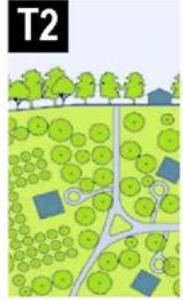 | T-2 RURAL T-2 rural zone consists of sparsely settled lands in open or cultivated states. These include woodland, agricultural land, grassland, and irrigable desert. Typical buildings are farmhouses, agricultural buildings, and cabins. | General Character: | Primarily agricultural with woodland & wetland and scattered buildings |
| Building Placement: | Variance setbacks | ||
| Frontage Types: | Not applicable | ||
| Typical Building Height: | 1- to 2-story | ||
| Type of Civic Space: | Parks, greenways | ||
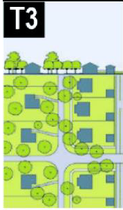 | T-3 SUB-URBAN T-3 sub-urban zone consists of low density residential areas adjacent to higher zones that have some mixed use. Home occupations and outbuildings are allowed. Planting is naturalistic and setbacks are relatively deep. Blocks may be large and the roads irregular to accommodate natural conditions. | General Character: | Lawns and landscaped yards surrounding single-family dwellings; pedestrians occasionally |
| Building Placement: | Large and variable front and side yard setbacks | ||
| Frontage Types: | Porches, fences, naturalistic tree planting | ||
| Typical Building Height: | 1- to 2-story | ||
| Type of Civic Space: | Parks, greenways | ||
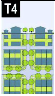 | T-4 GENERAL URBAN T-4 general urban zone consists of mixed uses including residential, office, and commercial. Residential may have a wide range of building types: single, sideyard, and rowhouses. Setbacks and landscaping are variable. Streets with curbs and sidewalks define medium-sized blocks. | General Character: | Mix of houses and townhouses with commercial and office activity; balance between landscape and buildings; presence of pedestrians |
| Building Placement: | Shallow to medium front and side yard setbacks | ||
| Frontage Types: | Porches, fences, dooryards | ||
| Typical Building Height: | 1- to 3-story | ||
| Type of Civic Space: | Squares, greens | ||
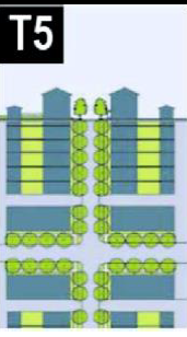 | T-5 URBAN CENTER T-5 urban center zone consists of higher density mixed use building that accommodate retail, offices, townhouses, and multifamily. It has a tight network of streets, with wide sidewalks, steady street tree planting and buildings set close to the sidewalks. | General Character: | Shops mixed with townhouse, multifamily, offices, work place, and civic buildings; predominantly attached buildings; trees within the public right-of-way; substantial pedestrian activity |
| Building Placement: | Shallow setbacks or none; buildings oriented to street defining a street wall | ||
| Frontage Types: | Stoops, dooryards, forecourts, shopfronts, and galleries | ||
| Typical Building Height: | 1- to 3-story | ||
| Type of Civic Space: | Parks, plazas and squares, median landscaping | ||
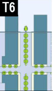 | T-6 URBAN CORE T-6 urban core zone consists of the highest density and height, with the greatest variety of uses. It may have larger blocks; streets have steady street tree planting and buildings are set close to wide sidewalks. | General Character: | Medium to high-density mixed use buildings, entertainment, civic and cultural uses. Attached buildings forming a continuous street wall; trees within the public right-of-way; highest pedestrian and transit activity. |
| Building Placement: | Shallow setbacks or none; buildings oriented to street defining a street wall | ||
| Frontage Types: | Stoops, dooryards, forecourts, shopfronts, and galleries | ||
| Typical Building Height: | 4-plus story with few shorter buildings | ||
| Type of Civic Space: | Parks, plazas and squares, median landscaping |
(Ord. No. 25-05-578, § 1(Exh. A), 5-19-2025)
7B.5.2. - Table 2: Modification to Non-Conforming Properties
This table provides descriptions of changes to non-conforming properties that result in conformance with the specifications of this Article 7B. Other changes to decrease the degree of non-conformity are also possible.
| NON-CONFORMING PROPERTY | POSSIBLE TECHNIQUES | CONFORMING MODIFICATION | ||
|---|---|---|---|---|
DRIVE-THROUGH | 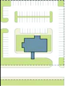 |
• Keep existing building and drive-through and add liner buildings in front of building
to engage the thoroughfare, or
• Replace building | 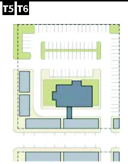 | 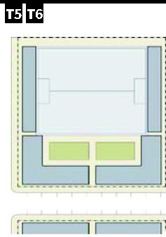 |
GAS STATION | 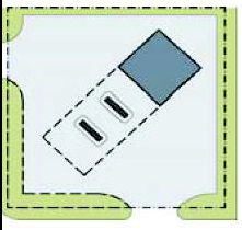 |
• Keep gas station building and pumps and build a new building at the intersection,
or
• Eliminate the gas station building, but keep the pumps and increase them, while building a new building at the intersection | 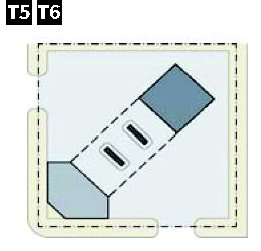 | 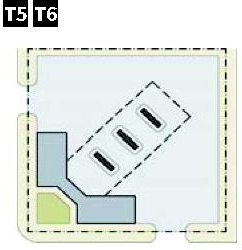 |
STRIP CENTER | 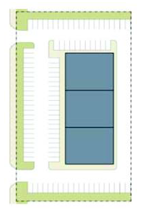 |
• Keep existing building and add liner buildings in front of it to engage the thoroughfare
• Convert frontal parking into forecourt and add on-street parking to the existing thoroughfare | 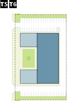 | 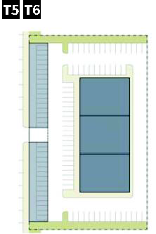 |
BIG BOX OR OFFICE BUILDING | 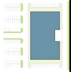 |
• Infill the frontal parking with new liner buildings and streets terminating on the
existing building; retain current building use or convert to new use
• Infill the frontal parking with new liner buildings and streets terminating on the existing building; reconfigure existing buildings for new use | 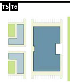 | 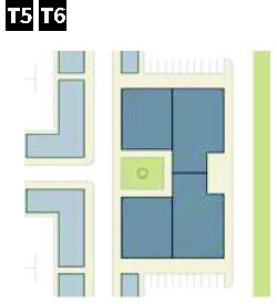 |
RELIGIOUS BUILDING | 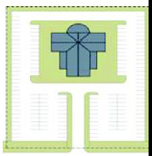 |
• Infill the frontal parking lot with senior housing; add on-street parking to existing
thoroughfare
• Create a street and civic space with liner buildings terminating on the existing religious building; add on-street parking to the existing thoroughfare | | |
7B.5.3. - Table 3A: Public Frontages - General
The public frontage is the area between the private lot line and the edge of the vehicular lanes. Dimensions are given in Table 3B and Table 4.
 | |
| a. (HW) For Highway: This frontage has open swales drained by percolation, bicycle trails and no parking. The landscaping consists of the natural condition or multiple species arrayed in naturalistic clusters. Buildings are buffered by distance or berms. | 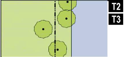 |
| b. (RD) For Road: This frontage has open swales drained by percolation and a walking path or bicycle trail along one or both sides and yield parking. The landscaping consists of multiple species arrayed in naturalistic clusters. | 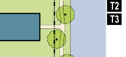 |
| c. (ST) For Street: This frontage has raised curbs drained by inlets and sidewalks separated from the vehicular lanes by individual or continuous planters, with parking on one or both sides. The landscaping consists of street trees of a single or alternating species aligned in a regularly spaced allee. | 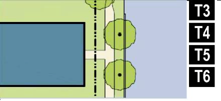 |
| d. (DR) For Drive: This frontage has raised curbs drained by inlets and a wide sidewalk or paved path along one side, related to a greenway or waterfront. It is separated from the vehicular lanes by individual or continuous planters. The landscaping consists of street trees of a single species or alternating species aligned in a regularly spaced allee. | 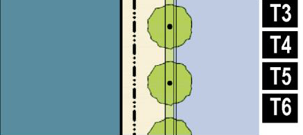 |
| e. (AV) For Avenue: This frontage has raised curbs drained by inlets and wide sidewalks separated from the vehicular lanes by a narrow continuous planter with parking on both sides. The landscaping consists of a single tree species aligned in a regularly spaced allee. | 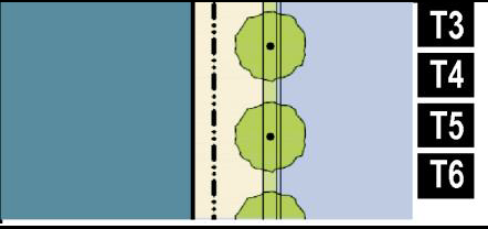 |
| f. (CS) For Commercial Street: This frontage has raised curbs drained by inlets and very wide sidewalks along both sides separated from the vehicular lanes by separate tree wells with grates and parking on both sides. The landscaping consists of a single tree species aligned with regular spacing where possible but clears the storefront entrances. | 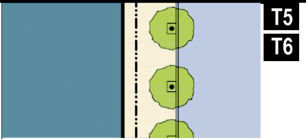 |
| g. (BV) For Boulevard: This frontage has slip roads on both sides. It consists of raised curbs drained by inlets and sidewalks along both sides, separated from the vehicular lanes by planters. The landscaping consists of double rows of a single tree species aligned in a regularly spaced allee. | 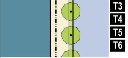 |
7B.5.4. - Table 3B: Public Frontages - Specific Existing Thoroughfares
This table assembles prescriptions and dimensions for the public frontage elements - curbs, sidewalks, planters, and landscape strips - relative to specific existing thoroughfares, regardless of the Transect Zone or Special District in which they are located.
| EXISTING THOROUGHFARE | STATE ROUTE 9 (35 MPH OR LESS) | STATE ROUTE 9 (OVER 35 MPH) | WINDWARD PKY | DEERFIELD PKWY, MORRIS RD, MCGINNIS FERRY RD, OLD MORRIS RD, WEBB RD, BETHANY BEND, COGBURN RD | OTHER EXISTING THOROUGHFARES (AS APPROVED BY WARRANT) |
| a. Assembly: The principal variables are the type and dimension of curbs, walkways, planters and landscape. |  |  |  | 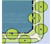 | 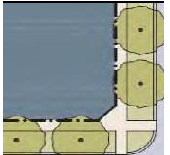 |
| Total Width | Min. 38 feet | Min. 32 feet | Min. 30 feet | Min. 28 feet | Min. 12 feet |
| b. Curb: The detailing of the edge of the vehicular pavement incorporating drainage. |  |  |  |  | 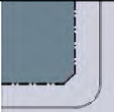 |
| Type | Raised Curb | Raised Curb | Raised Curb | Raised Curb | Raised Curb |
| Radius | Variable | Variable | Variable | Variable | Variable |
| c. Walkway: The hard surface dedicated exclusively to pedestrian activity. | 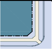 |  |  | 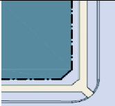 | 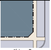 |
| Type | Sidewalk | Sidewalk | Sidewalk | Sidewalk | Sidewalk |
| Width | Min. 8 feet | Min. 8 feet | Min. 8 feet | Min. 6 feet | Min. 6 feet |
| d. Planter: The layer which accommodates street trees and other landscape materials. | 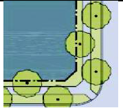 | 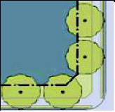 | 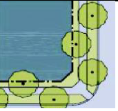 | 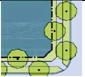 |  |
| Arrangement | Regular | Regular | Opportunistic | Regular | Regular |
| Species | Single | Single | Alternating | Alternating | Single |
| Planter Type | Continuous Planter | Continuous Planter | Continuous Planter | Continuous Planter | Continuous Planter |
| Planter Width | Min. 10 feet | Min. 4 feet | 2—12 feet | 2—12 feet | Min. 6 feet |
| Landscape Strip Width | 20 feet | 20 feet | 20 feet | 20 feet | None |
(Ord. No. 25-05-578, § 1(Exh. A), 5-19-2025)
7B.5.5. - Table 3C: Public Frontages - Slip Road Retrofit
Existing thoroughfares may be retrofitted into a Boulevard through the addition of one slip road along one or both sides. Where this occurs the frontage line must be along the slip road, not the existing thoroughfare.
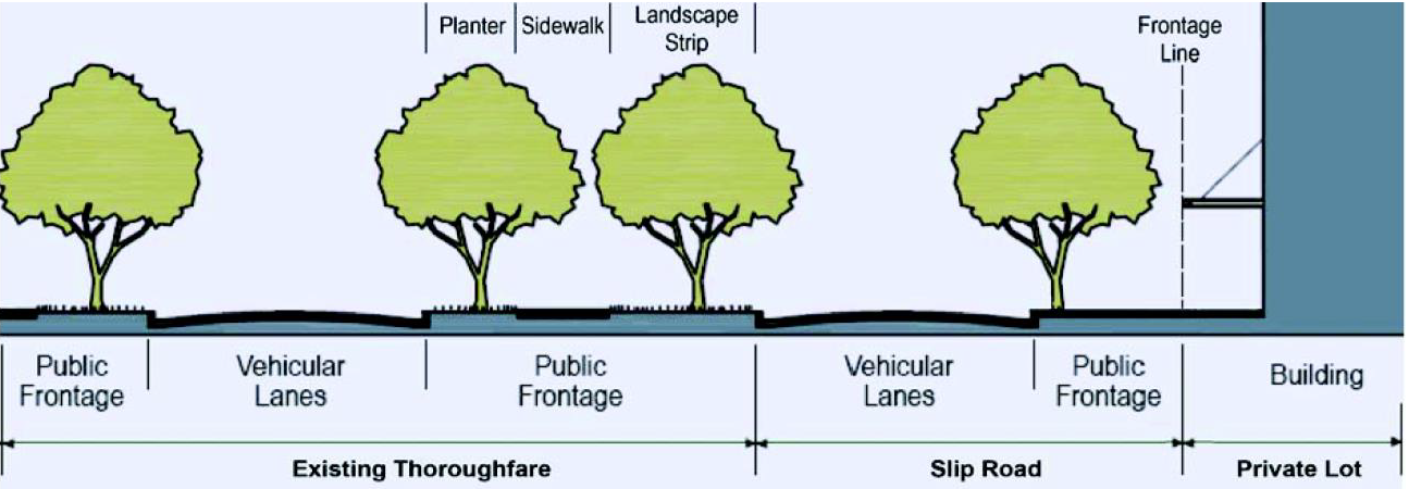
7B.5.6. - Table 3D: Public Frontages - Specific New Thoroughfares
This table assembles prescriptions and dimensions for the public frontage elements - curbs, walkways and planters - relative to specific thoroughfare types within Transect Zones.
 | ||||||
| TRANSECT ZONE Public Frontage Type | HW & RD | RD & ST | ST-DR-AV | ST-DR-AV-BV | CS-DR-AV-BV | CS-DR-AV-BV |
| a. Assembly: The principal variables are the type and dimension of curbs, walkways, planters and landscape. |  |  | 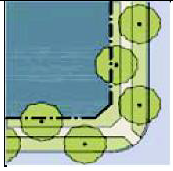 | 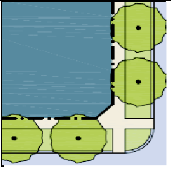 | 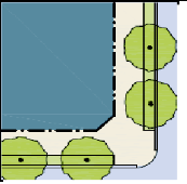 | 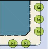 |
| Total Width | 16—24 feet | 12—24 feet | 12—18 feet | 12—18 feet | 18—24 feet | 18—30 feet |
| b. Curb: The detailing of the edge of the vehicular pavement incorporating drainage. |  |  |  |  |  |  |
| Type | Open Swale | Open Swale | Raised Curb | Raised Curb | Raised Curb | Raised Curb |
| Radius | 10—30 feet | 10—30 feet | 5—20 feet | 5—20 feet | 5—20 feet | 5—20 feet |
| c. Walkway: The hard surface dedicated exclusively to pedestrian activity. | 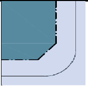 | 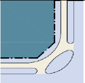 | 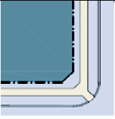 | 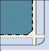 | 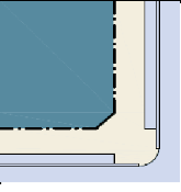 | 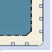 |
| Type | Path Optional | Path | Sidewalk | Sidewalk | Sidewalk | Sidewalk |
| Width | n/a | 4—8 feet | 4—8 feet | 4—8 feet | 12—20 feet | 12—30 feet |
| d. Planter: The layer which accommodates street trees and other landscape materials. | 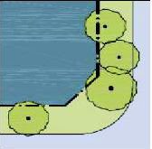 | 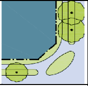 | 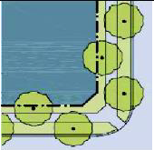 | 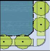 | 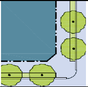 | 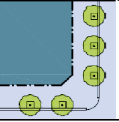 |
| Arrangement | Clustered | Clustered | Regular | Regular | Regular | Opportunistic |
| Species | Clustered | Clustered | Alternating | Single | Single | Single |
| Planter Type | Continuous Swale | Continuous Swale | Continuous Planter | Continuous Planter | Continuous Planter | Tree Well |
| Planter Width | 8 feet—16 feet | 8 feet—16 feet | 8 feet—12 feet | 8 feet—12 feet | 4 feet—6 feet | 4 feet—6 feet |
7B.5.7. - Table 4: Thoroughfare Assemblies
New thoroughfares must comply with this table. The key gives the thoroughfare type followed by the right-of-way width, followed by the pavement width, and in some instances followed by specialized transportation capability. Variations may only be approved by the Public Works Director if the public health, safety, and welfare demand.
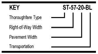 | 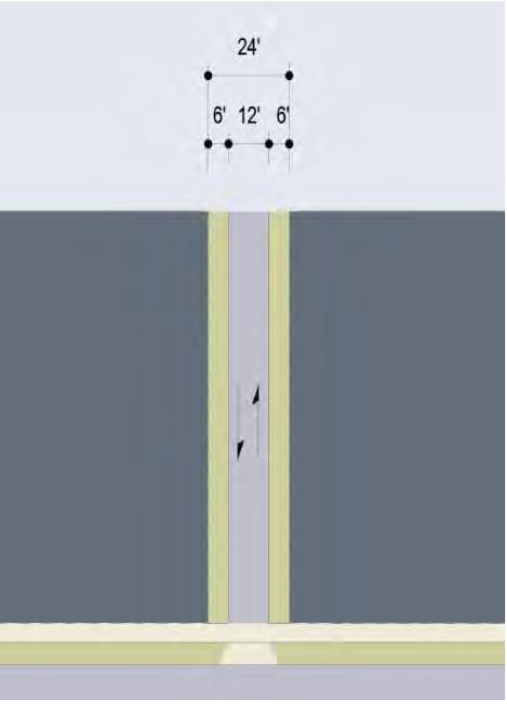 | 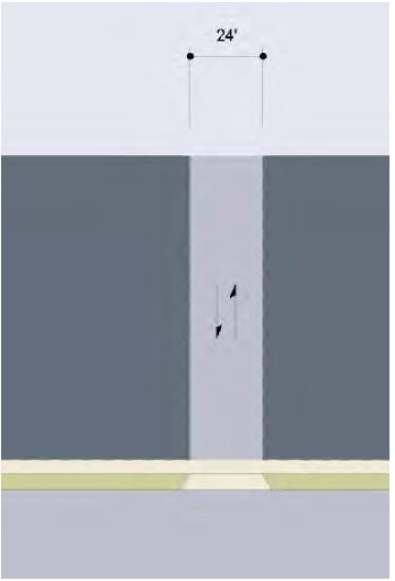 | |
| THOROUGHFARE TYPES | |||
| Highway | HW | ||
| Boulevard | BV | ||
| Avenue | AV | ||
| Commercial Street | CS | ||
| Drive | DR | ||
| Street | ST | ||
| Road | RD | ||
| Rear Alley | RA | ||
| Rear Lane | RL | ||
| Multi-Use Trail | MT | ||
| Equestrian Trail | ET | ||
| Bicycle Lane | BL | ||
| Bicycle Route | BR | ||
| Path | PT | ||
| Passage | PS | ||
| RL-24-12 | RA-24-24 | ||
| Thoroughfare Type | Rear Lane | Rear Alley | |
| Transect Zone Assignment | T2, T3, T4 | T3, T4, T5 | |
| Right-of-Way Width | 24 feet | 24 feet | |
| Pavement Width | 12 feet | 24 feet | |
| Movement | Yield Movement | Slow Movement | |
| Design Speed | 10 MPH | 10 MPH | |
| Pedestrian Crossing Time | 3.5 seconds | 7 seconds | |
| Traffic Lanes | n/a | n/a | |
| Parking Lanes | None | None | |
| Curb Radius | Taper | Taper | |
| Walkway Type | None | None | |
| Planter Type | None | None | |
| Curb type | Inverted crown | Inverted crown | |
| Landscape Type | None | None | |
| 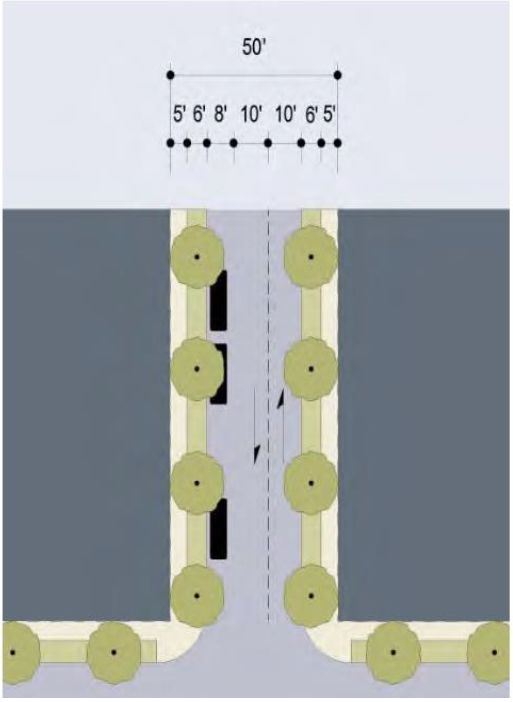 | 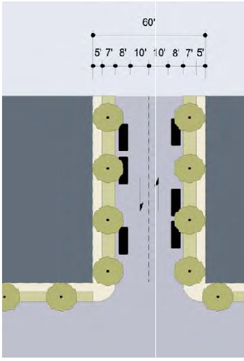 | |
| THOROUGHFARE TYPES | |||
| Highway | HW | ||
| Boulevard | BV | ||
| Avenue | AV | ||
| Commercial Street | CS | ||
| Drive | DR | ||
| Street | ST | ||
| Road | RD | ||
| Rear Alley | RA | ||
| Rear Lane | RL | ||
| Multi-Use Trail | MT | ||
| Equestrian Trail | ET | ||
| Bicycle Lane | BL | ||
| Bicycle Route | BR | ||
| Path | PT | ||
| Passage | PS | ||
| ST-50-281 | ST-60-361 | ||
| Thoroughfare Type | Street | Street | |
| Transect Zone Assignment | T3, T4, T5, T6 | T3, T4, T5, T6 | |
| Right-of-Way Width | 50 feet | 60 feet | |
| Pavement Width | 28 feet | 36 feet | |
| Movement | Slow Movement | Free Movement | |
| Design Speed | 25 MPH | 25 MPH | |
| Pedestrian Crossing Time | 8 seconds | 10.3 seconds | |
| Traffic Lanes | 2 lanes | 2 lanes | |
| Parking Lanes | One side @ 8 feet unmarked, bulbouts permitted | Both sides @ 8 feet unmarked | |
| Curb Radius | 15 feet | 10 feet | |
| Walkway Type | 5 foot Sidewalk on both sides | 5 foot Sidewalk on both sides | |
| Planter Type | 6 foot continuous Planter on both sides | 7 foot continuous Planter on both sides | |
| Curb type | Curb | Curb | |
| Landscape Type | Trees @ 30' o.c. Avg. | Trees @ 30' o.c. Avg. | |
| 1. When on-street facilities are provided, the width of the thoroughfare must be correspondingly increased, subject to approval of the Public Works Director. | |||
| 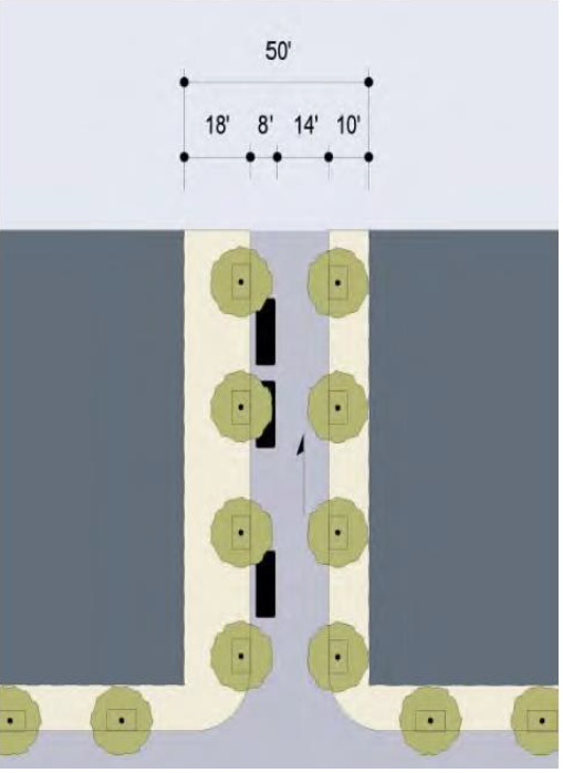 | 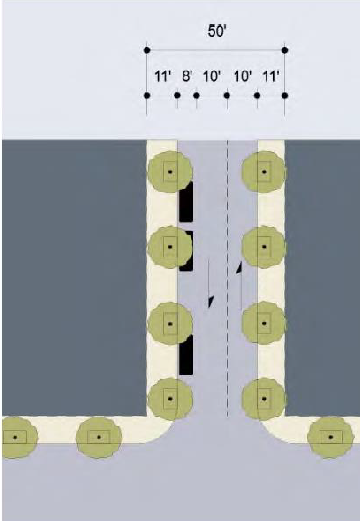 | |
| THOROUGHFARE TYPES | |||
| Highway | HW | ||
| Boulevard | BV | ||
| Avenue | AV | ||
| Commercial Street | CS | ||
| Drive | DR | ||
| Street | ST | ||
| Road | RD | ||
| Rear Alley | RA | ||
| Rear Lane | RL | ||
| Multi-Use Trail | MT | ||
| Equestrian Trail | ET | ||
| Bicycle Lane | BL | ||
| Bicycle Route | BR | ||
| Path | PT | ||
| Passage | PS | ||
| CS-50-221 | CS-50-281 | ||
| Thoroughfare Type | Commercial Street | Commercial Street | |
| Transect Zone Assignment | T4-O, T5, T6 | T4-O, T5, T6 | |
| Right-of-Way Width | 50 feet | 50 feet | |
| Pavement Width | 22 feet | 28 feet | |
| Movement | Slow Movement | Slow Movement | |
| Design Speed | 20 MPH | 25 MPH | |
| Pedestrian Crossing Time | 6.2 seconds | 8 seconds | |
| Traffic Lanes | 1 lane | 2 lanes | |
| Parking Lanes | One side @ 8 feet marked | One side @ 8 feet marked | |
| Curb Radius | 15 feet | 15 feet | |
| Walkway Type | 18/10 foot Sidewalk | 11 foot Sidewalk on both sides | |
| Planter Type | 5 × 8 foot tree well | 5 × 8 foot tree well | |
| Curb type | Curb | Curb | |
| Landscape Type | Trees @ 30' o.c. Avg. | Trees @ 30' o.c. Avg. | |
| 1. When on-street facilities are provided, the width of the thoroughfare must be correspondingly increased, subject to approval of the Public Works Director. | |||
| 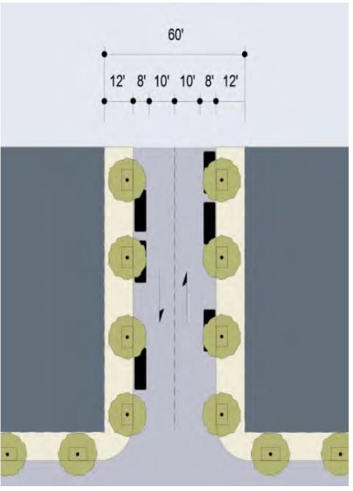 | 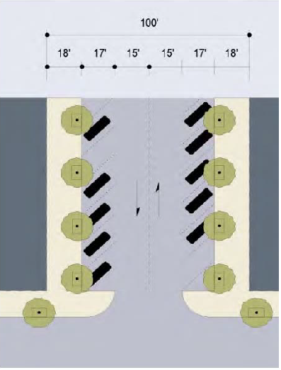 | |
| THOROUGHFARE TYPES | |||
| Highway | HW | ||
| Boulevard | BV | ||
| Avenue | AV | ||
| Commercial Street | CS | ||
| Drive | DR | ||
| Street | ST | ||
| Road | RD | ||
| Rear Alley | RA | ||
| Rear Lane | RL | ||
| Multi-Use Trail | MT | ||
| Equestrian Trail | ET | ||
| Bicycle Lane | BL | ||
| Bicycle Route | BR | ||
| Path | PT | ||
| Passage | PS | ||
| CS-60-361 | CS-100-641 | ||
| Thoroughfare Type | Commercial Street | Commercial Street | |
| Transect Zone Assignment | T4-O, T5, T6 | T4-O, T5, T6 | |
| Right-of-Way Width | 60 feet | 100 feet | |
| Pavement Width | 36 feet | 64 feet | |
| Movement | Free Movement | Slow Movement | |
| Design Speed | 25 MPH | 25 MPH | |
| Pedestrian Crossing Time | 10.3 seconds | 8.5 seconds at corners | |
| Traffic Lanes | 2 lanes | 2 lanes | |
| Parking Lanes | Both sides @ 8 feet marked | Both sides angled @ 17 feet marked | |
| Curb Radius | 10 feet | 15 feet | |
| Walkway Type | 12 foot Sidewalk | 18 foot Sidewalk | |
| Planter Type | 5 × 8 foot tree well | 5 × 8 foot tree well | |
| Curb type | Curb | Curb | |
| Landscape Type | Trees @ 30' o.c. Avg. | Trees @ 30' o.c. Avg. | |
| 1. When on-street facilities are provided, the width of the thoroughfare must be correspondingly increased, subject to approval of the Public Works Director. | |||
| 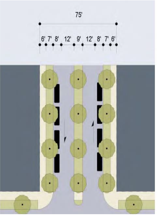 | 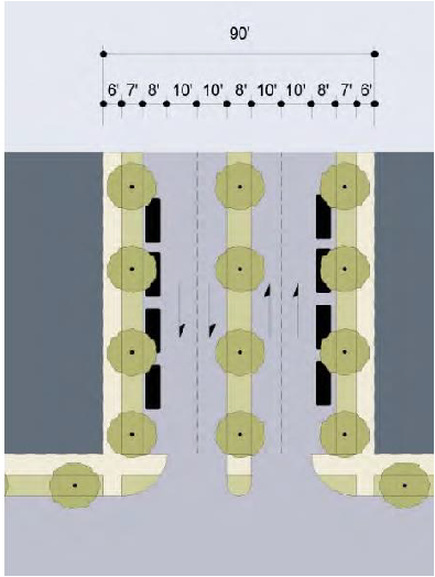 | |
| THOROUGHFARE TYPES | |||
| Highway | HW | ||
| Boulevard | BV | ||
| Avenue | AV | ||
| Commercial Street | CS | ||
| Drive | DR | ||
| Street | ST | ||
| Road | RD | ||
| Rear Alley | RA | ||
| Rear Lane | RL | ||
| Multi-Use Trail | MT | ||
| Equestrian Trail | ET | ||
| Bicycle Lane | BL | ||
| Bicycle Route | BR | ||
| Path | PT | ||
| Passage | PS | ||
| CS-75-401 | AVE-90-561 | ||
| Thoroughfare Type | Avenue | Avenue | |
| Transect Zone Assignment | T3, T4, T5, T6 | T3, T4, T5, T6 | |
| Right-of-Way Width | 75 feet | 90 feet | |
| Pavement Width | 40 feet | 56 feet | |
| Movement | Slow Movement | Slow Movement | |
| Design Speed | 25 MPH | 25 MPH | |
| Pedestrian Crossing Time | 5.7 seconds - 5.7 seconds |
5.7 seconds - 5.7 seconds at
corners | |
| Traffic Lanes | 2 lanes | 4 lanes | |
| Parking Lanes | Both sides @ 8 feet marked | Both sides @ 8 feet marked | |
| Curb Radius | 15 feet | 15 feet | |
| Walkway Type | 6 foot Sidewalk | 6 foot Sidewalk | |
| Planter Type | 7 foot continuous planter | 7 foot continuous planter | |
| Curb type | Curb | Curb | |
| Landscape Type | Trees @ 30' o.c. Avg. | Trees @ 30' o.c. Avg. | |
| 1. When on-street facilities are provided, the width of the thoroughfare must be correspondingly increased, subject to approval of the Public Works Director. | |||
7B.5.8. - Table 5: Civic Space
| a. Park: A natural preserve available for unstructured recreation. A park may be independent of surrounding building frontages. Its landscape consists of paths and trails, meadows, water bodies, woodland and open shelters, all naturalistically disposed. Parks may be lineal, following the trajectories of natural corridors. The minimum size is 8 acres. Every park and portions thereof must be at least 60 feet in width and length. A park may contain public art as approved by the City Council. | 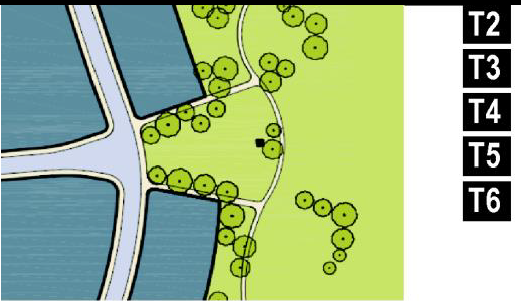 |
| b. Green: An open space, available for unstructured recreation. A green may be spatially defined by landscaping rather than building frontages. Its landscape consists of lawn and trees, naturalistically disposed. The minimum size is ½ acre and the maximum is 8 acres. Every green and portions thereof must be at least 60 feet in width and length. A green may contain public art as approved by the City Council. | 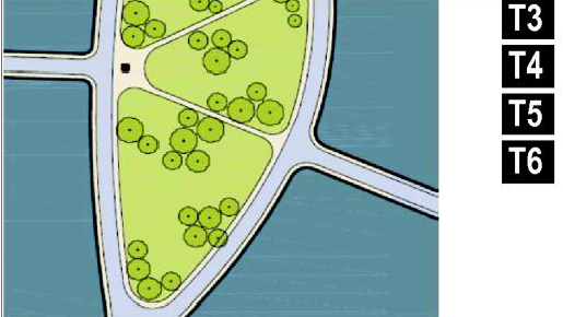 |
| c. Square: An open space available for unstructured recreation and civic purposes. A square is spatially defined by building frontages. Its landscape consists of paths, lawns and trees, formally disposed. Squares must be located at the intersection of important thoroughfares. The minimum size is ½ acre and the maximum is 5 acres. Every square and portions thereof must be at least 60 feet in width and length. A square may contain public art as approved by the City Council. | 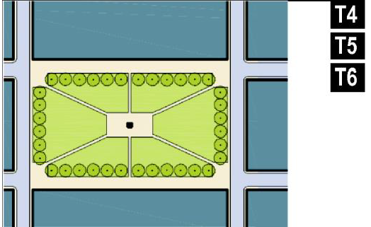 |
| d. Plaza: An open space available for civic purposes and commercial activities. A plaza must be spatially defined by building frontages. Its landscape consists primarily of pavement. Trees are optional. Plazas should be located at the intersection of important streets. The minimum size is ½ acre and the maximum is 2 acres. Every plaza and portions thereof must be at least 60 feet in width and length. A plaza may contain public art as approved by the City Council. | 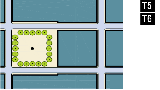 |
| e. Playground: An open space designed and equipped for the recreation of children. A playground
should be fenced and may include an open shelter. Playgrounds must be interspersed
within residential areas and may be placed within a block. Playgrounds may be included
within parks and greens. The minimum size is 9,000 square feet. Every playground must
be at least 60 feet in width and length.
f. Pocket Park: An open space available for passive recreation and relaxation. Pocket parks must include seating, trees, and other landscaping. Pocket parks must be interspersed within residential areas. The minimum size is 9,000 square feet. Every pocket park must be at least 60 feet in width and length. A pocket park may contain public art as approved by the City Council. g. Linear Park: See Sec. 7B.3.8.A. | 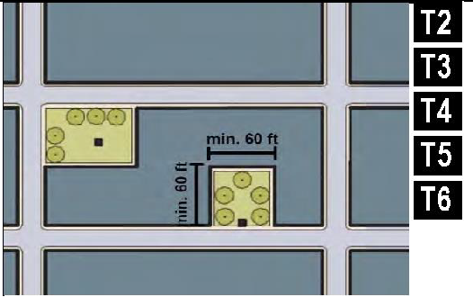 |
(Ord. No. 25-05-578, § 1(Exh. A), 5-19-2025)
7B.5.9. - Table 6: Building Form - Height
This table shows the configurations for different building heights for each Transect Zone, except where said zone lies within the Maximum Two-Story Building Height Zone as established on the Deerfield/Highway 9 Regulating Plan. Recess lines must occur on higher buildings in zone T6 as shown. Attics are included when counting stories.
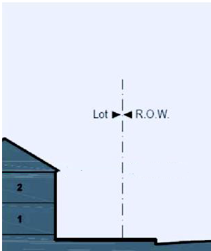 | 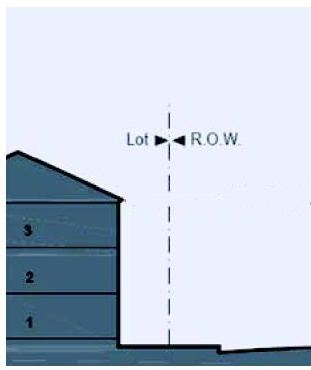 | 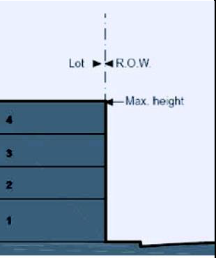 | 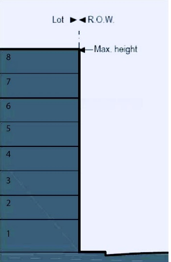 |
| T2, T3, T4-P1 | T43, T4-04 | T5 | T65 |
| 1. T4-permissive. | |||
| 2. Max. height without first story civic or commercial function/max. height with first story civic or commercial function. | |||
| 3. T4 includes T4-permissive but not T4-open. | |||
| 4. T4-Open. | |||
| 5. T6-Office and Hotel Uses may be up to 8 stories, all other uses shall not exceed 4 stories. | |||
(Ord. No. 25-05-578, § 1(Exh. A), 5-19-2025)
7B.5.10. - Table 7: Building Placement
This table approximates the location of the structure relative to the boundaries of each individual lot, establishing suitable basic building types for each Transect Zone. Adjustments may be permitted by the Director based on Sec. 7B.3.8.A. for buildings adjacent to a Linear Park.
| a. Edgeyard: A building that occupies the center of its lot with setbacks on all sides. This is the least urban of types as the front yard sets it back from the frontage, while the side yards weaken the spatial definition of the public thoroughfare space. The front yard is intended to be visually continuous with the yards of adjacent buildings. The rear yard can be secured for privacy by fences and a well-placed backbuilding and/or outbuilding. | 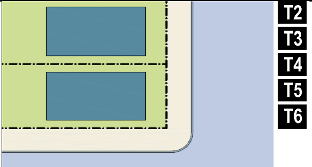 |
| b. Sideyard: A building that occupies one side of the lot with the setback to the other side. A shallow frontage setback defines a more urban condition. If the adjacent building is similar with a blank side wall, the yard can be quite private. This type permits systematic climatic orientation in response to the sun or the breeze. Energy costs, and sometimes noise, are reduced by sharing a party wall in this disposition. | 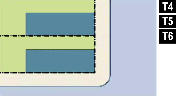 |
| c. Rearyard: A building that occupies the full frontage, leaving the rear of the lot as the sole yard. This is a very urban type as the continuous facade steadily defines the public thoroughfare. The rear elevations may be articulated for functional purposes. In its residential form, this type is the townhouse. For its commercial form, the rear yard can accommodate substantial parking. | 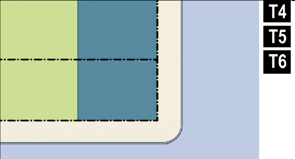 |
| d. Courtyard: A building that occupies the boundaries of its lot while internally defining one or more private patios. This is the most urban of types, as it is able to shield the private realm from all sides while strongly defining the public thoroughfare. Because of its ability to accommodate incompatible activities, masking them from all sides, it is recommended for workshops, lodging and schools. The high security provided by the continuous enclosure is useful for crime-prone areas. | 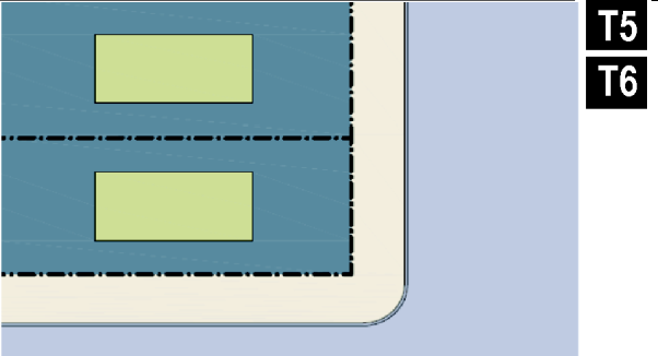 |
(Ord. No. 25-05-578, § 1(Exh. A), 5-19-2025)
7B.5.11. - Table 8: Private Frontages
The private frontage is the areas between the building facades and the lot lines. Buildings subject to Sec. 7B.4.4.A.4 may substitute open parking for the thoroughfare. Adjustments may be permitted by the Director based on Sec. 7B.3.8.A. for buildings adjacent to a Linear Park.
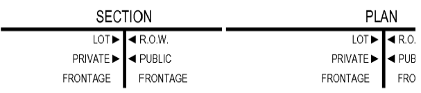 | |
| a. Common Yard: A planted frontage wherein the facade is set back substantially from the frontage line. The front yard created remains unfenced and is visually continuous with adjacent yards, supporting a common landscape. The deep setback provides a buffer from the higher speed thoroughfares. | 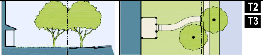 |
| b. Porch & Fence: A planted frontage where the facade is set back from the frontage line with an attached porch permitted to encroach. A fence, wall, or hedge at the frontage line maintains street spatial definition. Porches must be no less than 8 feet deep. | 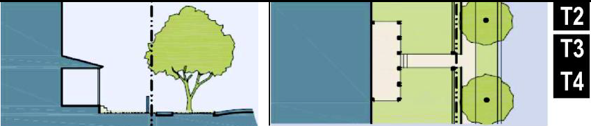 |
| c. Terrace or Lightwell: A frontage wherein the facade is set back from the frontage Line by an elevated terrace or sunken lightwell. This type buffers residential use from urban sidewalks and removes the private yard from public encroachment. Terraces are suitable for conversion to outdoor cafes. Synonym: dooryard. | 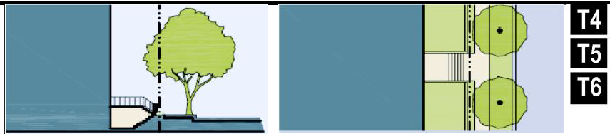 |
| d. Forecourt: A frontage wherein the facade is close to the frontage line and the central portion is set back. The forecourt created is suitable for vehicular drop-offs. This type should be allocated in conjunction with other frontage types. Large trees within the forecourts may overhang the sidewalks. | 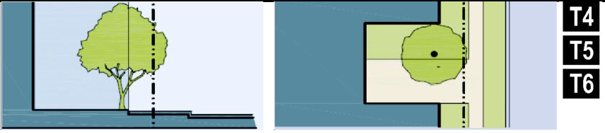 |
| e. Stoop: A frontage wherein the facade is aligned close to the frontage line with the first story elevated from the sidewalk sufficiently to ensure privacy for the windows. The entrance is usually an exterior stair and landing. This type is recommended for first story residential use. Stoops must be no less than 30 inches deep. | 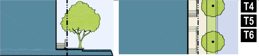 |
| f. Shopfront: A frontage wherein the facade is aligned close to the frontage line with the building entrance at sidewalk grade. This type is conventional for retail use. It has glazing on the sidewalk level and an awning that should overlap the sidewalk to within 2 feet of the curb. Synonym: retail frontage. | 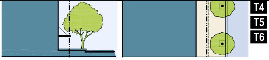 |
| g. Gallery: A frontage wherein the facade is aligned with the frontage line with an attached cantilevered shed or lightweight colonnade overlapping the sidewalk. This type is conventional for retail use. The gallery should be no less than 10 feet wide and should overlap the sidewalk to within 2 feet of the curb, except where prevented by a required landscape. | 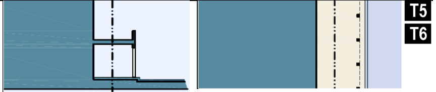 |
(Ord. No. 25-05-578, § 1(Exh. A), 5-19-2025)
7B.5.12. - Table 9A: Building Function
This table categorizes building functions within Transect Zones. For specific permitted uses, see Sec. 8.2.3. (Use Table for Deerfield Form-Based Code).
(Ord. No. 25-05-578, § 1(Exh. A), 5-19-2025)
7B.5.13. - Table 9B: Building Unit Function Exchange
This table shows the rate that building units must be exchanged for functions.
(Ord. No. 25-05-578, § 1(Exh. A), 5-19-2025)
7B.5.14. - Table 10: Permitted Uses
See Sec. 8.2.3 (Use Table for Deerfield Form-Based Code).
7B.5.15. - Table 11: Code Summary
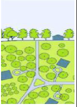 | 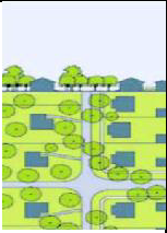 | 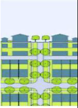 | 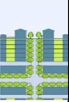 |  | ||||
|---|---|---|---|---|---|---|---|---|
 |  |  |  |  | ||||
| RURAL ZONE | SUB-URBAN ZONE | GENERAL | URBAN CENTER | URBAN CORE | ||||
| a. BASE BUILDING DENSITY (See Sec. 7A.1.6) | ||||||||
| By Right | 1 unit/ac. | 3 units/ac. | 5 units/ac. | 9 units/ac. | 12 units/ac. | |||
| By TDR | TDR not permitted | 6 units/ac. | 9 units/ac. | 14 units/ac. | 16 units/ac. | |||
| By incentive | Not Applicable | Not Applicable | Not Applicable | Up to 3 units/ac. | Up to 3 units/ac. | |||
| b. BLOCK SIZE | ||||||||
| Block Perimeter | no maximum | 3,000 ft. max. | 2,400 ft. max. | 3,200 ft. max. | 3,200 ft. max. | |||
| c. THOROUGHFARES (See Table 3 and Table 4) | ||||||||
| HW | permitted | permitted | not permitted | not permitted | not permitted | |||
| BV | not permitted | permitted | permitted | permitted | permitted | |||
| AV | not permitted | permitted | permitted | permitted | permitted | |||
| CS | not permitted | not permitted | not permitted | permitted | permitted | |||
| DR | not permitted | permitted | permitted | permitted | permitted | |||
| ST | not permitted | permitted | permitted | permitted | permitted | |||
| RD | permitted | permitted | not permitted | not permitted | not permitted | |||
| Rear Lane | permitted | permitted | required, or Alley | not permitted | not permitted | |||
| Rear Alley | not permitted | permitted | required | required | required | |||
| Path | permitted | permitted | permitted | not permitted | not permitted | |||
| Passage | not permitted | permitted | permitted | permitted | permitted | |||
| Multi-Use Trail | permitted | permitted | permitted | permitted | permitted | |||
| Equestrian Trail | permitted | permitted | permitted | permitted | permitted | |||
| Bicycle Lane | permitted | permitted | permitted | permitted | permitted | |||
| Bicycle Route | permitted | permitted | permitted | permitted | permitted | |||
| d. CIVIC SPACES (See Table 5) | ||||||||
| Park | permitted | permitted | permitted | permitted | permitted | |||
| Green 5 | not permitted | permitted | permitted | permitted | permitted | |||
| Square 5 | not permitted | not permitted | permitted | permitted | permitted | |||
| Plaza 5 | not permitted | not permitted | not permitted | permitted | permitted | |||
| Playground, Pocket Park 5 | permitted | permitted | permitted | permitted | permitted | |||
| e. LOT OCCUPATION | ||||||||
| Lot Width | 100 ft. min. | 70 ft. min. 120 ft. max. | 28 ft. min. 96 ft. max. | 28 ft. min. no max. | 28 ft. min. no max. |
BUILDING PLACEMENT
| ||
| Lot Coverage | 20% max. | 60% max. | 70% max. | 80% max. | 80% max. | |||
| f. SETBACKS - PRINCIPAL BUILDING (See Table 12) | ||||||||
| (f.1) Front Setback Principal 5 | 60 ft. min. | 15 or 20 ft. min. 2 | 10 ft. min. 30 ft. max. 7 | 2 ft. min. 15 ft. max. 7 | 2 ft. min. 15 ft. 7 | |||
| (f.2) Front Setback Secondary 5 | 40 ft. min. | 12 ft. min. | 8 ft. min. 20 ft. max. | 2 ft. min. 15 ft. max. | 2 ft. min. 15 ft. | |||
| (f.3) Side Setback | 25 ft. min. | 5 or 10 ft. min. 2 | 0 ft. min. | 0 ft. min. | 0 ft. min. | |||
| (f.4) Rear Setback | 50 ft. min. | 12 ft. min. | 3 ft. min. | 3 ft. min. | 3 ft. min. | |||
| Frontage Buildout 5 | not applicable | 30% min. | 50% min. | 50% min. | 50% min. | |||
| g. SETBACKS - OUTBUILDING (See Table 12) | ||||||||
| Front Setback | 20 ft. min. + bldg. | 20 ft. min. + bldg. | 20 ft. min. + bldg. | 40 ft. max. from rear | 40 ft. max. from rear | |||
| Side Setback | 25 ft. min. | 3 ft. or 6 ft. min. 3 | 0 ft. or 3 ft. min. 3 | 0 ft. min. | 0 ft. min. | |||
| Rear Setback | 50 ft. min. | 3 ft. min | 3 ft. | 3 ft. max. | 3 ft. max. | |||
| h. BUILDING PLACEMENT (See Table 7) | ||||||||
| Edgeyard 5 | permitted | permitted | permitted | not permitted | permitted | |||
| Sideyard 5 | not permitted | not permitted | permitted | permitted | permitted | |||
| Rearyard 5 | not permitted | not permitted | permitted | permitted | permitted | |||
| Courtyard 5 | not permitted | not permitted | not permitted | permitted | permitted | |||
| i. PRIVATE FRONTAGES (See Table 8) 5 | ||||||||
| Common Yard | permitted | permitted | not permitted | not permitted | not permitted |
BUILDING FORM
| ||
| Porch & Fence | permitted | permitted | permitted | not permitted | not permitted | |||
| Terrace, Dooryard | not permitted | not permitted | permitted | permitted | permitted | |||
| Forecourt | not permitted | not permitted | permitted | permitted | permitted | |||
| Stoop | not permitted | not permitted | permitted | permitted | permitted | |||
| Shopfront | not permitted | not permitted | permitted | permitted | permitted | |||
| Gallery | not permitted | not permitted | not permitted | permitted | permitted | |||
| j. BUILDING FORM-HEIGHT (See Table 6) | ||||||||
| Principal Building | 3 stories max. | 3 stories max. | 3 stories max. | 4 stories max. | 8 stories max. 8 | |||
| Outbuilding | 2 stories max. | 2 stories max. | 2 stories max. | 2 stories max. | 2 stories max. | |||
| k. BUILDING FUNCTION (See Table 9 and Table 10) | ||||||||
| Residential | restricted use | restricted use | limited use 6 | open use | open use |
FUNCTION
| ||
| Lodging | prohibited use | restricted use | limited use 4, 6 | open use | open use | |||
| Office | restricted use | restricted use | restricted use 4, 6 | open use | open use | |||
| Retail | prohibited use | prohibited use | limited use 4, 6 | open use 4 | open use | |||
| Sec. 7B.4 | ||||||||
| Secs. 8.1 through 7B.3 | ||||||||
1. Minimum setbacks and building separations are subject to fire and building code restrictions.
2. Greater setback applies except for projects utilizing TDR, in which case the lesser setback applies.
3. Greater setback applies at a corner; lesser applies in all other situations.
4. Within T4-permissive, T4-open, and T5-limited different building function requirements apply.
5. See Sec. 7B.4.4.A.4 for alternate requirements for certain sized buildings along State Route 9.
6. See Section 7B.4.6.A for additional restrictions in T4-permissive.
7. Greater setbacks may be required based on Sec. 7B.3.8.A.
8. See Table 6: Building Form-Height for more height restrictions.
(Ord. No. 25-05-578, § 1(Exh. A), 5-19-2025)
7B.5.16. - Table 12A: Code Graphics - T3
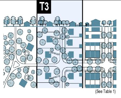 (see Table 1) |
BUILDING CONFIGURATION
1. Building height is measured in number of stories, excluding above-ground portions of basements. 2. Stories must not exceed 14 feet in height from finished floor to finished ceiling. 3. Height is measured to the eave or roof deck as specified on Table 5. | 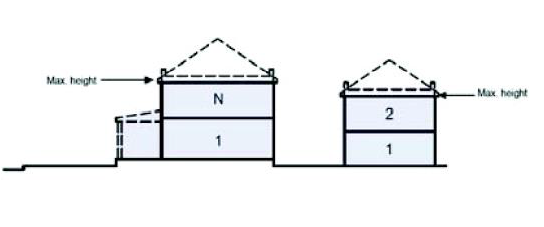 | |
| BUILDING FUNCTION (see Tables 8 & 9) |
SETBACKS - PRINCIPAL BLDG.
1. The facades and elevations of principal buildings must be distanced from the lot lines as shown. 2. Facades must be built along the principal frontage to the minimum specified width in the table. | 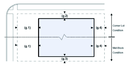 | |
| Residential | restricted use | ||
| Lodging | restricted use | ||
| Office | restricted use | ||
| Retail | prohibited use | ||
| BUILDING FORM (see Table 9) | |||
| Principal Building | 3 stories max | ||
| Outbuilding | 2 stories max | ||
| LOT OCCUPATION (see Table 11 section e) | |||
| Lot Width | 70 ft. min., 120 ft. max. | ||
| Lot Coverage | 60% max. | ||
| BUILDING PLACEMENT (See Table 7) |
SETBACKS - OUTBUILDING
1. The elevations of the outbuilding must be distanced from the lot lines as shown. | 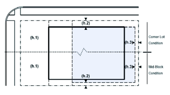 | |
| Edgeyard | permitted | ||
| Sideyard | not permitted | ||
| Rearyard | not permitted | ||
| Courtyard | not permitted | ||
| SETBACKS - PRINCIPAL BUILDING (see Table 11 section f) | |||
| Front Setback Principal (g.1 at right) | 15 or 20 ft. min.* | ||
| Front Setback Secondary (g.2 at right) | 12 ft. min. | ||
| Side Setback (g.3 at rt.) | 5 or 10 ft. min.* | ||
| Rear Setback (g.4 at rt.) | 12 ft. min.** | ||
| Frontage Buildout | 30% min. at setback | ||
| SETBACKS - OUTBUILDING (see Table 11 sec. g) | |||
| Front Setback Principal (h.1 at right) | 20 ft. min. + bldg. setback | PARKING PLACEMENT 1. Uncovered parking spaces may be provided within the second and third layer as shown in the diagram (see Table 13 section d). 2. Covered parking may only be provided within the third layer as shown in the diagram (see Table 13 section d). Side- or rear-entry garages may be allowed in the first or second layer by warrant. 3. Trash containers must be stored within the third layer. (Ord. No. 25-05-578, § 1(Exh. A), 5-19-2025) | 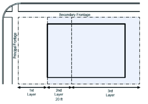 |
| Front Setback Seconary (h.2 at right) | 3 ft. min. or 6 ft. min. at corner | ||
| Side Setback (h.3 at rt.) | 3 ft. min. | ||
| PRIVATE FRONTAGES (see Table 8) | |||
| Common Yard | permitted | ||
| Porch & Fence | permitted | ||
| Terrace or Lightwell | not permitted | ||
| Forecourt | not permitted | ||
| Stoop | not permitted | ||
| Shopfront & Awning | not permitted | ||
| Gallery | not permitted | ||
| Refer to Summary Table 11 | |||
| *Greater setback applies except for projects utilizing TDR, in which case the lesser setback applies. | |||
| **or 15 ft. from center line of alley "N" stands for any stories above those shown, up to the maximum. Refer to metrics for exact minimums and maximums. | |||
7B.5.17. - Table 12B: Code Graphics - T4
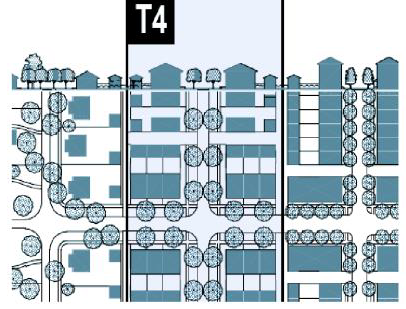 (see Table 1) |
BUILDING CONFIGURATION
1. Building height is measured in number of stories, excluding above-ground portions of basements. 2. Stories must not exceed 14 feet in height from finished floor to finished ceiling, except for a first story ccommercial function which must be a minimum of 11 feet with a maximum of 25 feet. 3. Height is measured to the eave or roof deck as specified on Table 5. | 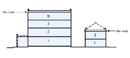 | |
| BUILDING FUNCTION (see Table 9 & Table 10) |
SETBACKS - PRINCIPAL BLDG.
1. The facades and elevations of principal buildings must be distanced from the lot lines as shown. 2. Facades must be built along the principal frontage to the minimum specified width in the table. | 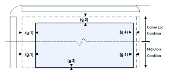 | |
| Residential | limited use* | ||
| Lodging | limited use* | ||
| Office | restricted use* | ||
| Retail | limited use* | ||
| BUILDING FORM (see Table 6) | |||
| Principal Building | 3 stories max | ||
| Outbuilding | 2 stories max | ||
| LOT OCCUPATION (see Table 11 section e) | |||
| Lot Width | 18 ft. min., 96 ft. | ||
| Lot Coverage | 70% max. | ||
| BUILDING PLACEMENT (See Table 7) |
SETBACKS - OUTBUILDING
1. The elevations of the outbuilding must be distanced from the lot lines as shown | 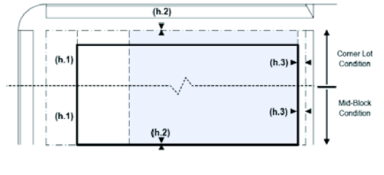 | |
| Edgeyard | permitted | ||
| Sideyard | permitted | ||
| Rearyard | permitted | ||
| Courtyard | not permitted | ||
| SETBACKS - PRINCIPAL BUILDING (see Table 11 section f) | |||
| Front Setback Principal (g.1 at right) | 10 ft. min., 30 ft. max. | ||
| Front Setback Secondary (g.2 at right) | 8 ft. min., 20 ft. max. | ||
| Side Setback (g.3 at right) | 0 ft. min. | ||
| Rear Setback (g.4 at right) | 3 ft. min.** | ||
| Frontage Buildout | 50% min. at setback | ||
| SETBACKS - OUTBUILDING (see Table 11 sec. g) | |||
| Front Setback Principal (h.1 at right) | 20 ft. min. + bldg. setback | PARKING PLACEMENT 1. Uncovered parking spaces may be provided within the third layer as shown in the diagram (see Table 13 section d). 2. Covered parking may only be provided within the third layer as shown in the diagram (see Table 13 section d). 3. Trash containers must be stored within the third layer. (Ord. No. 25-05-578, § 1(Exh. A), 5-19-2025) | 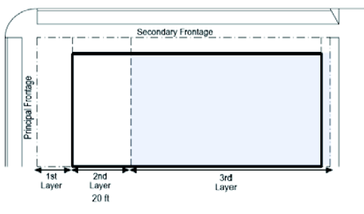 |
| Front Setback Secondary (h.2 at right) | 0 ft. min. or 3 ft. min. at setback | ||
| Side Setback (h.3 at right) | 3 ft. min. | ||
| PRIVATE FRONTAGES (see Table 8) | |||
| Common Yard | not permitted | ||
| Porch & Fence | permitted | ||
| Terrace or Lightwell | permitted | ||
| Forecourt | permitted | ||
| Stoop | permitted | ||
| Shopfront & Awning | permitted | ||
| Gallery | not permitted | ||
| Refer to Summary Table 10 | |||
| *Within T4-restriccted and T4-open different building function requirements apply. | |||
| **or 15 ft. from center line of alley. "N" stands for any stories above those shown, up to the maximum. Refer to metrics for exact minimums and maximums. | |||
7B.5.18. - Table 12C: Code Graphics - T5
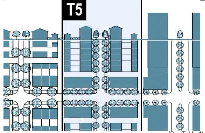 (see Table 1) |
BUILDING CONFIGURATION
1. Building height is measured in number of stories, excluding above-ground portions of basements. 2. Stories must not exceed 14 feet in height from finished floor to finished ceiling, except for a first story commercial function which must be a minimum of 11 feet with a maximum of 25 feet. 3. Height is measured to the eave or roof deck as specified on Table 8. | 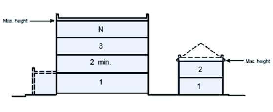 | |
| BUILDING FUNCTION (see Table 9 & Table 10) |
SETBACKS - PRINCIPAL BLDG.
1. The facades and elevations of principal buildings must be distanced from the lot lines as shown. 2. Facades must be built along the principal frontage to the minimum specified width in the table. | 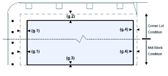 | |
| Residential | open use | ||
| Lodging | open use | ||
| Office | open use | ||
| Retail | open use* | ||
| BUILDING FORM (see Table 6) | |||
| Principal Building | 4 stories max | ||
| Outbuilding | 2 stories max | ||
| LOT OCCUPATION (see Table 11 section e) | |||
| Lot Width | 18 ft. min., no max. | ||
| Lot Coverage | 80% max. | ||
| BUILDING PLACEMENT (See Table 7) |
SETBACKS - OUTBUILDING
1. The elevations of the outbuilding must be distanced from the lot lines as shown | 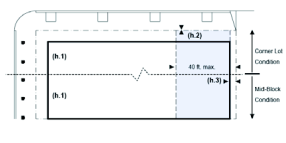 | |
| Edgeyard | permitted | ||
| Sideyard | permitted | ||
| Rearyard | permitted | ||
| Courtyard | permitted | ||
| SETBACKS - PRINCIPAL BUILDING (see Table 11 section f) | |||
| Front Setback Principal (g.1 at right) | 2 ft. min., 15 ft. max. | ||
| Front Setback Secondary (g.2 at right) | 2 ft. min., 15 ft. max. | ||
| Side Setback (g.3 at right) | 0 ft. min., 24 ft. max. | ||
| Rear Setback (g.4 at right) | 3 ft. min.** | ||
| Frontage Buildout | 50% min. at setback | ||
| SETBACKS - OUTBUILDING (see Table 11 sec. g) | |||
| Front Setback Principal (h.1 at right) | 40 ft. max. from rear prop. | PARKING PLACEMENT 1. Uncovered parking spaces may be provided within the third layer as shown in the diagram (see Table 13 section d). 2. Covered parking may only be provided within the third layer as shown in the diagram (see Table 13 section d). 3. Trash containers must be stored within the third layer. (Ord. No. 25-05-578, § 1(Exh. A), 5-19-2025) | 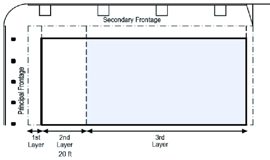 |
| Front Setback Secondary (h.2 at right) | 0 ft. min. or 2 ft. min. at corner | ||
| Side Setback (h.3 at right) | 3 ft. max. | ||
| PRIVATE FRONTAGES (see Table 8) | |||
| Common Lanw | not permitted | ||
| Porch & Fence | not permitted | ||
| Terrace or Lightwell | permitted | ||
| Forecourt | permitted | ||
| Stoop | permitted | ||
| Shopfront & Awning | permitted | ||
| Gallery | permitted | ||
| Refer to Summary Table 10. | |||
|
**or 15 ft. from center line of alley.
"N" stands for any stories above those shown, up to the maximum. Refer to metrics for exact minimums and maximums. | |||
7B.5.19. - Table 12D: Code Graphics - T6
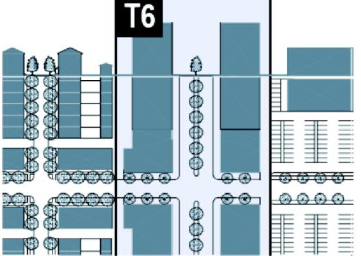 (see Table 1) |
BUILDING CONFIGURATION
1. Building height is measured in number of stories, excluding above-ground portions of basements. 2. Stories must not exceed 14 feet in height from finished floor to finished ceiling, except for a first story commercial function which must be a minimum of 11 feet with a maximum of 25 feet. 3. Height is measured to the eave or roof deck as specified on Table 6. | 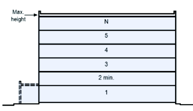 | |
| BUILDING FUNCTION (see Table 9 & Table 10) |
SETBACKS - PRINCIPAL BLDG.
1. The facades and elevations of principal buildings must be distanced from the lot lines as shown. 2. Facades must be built along the principal frontage to the minimum specified width in the table. | 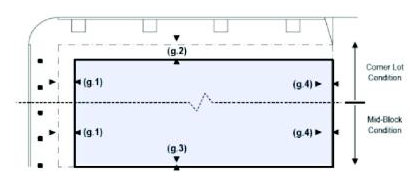 | |
| Residential | open use | ||
| Lodging | open use | ||
| Office | open use | ||
| Retail | open use | ||
| BUILDING FORM (see Table 6) | |||
| Principal Building | 8 stories max, 2 min. | ||
| Outbuilding | 2 stories max | ||
| LOT OCCUPATION (see Table 14 section f) | |||
| Lot Width | 18 ft. min., no max. | ||
| Lot Coverage | 80% max. | ||
| BUILDING PLACEMENT (See Table 7) |
SETBACKS - OUTBUILDING
1. The elevations of the outbuilding must be distanced from the lot lines as shown. | 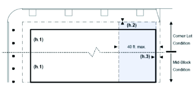 | |
| Edgeyard | permitted | ||
| Sideyard | permitted | ||
| Rearyard | permitted | ||
| Courtyard | permitted | ||
| SETBACKS - PRINCIPAL BUILDING (see Table 11 section f) | |||
| Front Setback Principal (g.1 at right) | 2 ft. min., 15 ft. max. | ||
| Front Setback Secondary (g.2 at right) | 2 ft. min., 15 ft. max. | ||
| Side Setback (g.3 at right) | 0 ft. min. | ||
| Rear Setback (g.4 at right) | 3 ft. min.* | ||
| Frontage Buildout | 50% min. at setback | ||
| SETBACKS - OUTBUILDING (see Table 11 section g) | |||
| Front Setback Principal (h.1 at right) | 40 ft. max. from rear prop. | ||
| Front Setback Secondary (h.2 at right) | 0 ft. min. or 2 ft. at corner | ||
| Side Setback (h.3 at right) | 3 ft. max. | ||
| PRIVATE FRONTAGES (see Table 7) | PARKING PLACEMENT (see Table 7)
1. Uncovered parking spaces may be provided within the third layer as shown in the diagram (see Table 13 section d). 2. Covered parking may only be provided within the third layer as shown in the diagram (see Table 13 section d). 3. Trash containers must be stored within the third layer. (Ord. No. 25-05-578, § 1(Exh. A), 5-19-2025) | 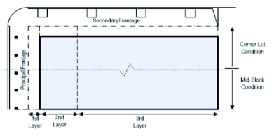 | |
| Common Yard | not permitted | ||
| Porch & Fence | not permitted | ||
| Terrace or Lightwell | permitted | ||
| Forecourt | permitted | ||
| Stoop | permitted | ||
| Shopfront & Awning | permitted | ||
| Gallery | permitted | ||
| Refer to Summary Table 11 | |||
| **or 15 ft. from center line of alley | |||
| "N" stands for any stories above those shown, up to the maximum. Refer to metrics for exact minimums and maximums. | |||
7B.5.20. - Table 13: Definitions Illustrated
a. THOROUGHFARE & FRONTAGES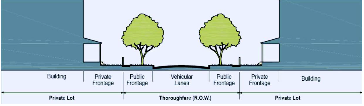 | |
b. TURNING RADIUS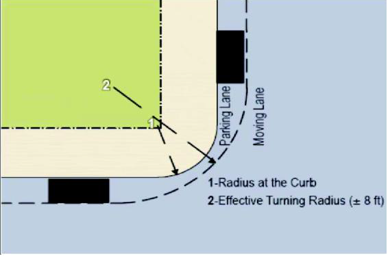 | c. BUILDING DISPOSITION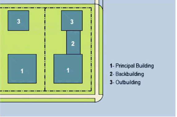 |
d. LOT LAYERS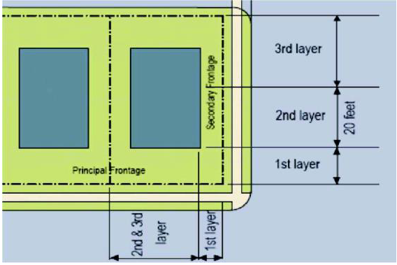 | e. FRONTAGE & LOT LINES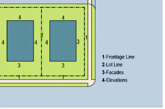 |
f. SETBACK DESIGNATIONS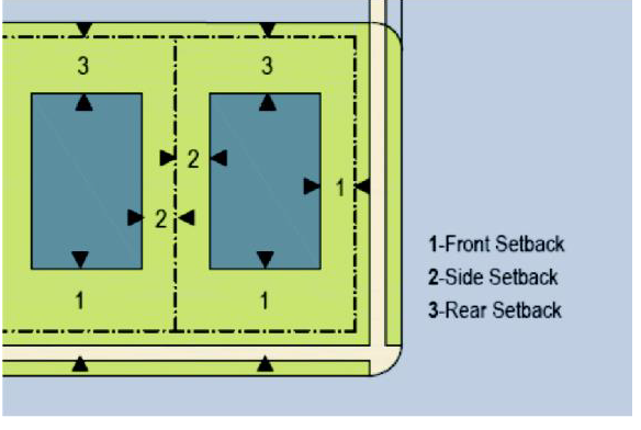 | |

