Grandview City Zoning Code
CITY OF GRANDVIEW
M-150 Sustainable Development Corridor Plan October 2012 - Implementation Plan
This plan has been prepared by the PlaceMaking Group at Parsons Brinckerhoff and their subconsultants for the City of Grandview, Missouri.
Parsons Brinckerhoff, Inc.
16201 West 95th Street
Suite 200
Lenexa, Kanas 66219
(913) 754-5557 phone
www.pbworld.com
Project Manager:
Tom Hester (602) 418-8091
hester@pbworld.com
City of Grandview
Community Development
1200 Main Street
Grandview, Missouri
(816) 316-4800 phone
www.grandview.org
Project Managers:
Chris Chiodini
cchiodini@ci.grandview.mo.us
Sara Copeland
scopeland@ci.grandview.mo.us
Project Team:
City of Grandview,
Parsons Brinckeroff, Inc.
Venice Communications, Inc.
Richard Farley Urban Design, LLC
Copyright © 2012
Parsons Brinckerhoff, Inc. All rights reserved.
This report is copyright. Apart from any fair dealings for the purpose of private research, criticism, or reviews, as permitted under the Copyright Act, no part of this document may be reproduced, stored in a retrieval system, or transmitted, in any form or by any means, electronic or mechanical, recording or otherwise, without the written permission of Parsons Brinckerhoff, Inc.
Disclaimer
The content of this document is furnished for informational use only, is subject to
change without notice, and should not be construed as a commitment by Parsons Brinckerhoff,
Inc. Every effort has been made to ensure that the information contained herein is
correct. Parsons Brinckerhoff, Inc. assumes no responsibility or liability for any
errors or inaccuracies that may appear in this document.
The suggestions and recommendations made in this report are for the purposes of discussion and debate in regard to corridor redevelopment. Some of the ideas contained herein have regard to private and public lands. These ideas have been developed as a professional service without the full consultation of property owners.
Achieving the Vision
Achieving the long-term vision established for the M-150 corridor will require leadership and commitment. This Plan provides the policy and regulatory framework to enable the vision; however continued leadership will be critical to the long-term success of creating a new regional destination. Achieving the vision hinges on three overarching principles: raise the bar for creating quality development along the corridor, implement a long term infrastructure plan that is based on successional development and a full build-out scenario, and build a range of development products at higher densities. Following is a description of each of the principles.
Raise the Bar for Development
The City of Grandview has many development opportunities, of which, the M-150 corridor is only one. However, the character of new development throughout the City will impact the quality of development that will be achieved along this corridor. The standard has to be set by other projects, and continued in the M-150 corridor, rather than waiting to implement higher standards only along this corridor. The following actions are required to raise the bar for development in the City.
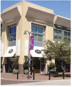
Focus on Creating Destinations, not Projects
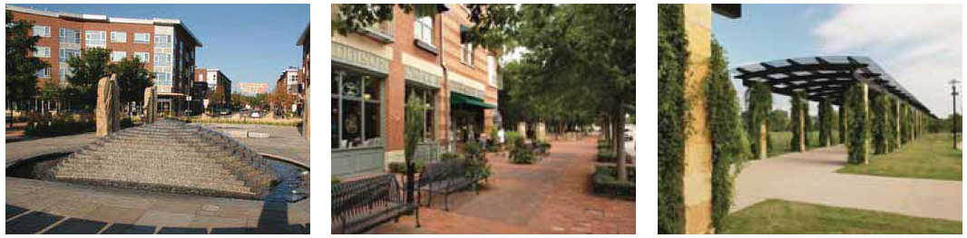
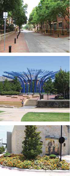
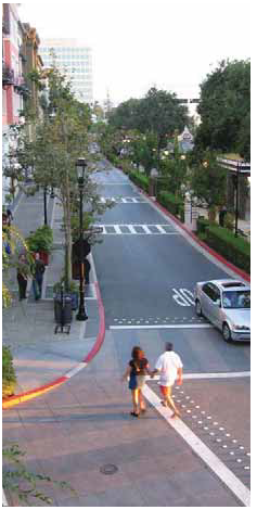
Similar to the study along the M-150 corridor, the City should identify other areas in the city that should develop as focal centers. The areas could include existing underutilized neighborhood and commercial areas that provide needed services, but do not create places of destination. Destination places will include a broad range of horizontally mixed uses, provide transportation options in addition to single occupancy vehicle trips, and be defined by a landmark location that serves as a place identifier.
Create Catalytic Opportunities
Each new development project that is evaluated by the city for approval should be assessed for its ability to catalyze adjacent complementary development. This is especially important for projects that could require any form of public subsidy or incentive. Part of the evaluation criteria for subsidy or incentive should be based on how much potential revenue the anticipated incentive will provide over a pre-established period, for instance, 10 years. Projects that have the opportunity to catalyze more revenue for the city should be given higher priority and reviewed against additional evaluation criteria to assure overall community benefits outweighs overall community impacts.
Market Regionally and Nationally
A key for raising the bar for building destination developments is to work with a range of local, regional and national developers. It can be difficult for some local developers to leverage the resources to build complete destinations. Many times, this type of development will require the resources of large regional or national developers that have brokerage relationships and can attract long term anchor tenants and provide opportunities for local developers to respond to the local market demand. Marketing these larger companies can be accomplished through participation at a number of regional and national conferences, or contracting with a consultant group specializing in regional and national marketing, or contracting with a development consultant tasked to secure relationships with regional and national developers to build a market-based development program.
Secure Long-term Partnerships
Achieving higher quality development will require creating numerous long-term partnerships. It will be important to work with developers that will hold and manage a portion of the development they build, rather than build and sell to an investment company. This relationship will help ensure that quality development will be built and maintained. Additionally, it will be important to identify possible benefactors and donors for projects. These relationships can provide tax incentives to some organizations while reducing the amount of public funds that will be required to achieve desired development. Partnering with institutions, like some non-profit organizations, foundations and academic institutions can be beneficial since community development may be part of their overall mission. These organizations can either provide grants or low interest loans to provide gap financing for some projects.
Implement a Long-term Infrastructure Program
The M-150 development vision will be built over time, through multiple development cycles. A critical component to achieving successional development is to establish and implement a long-term infrastructure program, including: streets, open space, utilities and associated public facilities. New development should leverage existing infrastructure when possible, rather than necessitate new facilities. Additionally, development triggers should be established for provision of phased facilities that are linked to dedicated funding mechanisms.
Streets
Future streets should be platted to guide development. It will be important to allow flexibility for development, while assuring walkable block sizes. This can be accomplished by establishing key intersection locations for arterials based on street setbacks and anticipated vehicle stacking depths. Streets should include the appropriate right-of-way easements based on the anticipated character of the street as presented in the Plan.
Open space
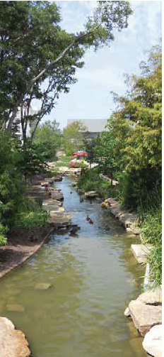
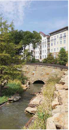
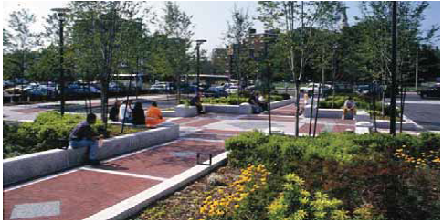
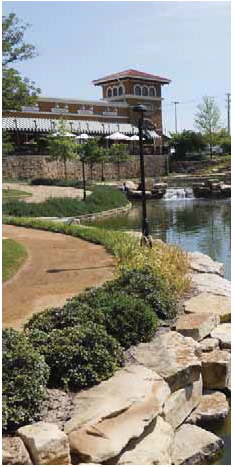
Connected, high-quality open space will form a key component of a long-term infrastructure program. The open space framework presented in the Plan is based on interconnected streets, trails and neighborhood parks. Development should leverage open space opportunities and integrate open space as part of the planning and development process. The City should encourage development to provide, operate and maintain public open space components as part of development agreements, thereby allowing development to implement and maintain portions of the open space framework. Dedicated funds, separate from existing Parks funding, should be established to provide key open space components that will catalyze development.
Utilities & Facilities
Planning and funding for public utilities and facilities is a critical component in realizing the vision for the M-150 corridor development. The infrastructure program should identify the needed capacities for all wet and dry utilities based on the densities envisioned in the Plan, including: water supply, water treatment, storm drainage and electrical substations.
Point source sustainable strategies should be included in a long-term infrastructure plan to minimize over-expansion of facilities. Strategies can include active and passive solar applications to reduce energy needs, primary and secondary on-site water treatment through retention basins to reduce water treatment, and water conservation applications to reduce water supply needs.
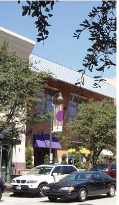
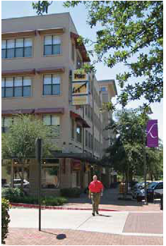
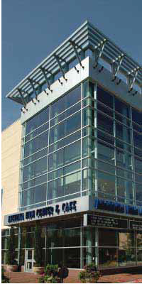
Build High-Quality Density
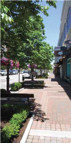
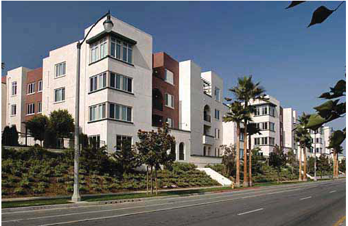
A key part of achieving the community vision for the M-150 corridor is to build higher density places than currently exist in Grandview. This type of development should be more compact, nodal development with higher residential densities and greater commercial intensity. Building denser higher-quality places will leverage development synergies and lead to lower total infrastructure costs, due to compact design; more multimodal options, due to a closer proximity to a range of uses; and increased municipal revenues, due to increased development and business growth. When evaluating development proposals, the City must ensure that approved developments achieve the densities recommended in the Framework Plan. These densities can be established through the development review process and the evaluation of Conceptual Development Plans, which must show residential densities and commercial intensity for approval of the Planning Commission and Board of Aldermen. The Board can also enforce the base densities by reserving economic incentives for projects that establish these densities.
Build a destination for the changing demographics
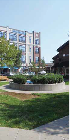
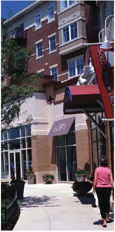
Nationally, projected demographic changes are expected to change development over the next 30 years. The US population is expected to grow older and more racially diverse; household types are also changing, as married couples with children decrease in proportion to single adults and other family types. Development along the corridor must meet the needs of current and future residents and visitors.
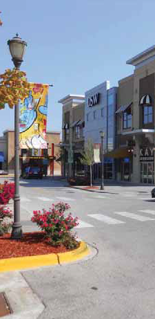
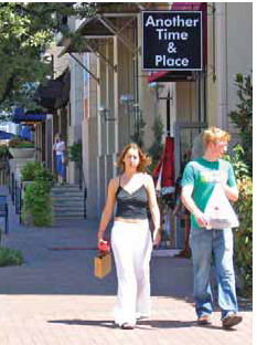
In addition, development along the corridor provides an opportunity to diversify the housing and commercial development available in Grandview. Existing commercial development is predominately low-intensity, strip development. Compact, nodal development will differentiate itself immediately from other commercial developments in Grandview or in neighboring cities. New development along the corridor must attract new residents with a range of housing types and prices, beyond the low density, single-family neighborhoods and conventional apartment complexes that characterize nearly all existing housing.
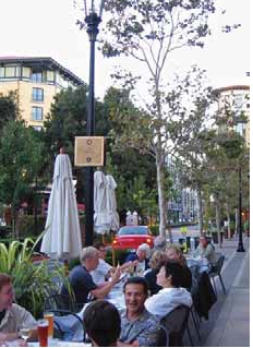
Higher density will create the land use and mobility synergies
This Plan recognizes that land use and transportation choices are integrated, with decisions in one area influencing the choices available in the other. The Plan's frameworks are built on a multi-modal infrastructure platform, accommodating autos, pedestrians, and bicyclists. While there is no existing transit service, the frameworks envision compact, nodal development that could support future transit expansion. Higher densities are necessary to support the full range of transportation options. Similarly, providing a variety of transportation choices allows greater flexibility to mix land uses and creativity to capitalize on amenities such as open spaces and trails.
Short-Term Strategies
A number of short term strategies have been identified that are envisioned as discreet projects that form essential components of the next steps to achieve desired development.
Create a Destination at Truman Corners
While the redevelopment of Truman Corners is not happening along the M-150 corridor, the impact of this project will definitely be felt along M-150. Truman Corners is a high-profile front door to Grandview, situated along I-49/US-71 where thousands of motorists a day see the development. Over the past twenty years, the decline of Truman Corners aesthetically and economically has resulted in a general decline in the perception of Grandview as a place to invest and a place to shop. One of the City's goals with this redevelopment project is to recapture some of the original development's allure and recreate the area as a regional magnet for shopping and dining. The resulting development will again play a key role in the perception of Grandview, a perception that will have ripple effects on the M-150 corridor.
Part of the planning process included the preparation of Design Standards & Guidelines for the M-150 corridor. The City should review this document and determine if it can be used to assess and evaluate redevelopment at Truman Corners. Additionally, a series of logical Frameworks Plans have been created for the M-150 Corridor and illustrated and described in the Plan. The city should consider if such framework plans would benefit development in this area and provide broader communication among the city and potential developers.
Create a Place at the West subarea
The West subarea, anchored by Gail's Harley Davidson dealership, is the gateway into the M-150 corridor from I-49/US-71. It is also most likely to be the first area along the corridor to develop, with the available infrastructure, level of existing development, and highway visibility. The evolution of this area from a handful of isolated businesses to a full-fledged destination, with a coordinated identity and sense of place with a horizontal mix of uses, is critical to set the tone for the further development of the M-150 corridor. A high-quality, integrated, and successful development in the West Subarea elevates the entire corridor and makes future development on the east side of Byars Road more attractive and feasible. Careful scrutiny of development proposals and coordination with potential developers will be critical to achieving short-term success in this area and the long-term benefits further along the corridor. To achieve this, the following actions are recommended.
Refine the framework plan included in the plan.
Meet with developers to create a framework of access, open space and land use that is market-based and meets the desires and visions of the community.
Assess the open space improvements.
Based on the refined framework plan above, determine the costs associated with improving the open space area, including: clearing desired areas, building a trail system, providing other public amenities.
Assess the transportation improvements.
Based on the refined framework plan above, determine transportation improvements needed to be made to implement the framework. Determine sections and improvements that should be provided by the public sector, and improvements that a developer should provide.
Prepare a conceptual development proforma to define development costs and revenues.
This tool may be used to understand possible gap financing needs, phasing options, or where the city could add value to the process, and seek a commensurate return via a development agreement.
Complete the Frontage Road on the south side of M-150
Frontage roads along M-150 are a key component of the road hierarchy framework. On the south side of the highway, there are long segments of frontage road that will create a foundation for the road system through the southern half of the corridor. However, the frontage road has some gaps, mainly between Grand Summit Boulevard and Byars Road and on the west side of White Avenue connecting to the I-49/US-71 Frontage Road.
Identify and Codify Key Public Easements
To achieve the long-term vision set out in this Plan, it is important that the City secure and protect essential public elements of the Plan. The City should identify the key public easements that will form a long-term block and infrastructure layout. It is important that this is done within the next 12 months so that developers understand the public commitments and locate buildings or particular systems in context to these easements. This should include the mapping and codification of future key open space (Oil Creek trail extensions, and the lake) and key streets (collectors identified at quarter-mile locations).
Build Achievable Open Space & Gateway Components
The future of the M-150 corridor is envisioned as a series of nodal development areas with landscape buffers between the nodes. To attract desired development, it is important to implement portions of the open space framework annually and to direct developer contributions in accordance with the Framework Plans.
In addition to the open space components, gateway features are envisioned at the I-49/US-71 interchange with M-150 and at the Park Hills Drive intersection. Gateway features can include a range of features and integrate vertical elements, nighttime lighting, city identifiers, and focal landscaping treatments. When the frontage road system connection with 147 th Street is completed, gateway treatments should be implemented at US 71/M-150.
Update Capital Improvement Plans
This Plan envisions future development to be more intense than other areas in the City. While this Plan acknowledges that this could take many years to achieve, it is important to identify long-term infrastructure requirements. A 10-year Capital Improvement Plan (CIP) for transportation, utilities, water treatment, and water quality should be updated. It is important that infrastructure improvements are sized and built for ultimate development intensities and provided with new development projects. Providing ultimate sized infrastructure could require additional capital costs, but will reduce future redevelopment barriers. While some costs may be over and above what a particular development should pay for, alternative funding should be in place to cover the financial gap to provide this infrastructure. The updated CIP should also include development thresholds that trigger required improvements.
Amend Zoning Ordinance & Future Land Use Map
The City's Zoning Ordinance and other codes related to development create a legal framework for evaluating development proposals and shepherding projects through the entitlement process. This plan identifies key amendments to the Zoning Ordinance, including rezoning key developable areas along the M-150 corridor, updating the Future Land Use Map in the Comprehensive Plan, and creating a Corridor Overlay District that will create the legal framework needed to achieve the vision for the M-150 corridor. Undertaking these amendments immediately will also prevent any short-term development that would be contrary to the Plan's vision.
Guiding & Funding Development
The implementation of the recommendations in this Plan will require focused leadership, strategic partnerships and a broad range of dedicated funding mechanisms.
The ability of cities to participate in private development projects faces several challenges in the near term, largely in response to general market conditions for municipal debt instruments, more conservative actions by debt rating agencies, and risk-avoidance that has spread across financial markets. As the U.S. economy recovers, the impediments to redevelopment will likely diminish. However, it is likely that rating agencies will remain conservative for several more years.
City participation in private development projects will need to include well-tested mechanisms and innovative financial solutions. City participation should be decided on a case-by-case basis based on the project size, viability, and private developer interest and commitment. The City should work closely with developers that are most proactive to develop catalyst projects that can then spur nearby supportive projects.
The City has an adopted Economic Development Incentive Policies manual that contains guidance on the use of various incentives, including Tax Increment Financing, Neighborhood Improvement Districts, Community Improvement Districts, and Transportation Development Districts. In addition to those policies, the following addresses a few of the tools available to the city to spur development in the M-150 corridor.
Local Revenue Tools
The term 'local revenue tools' is used to describe the set of tax and fee mechanisms (i.e. special property tax assessments or special purpose retail sales taxes) and government powers (like tax increment finance) that exist in Missouri and are available to the City to raise revenue to promote development and also potentially fund necessary infrastructure.
Local revenue tools available in Missouri fall into three general categories: tax-increment financing, special tax assessments and development impact based fees. Mechanisms available in Missouri have often historically been used more for economic development incentives as opposed to public infrastructure. In these scenarios, the mechanism is used to channel local tax revenues to developers to entice development in one place or another. While the tools are often the same, economic development and infrastructure value capture have very different and sometimes conflicting objectives. Research on the historical usage of these mechanisms indicates that in areas with strong existing market conditions, the local jurisdiction has the leverage to apply mechanisms to help finance public infrastructure. In areas without strong development potential, the local jurisdiction has historically used these mechanisms as economic development tools, to facilitate development by reducing developer costs.
Existing market conditions suggest that the City will need to use these tools as economic development mechanisms, particularly in the early stages of development. These tools can help incentivize development and assist in delivering catalyst projects that eventually serve to spur further new development. Ideally, during this later stage development, some of these same mechanisms can be used to pay for public infrastructure as the location becomes more established and a more compelling location for new development. As the location evolves from pioneering to established, the City will be better positioned to use these revenue tools to fund infrastructure as opposed to being used as developer incentives.
TIF and sales tax reimbursement agreements tap into increased revenue potential from forecast property and sales tax revenues based on current rates, while the three types of improvement districts incorporate special tax assessments in addition to current taxes to fund specific projects. The key difference between the two categories is that tax-increment based mechanisms divert future tax revenues that would otherwise be collected by the jurisdiction, while special tax assessments involve additional taxes on top of what the jurisdiction would collect from the project. Impact based mechanisms such as impact fees and excise taxes are generally charged directly to developers and property owners based on unit development quantities to raise revenues for various purposes.
Tax-Increment Based Mechanisms
In general terms, tax-increment financing is a mechanism for capturing all or part of the increased property or sales tax paid by a subset of properties within a designated area. TIF is not an additional tax, nor does it deprive governments of existing tax revenues up to a set base within the TIF district. Instead, part of or all of future taxes (above the set base level) resulting from increased property values or new development are dedicated to paying for the public improvement that caused the value increases and additional development.
TIF is most commonly used by local governments to promote housing, economic development, and urban redevelopment in established neighborhoods, but in some cases has been used to finance transportation projects, mainly public transit. TIF revenues can be used as they accrue on a pay-as-you-go basis, or can be bonded against. TIF revenues can be applied towards a broad range of development cost categories including a variety of public infrastructure improvements.
In the Kansas City region, the use of TIF has suffered from somewhat negative public opinion in recent years as the weak economy resulted in far lower revenues than sometimes forecasted, often requiring the local jurisdiction to cover shortfalls, depending on the deal structure. Nevertheless, TIF has been used to successfully redevelop areas throughout region.
Sales tax reimbursement agreements are a mechanism used in Missouri that allow for the use of future sales tax revenues to finance public infrastructure improvements. Grandview's local policy with these agreements is to encourage the improvement of existing underutilized retail spaces as well as incentivize adaptive reuse of historic buildings. In light of the City's current policy, sales tax reimbursement agreements appear less applicable for catalyzing new development. However, the City should consider revisiting this policy to make it more flexible to potentially encourage new retail development.
As development plans evolve at the site, this mechanism could be used to help attract a large anchor retailer to the site by allocating the incremental future sales tax revenue to the infrastructure improvements necessary to facilitate the retail. This mechanism was recently used by the City of Bowling Green, Missouri to facilitate the delivery of the Bowling Green Town Center, a new construction retail center. Forecast sales tax revenue from the new Wal-Mart anchor at the site was used to fund necessary road improvements at the site. In Kansas, the equivalent mechanism, sales tax revenue bonds ("STAR bonds") have been used aggressively by local jurisdictions to foster new retail development over the past decade. Although there are different project criteria requirements in each state, it is worth exploring whether the City could apply this mechanism in the context of new development in the future as retail plans evolve at the site or if it is limited strictly to revitalizing existing developments.
Special Tax Assessment Mechanisms
Special tax assessments are additional taxes paid within defined geographic areas where parcels receive a direct and unique benefit from a public improvement. Generally, the cost of the improvement is allocated to property owners within the defined benefit zone and collected in conjunction with property or sales taxes over a predetermined number of years. Once the annual assessment collections cover the cost of the improvement (or debt issued to pay for the improvement), the assessment is removed.
Implementation of special tax districts can be challenging relative to other mechanisms, as increases in property and sales taxes are politically sensitive and visible to affected property owners, businesses and local consumers. Before this mechanism becomes politically feasible, it will require additional effort to convince local landowners and businesses that the tax is worth the value of the infrastructure improvement. Once in place, however, they are relatively easy to administer and the additional taxes are collected along with current property tax.
Nationally, special tax districts are one of the most common forms of value capture for transportation projects. In Missouri, local jurisdictions have legal authority to use three types of special taxing districts: transportation development districts (TDDs), community improvement districts (CIDs), and neighborhood improvement districts (NIDs).
TDDs are available to any city or county in Missouri for the purpose of financing transportation projects. Eligible improvements include the following:
•
roads
•
bridges
•
interchanges
•
intersections
•
parking facilities
•
other transportation related improvements
TDDs generate revenues through the use of special tax assessments on property located in the TDD or a new sales tax within the defined district. The transportation sales tax can be up to one percent additional local sales tax within the district and special assessments can be up to 10 cents per $100. Because they require approval from all property owners in the proposed district, establishing a TDD with numerous property owners can be challenging, and often faces the least resistance in larger greenfield developments with a single property owner or only a small number of owners.
CIDs are structured similarly to TDDs but have more flexibility in a variety of ways. They can be used to pay for a broader range of costs beyond those of the TDD, including:
•
Land acquisition and construction costs;
•
Public infrastructure, including transportation related costs;
•
Ongoing maintenance costs.
Although the transportation cost category is the relevant factor for this analysis, CIDs also have greater revenue potential than TDDs because they are allowed to levy a higher maximum sales tax of two percent, compared to one percent allowed under a TDD. Like the TDD, revenues can also come from special tax assessments on real estate as well as through sales taxes. Unlike the TDD, CIDs only require 50 percent approval of property owners, based on both assessed value and per capita. As a whole, CIDs offer more flexibility than TDDs in terms of eligible public improvements. However, a key advantage to using a TDD is that funds can be used to pay for transportation costs located outside of the TDD boundary while CID funds must be used within the CID boundary.
Although CIDs offer greater flexibility with respect to eligible costs, the intentions of developers and those of the local jurisdiction for the use of a CID are not always aligned. The proportion of CID revenues that go towards the developer's project costs will directly impact how much is left to go towards any public infrastructure.
NIDS offer another variation of special property tax assessment to fund public improvements. NIDs require either a favorable vote by those living in the NID boundary, or a petition from two thirds of the property owners within the proposed boundary. Revenue generated by a NID can be applied to a broad range of public improvements, including the following:
•
Acquisition of property;
•
Improvement of streets, sidewalks, crosswalks and all related components;
•
Landscaping streets or other public facilities including improvement of area walls on public ways;
•
Drainage, storm and sanitary sewer systems and service connections from utility mains, conduits and pipes;
•
Improvement of waterworks and flood control works;
•
Improvement of streetlights and street lighting systems;
•
Improvement of parks, playgrounds and recreational facilities;
•
Improvement of pedestrian and vehicle bridges, overpasses and tunnels;
•
Improvement of property for off-street parking;
NIDs require more scrutiny and involvement from the City as they entail general obligation bonds backed by the full faith and credit of the City.
Development Impact-Based Mechanisms
Development impact fees and excise taxes are one-time charges collected from developers and/or property owners to fund public infrastructure and services made necessary by new development. Impact programs are most successfully implemented in areas poised for significant growth with little or no existing development. Generally, rates are based on a formula taking into consideration the number of new dwelling units or square feet of non-residential space and the relative benefit the infrastructure provides the property. For transportation projects, relative benefit is usually determined by the distance a development is located from the improvement.
Development impact fees are often applied to highly localized improvements and provide a clear link between fees collected and benefits received. For instance, a residential impact fee may go to pay for sewer connection. However, they are also used programmatically for large scale projects, such as the impact fee program in Orange County, California which helps pay for the highway system developed in the southern half of the county to help connect large outlying tracts of developable land.
Politically, the mechanism is generally well-accepted, as fees are levied against new development rather than existing residents and business owners. Similar to TIF, the perception that imposing impact fees on new development allows improvements to "pay their own way" may increase public acceptance. However, in some instances, fees have become too onerous and have reduced the competitiveness of certain areas. Fees that are higher than one or two percent of the cost of a property could impact that property's competitiveness relative to a similar property with no fee, as fees are usually passed through from developers to buyers and/or tenants in the form of higher home prices or commercial rents.
Impact fees are less effective in scenarios where development needs to be incentivized as these could serve to further hinder development potential. As such, this mechanism is likely more applicable as a revenue generating tool in later stages of development as the site becomes more established.
Revenue Potential by Category
By definition, each of these general categories has a different type of tax/fee structure, each resulting in a unique financial profile in terms revenue stream stability, predictability, growth over time, and overall risk and return.
The typically stable growth and minimal long-term volatility of property values makes TIF a more reliable stream of revenues to bond against. Figure 1 highlights the revenue potential of a hypothetical TIF district, reflecting both the existing baseline tax revenue and the incremental revenue above the base that can be applied to the proposed improvement.
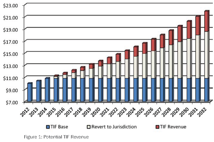
Potential TIF Revenue
The typical TIF revenue curve, denoted in red in Figure 1, tends to begin at a lower level and increase at a higher rate relative to other revenue collecting mechanisms, as property values increase over the period.
Because special taxes represent additional taxes on existing property in the defined district, the revenue stream tends to begin at a higher level compared to TIF. However, because it is typically limited to a certain maximum percentage, the upside growth potential of special tax is more limited relative to TIF revenues.
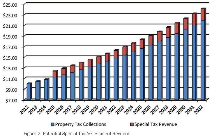
Potential Special Tax Assessment Revenue
Figure 2 represents the same total property tax revenue as the TIF scenario, with an additional special tax denoted in red. The special tax generally results in a revenue stream curve that begins at a higher amount and has more stability but less upside in terms of future growth potential relative to TIF.
Revenue streams from impact fees tend to be much more volatile and unpredictable relative to TIF and special assessments. This is because the revenue is contingent upon new real estate development, which tends to be heavily cyclical and extremely sensitive to regional and national economic conditions.
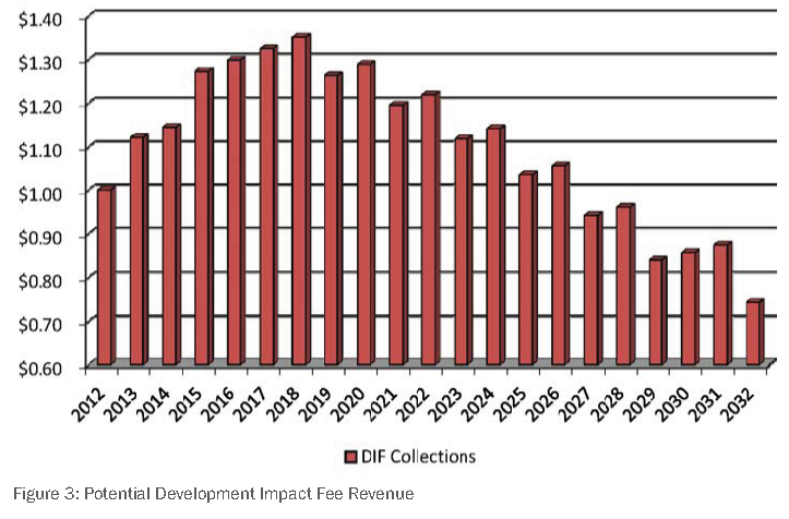
Potential Development Impact Fee (DIF) Revenue
Although there is no typical impact fee revenue stream, historical permitting and development activity in and around the designated area can be analyzed to gain a better estimate of future revenue. The above hypothetical scenario shows an initial increase in impact fee revenue as development increases due to the infrastructure improvement, followed by a gradual decline as the defined area becomes built out over time. See Figure 3.
Summary
The three general value capture categories tend to demonstrate different revenue profiles over time, depending on how they are structured as well as development patterns in the designated area. As shown in the chart below, TIF revenues tend to begin at lower levels but experience higher growth over time compared to special tax revenues, which typically begin at a higher level but experience slower growth. Although TIF revenue tends to have higher growth potential compared to other tools, it can also be more challenging for the local jurisdiction to accurately quantify the present value of the future revenue. As such, analysis of numerous growth scenarios is recommended to better understand the bonding capacity of these future revenues.
Economic Incentives
Due to a range of issues, including community need, job creation or market timing, the utilization of economic incentives may be required to build some of the recommendations contained this Plan. Typical economic development incentives include: property tax abatements, valuation offsets, exemptions, sales tax rebates, impact fee waivers, forgivable loans, below market rate financing, and grants and gifts. These mechanisms are not listed in the Local Revenue Tool section because they do not typically serve to directly generate local revenue to the City in the short term.
As such, unless a beneficial community need is being achieved, sustained economic incentives are not recommended for any particular project.
Additionally, economic incentives should not be considered unless this method is determined necessary to compete with other regional areas for an attractive business prospect, or to encourage specific development that is consistent with the overall growth strategies, but would not occur without economic incentives.
Each project considered for economic incentives should be evaluated based upon community benefit, revenue generation, and types of economic incentives possible to achieve the desired development. Representative examples of potential projects that could be eligible for city supported economic incentives could include pioneering projects that could catalyze successional development; higher-risk redevelopment that could reduce longer term infrastructure costs; projects that provide community benefit and include an acceptable profit potential; and projects that serve a broader community purpose that would not occur otherwise.
Other Development Strategies
A range of development strategies may be utilized to achieve desired development along the corridor. Tax Increment Financing and Public Private Partnerships (PPP) are both funding sources that can be part of a development strategy. Additionally, land-banking can be utilized to leverage future development.
Projects or substantial participation in Public-Private Partnerships will require general revenue and debt financing that could include the issuance of bonds.
Public-Private Partnerships and Joint Development
Some of the development projects envisioned for this corridor will require funding amounts beyond what the City of Grandview can typically provide. Many of the recommendations contained in the Plan could benefit from appropriate PPPs, in which a formalized relationship is developed between single or multiple public agencies, and single or multiple private sector or institutional entities, can be customized to address particular development requirements, but for this arrangement, would not be possible to achieve within the specified timeframe. The public sector has a range of development tools and incentives to benefit development, including tax reductions, provision of publicly owned land, financing capabilities, services in exchange for investment, and job creation by developers and businesses. The private sector has access to capital, professional development services, and construction expertise.
The creation of a successful PPP is complex and often prepared under the leadership of the City's chief administrative officer and legal staff. These programs are especially useful for a city to engage in a range of activities aimed to successfully realize economic development, including:
•
land assemblage;
•
credit financing options for land purchase;
•
site preparation for development;
•
public improvements;
•
public entity loan guarantees for developers;
•
CBDG and other funded programs; and
•
loans and grants.
Land-Banking
Land-banking is a strategy that can be used by a municipality to build a long-term vision. In this case, a municipality can purchase key parcels when they become available prior to improvement. This is a technique that can be used when assemblage would be required to achieve a broader vision, or when select parcels are part of a broader development vision and become available prior to redevelopment.
Timing and Applicability of Mechanisms
The broad spectrum of mechanisms available to incentivize development and fund infrastructure have various levels of importance and applicability at different stages of the long-term development cycle. For a site considered somewhat pioneering for new development, the most aggressive measures should be considered in the early stages to incentivize catalytic development and reward the private sector entities willing to take the most risk in these early stages of development. As such, the most generous mechanisms such as tax abatement should have the biggest impact in this initial stage of development. They should, however, be used sparingly and only in situations where the new construction should lead to ongoing successional development.
Tax increment and special district mechanisms become more applicable as the area becomes somewhat more established and has generated a track record of reliable tax revenue streams that may be bonded against. Finally, in later stages of development, after the critical mass has been established and the area has evolved into a more attractive, lower-risk destination for new development, mechanisms such as development impact fees can serve to pay for ongoing infrastructure needs.
Other Sources of Public Funding
Moderate public funding can be established from general revenues, and be used for business loans, grants and minor land purchases, and can include federal, county, state and local funds.
Federal
Federal funding in the form of Community Development Block Grants (CDBG), HUD grants and other programs could fully or partially fund planning and pre-development costs. Additional programs, related to increased mobility, could provide funds for pedestrian bridges and trail improvements. Some of these funds may be available through the Mid-America Regional Council (MARC), which manages Surface Transportation Program, Congestion Mitigation/Air Quality Program, and Transportation Enhancement Program funds. Grandview has had several recent successes in securing funds from these programs for key transportation-related projects, such as the Main Street project, and should continue to pursue these funds for improvements along the M-150 corridor.
State
The State of Missouri is another source of grant funds that could be applied for planning and pre-development costs, although programs of this type can be very competitive. Funding from the Department of Transportation (MoDOT) could fully or partially fund connector roads, pedestrian bridges and vehicle bridges. Local contributory funding may be required.
County
Jackson County could provide funds for planning and regional economic development. Local contributory funding may be required. The City should pursue future County Urban Road System (CURS) funding for some road network improvements along the corridor and should work with the County to designate future streets, such as the extension of Byars Road, as CURS routes in order to make these road segments eligible for this funding source.
Targeted Funding Strategies
Funding for infrastructure improvements, as well as gateway, aesthetic, and landscape buffer features will cost millions of dollars over multiple decades of the development program. Funding infrastructure will require multiple approaches and sources that will likely include federal (CBDG) funding, state (MoDOT), county, grants, gifts, sponsorship arrangements, targeted sales tax, fee revenues, business community participation, and local general obligation (GO) bonds. Based on the funding types and sources discussed in the previous section, the following suggests how some funds could be employed to realize development.
Targeted program funds could be created for the provision and operation of various corridor improvements. These program funds could collect revenues from multiple sources to populate and grow the fund. The following funding strategies illustrate what could be accomplished for partial or complete funding for any or all projects identified in the redevelopment program. Additionally, these funding strategies could provide contributory or matching funding required by federal, state or county programs for specific improvements, including: streets, bridges, environmental and landscape features. For example, a targeted program fund could be created for beautification and include landscaping and gateway improvements, while a different fund could be created to support funding for corridor infrastructure.
Beautification Fund
Beautification funds might support landscaping, screening, buffering, streetscaping, and park features described for the illustrative plans. This may also include partial or whole funding for gateway features within these areas. There are several potential sources for this funding including dedicating a portion of sales tax revenues to the fund, depositing general revenues into the fund, or issuing bonds to seed this fund. Tax Increment Financing could also provide revenue for these funds. Grants, corporate gifts, sponsorships, and public fund raising may also be used as revenue sources. Any of these sources may be counted as matches to leverage other donations and grants. If this mechanism is chosen for implementation, it should be created immediately to begin to create a fund balance, even if initial deposits are token amounts.
Corridor Infrastructure Fund
Similar to the Beautification Fund, this approach would create a targeted fund for accumulating monies to support the development of ancillary transportation infrastructure including interior roads, bicycle and walking paths, and contribute funds to the pedestrian bridges proposed in the illustrative plans. Given the level of funding required for the anticipated infrastructure improvements, these activities could require city and county bonding - the creation of a targeted fund would assure voters regarding the use of bond funding. However, the city may also engage in a fund raising program, similar to the beautification fund, identifying public and private sources of revenues. For example, the city could obtain a corporate sponsor for a pedestrian bridge.
Development Policies
Establishing consistent guidance and regulations for new development through public policies will provide quality assurances for the City, while offering predictability of processes and approvals for developers and investors. Additionally, properly crafted and administered policies can create a transparent review and approval process that can save significant time for applicants, and therefore, provide significant development incentive. This section outlines the policy recommendations that are required to achieve desired development and community character, and should be adopted as part of this Plan.
Corridor Land Use Framework & Future Land Use Map
The M-150 Sustainable Corridor Development Plan includes a Land Use Framework that defines land use designations for the study area (figure 6, page 32). This framework is based on market opportunities, proximity to quality mobility and adjacent uses. It includes both land use designations previously used in the City and new land use designations that are unique to the conditions along and vision for the M-150 corridor. While the Land Use Framework has been adopted as part of the overall corridor plan, these designations should also be incorporated into the Future Land Use map that is part of the City's Comprehensive Plan.
Land Use Typologies
Land use typologies have been created as part of this Plan based on existing land use policies. Four development-based land use typologies and four open space-based land use typologies have been defined. Each of the new typologies provides overall development guidelines. These typologies should be used in conjunction with the City's current land use designations to allow development more flexibility in providing an essential mix of uses. These typologies can also be used to determine whether a conceptual development plan submitted for City approval is in conformance with the established vision for development along the corridor, by comparing the proposed development to the appropriate typology's identified characteristics.
Corridor Overlay District
An overlay district should be created to identify formally the properties that must be in accordance with the recommendations contained in this Plan as well as those subject to the Design Guidelines. The district should encompass all key parcels along the corridor, including parcels that can be readily accessed from the local road system, and parcels that will contribute to the community character along the M-150 corridor. The breadth of the district should extend the width of M-150 within the city limits in the east-west direction, and extend one-half mile north and south of M-150. The total area of the overlay district will be approximately two square miles. The recommendations within this Plan should apply to areas within the overlay district. This district may be amended to include other areas if the recommendations in this Plan are determined to be consistent with other proposed areas with the City.
Design Standards & Guidelines
Design standards and guidelines are intended to enable the City to work together with the development and business communities in achieving the vision for M-150 corridor. The guidelines are divided into two types: guidelines and standards. The guidelines are general statements describing ideal development along the corridor. The standards are basic requirements for any development or redevelopment along the M-150 corridor. The use of these two types of statements is intended to: give flexibility to the developer or applicant to respond and contribute to the corridor vision in advance of a submittal, give the City of Grandview a basis on which to make judgments so that its determinations are not arbitrary, and give certainty to the City of Grandview and its citizens that the corridor vision is met and that the quality described is maintained.
Zoning Ordinance Amendments
The Grandview Zoning Ordinance includes all regulations guiding development within the City, and this plan does not supersede those requirements and standards. A majority of land identified as developable by the plan is currently zoned Planned District, which permits the developer to propose development through a Conceptual Development Plan with limited constraints from the Zoning Ordinance. Conceptual Development Plans are subject to public hearings and final approval by the Board of Aldermen. Within this structure, the corridor plan, its land use typologies, and the design guidelines may be used to establish whether proposed development furthers the plan's vision and thus should be approved by the Board of Aldermen. The identified developable areas that are not currently zoned Planned District are the areas on the south side of M-150, except for the Grand Summit apartments. These areas should be the subject of a City-initiated rezoning to Planned District.
Right-of-Way Transition Typologies
Typology diagrams are contained in the Design Standards & Guidelines appendix to this Plan, and provide development guidance regarding the transition areas between the M-150 frontage road and adjoining land use conditions including entry drives, screened parking lots, open space and private development. Specific standards are included in the typologies. These typologies should also be used to guide the design of new public and private streets along the corridor.
![]()
Management & Organization
The recommended Plan elements and financing requirements will require a number of planning and administrative changes to be implemented. The specific planning and administrative recommendations are outlined below and include the creation of the development review committee, and the clarification of key roles and responsibilities of City department functions related to development.
Development Review Committee
Quality standards serve to ensure high quality, desirable redevelopment. As part of this Plan, Design Standards & Guidelines have been prepared to guide development specifically along the M-150 corridor. Development applications should be reviewed against these guidelines. While the Design Standards & Guidelines provide direction to design quality, it is anticipated there could be situations where the guidelines do not provide enough objective direction. For these instances, a Development Review Committee (DRC) should provide leadership to ensure design quality. The DRC could function as a subcommittee of the Planning Commission that is focused on development within the proposed M-150 Corridor Overlay District. The DRC should include additional members of the real estate profession, and may include urban planners, architects, real estate brokers, and developers.
Unlike other Grandview boards and commissions, the DRC should be comprised of contracted on-call members who receive a small stipend in exchange for their professional review and advice. Using professional on-call services would ensure immediate action and quality feedback for applicants without comprising the short timeframes that are a benefit to developers in Grandview. This format is used successfully in other suburban communities around the country, such as Denver, CO; Kuna, ID; Provo City, UT; Olive Branch, MS; Andover, KS and Salina, KS.
Administrative Roles and Responsibilities
Critical to the success in achieving desired development along the M-150 corridor will be the ability for the City to create a development-friendly review and approvals program, monitor the range of economic benefits to the City, and successfully negotiate complex development agreements that represent the community's best interest.
Since the type and complexity of development envisioned for the M-150 corridor will be different than traditional development types, the City should consider retaining a development director with experience in mixed-use development, in addition to establishing the Development Review Committee. This person could supplement the existing staff capacity to manage development with specialized expertise and could function as on-call staff until such a time as development along the corridor requires a full-time staff member.
The following describes the key roles and responsibilities by department or entity.
Board of Alderman
•
Establishes redevelopment districts by ordinance to freeze tax base for future tax increment financing, to create bonds for infrastructure, incur debt for public investment, aggregate property, realize revenues from tax increment financing, and utilize the police powers of eminent domain.
•
Establishes Public Improvement Districts by ordinance.
•
Provides direction to development director and city departments through City Administrator.
•
Approves Conceptual Development Plans for development and redevelopment in Planned Districts along the corridor.
Planning Commission
•
Reviews and holds public hearings on all conceptual development plan applications and rezoning requests and makes recommendation to the Board of Alderman for approval or denial.
•
Oversees the Development Review Committee.
Development Review Committee
•
Governs the Corridor Overlay District.
•
Oversees development activities within the district.
•
Receives funding from development district.
•
Reviews all development applications within the development district.
•
Makes recommendation to Planning Commission for approval or denial.
•
Recommends updates and amendments to the Design Standards & Guidelines.
•
Has representation by the development community, neighborhood, Planning Commission, local businesses, city staff, planning and design professionals and the Chamber of Commerce.
Community Development Department
•
Provides staff support to the Planning Commission and Development Review Committee with the review and assessment of development applications.
•
Updates the Design Standards & Guidelines.
Development Director
•
Assists the Community Development Department with the review and assessment of development applications.
•
Review development applications for consistency with the Design Standards & Guidelines.
•
Provides expertise in legal and policy issues, economic development, funding sources and financial modeling, and redevelopment.
•
Provides staff support to Public Improvement Districts.
•
Provides direction to the Development Review Committee.
Public Works Department
•
Manages design and construction of capital improvement projects.
•
Assists the subcommittee with the review and assessment of development applications.
Taken together, the short-term strategies, funding sources and financing strategies, and an enhanced management and organizational structure will help to realize the successful development of the M-150 corridor and provide sustained economic benefit.
Preliminary Fiscal Overview
Because development at the M-150 site is still in its infancy, detailed estimates of fiscal and economic benefits are not easily measurable at this time. Ideally, more detailed fiscal and economic impact studies should be conducted as development plans evolve, and there are more refined estimates of future development by land use at the project level. As development plans become clearer, these types of analyses are recommended to assist the City with determining the pros and cons of using various economic incentives and revenue tools.
We can, however, speak conceptually about the various fiscal and economic impacts by the varying hypothetical development scenarios shown below.
Low Density/Status Quo: This scenario is based on existing MARC long-range forecasts plus increased demand potential resulting from the NNSA and CenterPoint developments. This scenario assumes continued low-density residential zoning patterns with eventual demand for grocery-anchored strip retail.
Higher Density/High Growth Scenario: The high-density/growth scenario assumes a mix of low, medium, and high-density land uses. We believe this to be the most likely scenario with strong placemaking efforts, higher-density flexible zoning, coupled with aggressive economic development efforts, and innovative use of revenue generating mechanisms.
Catalytic Growth Scenario: This scenario assumes the maximum development potential based on higher-density zoning and numerous catalytic market events. These include economic development efforts that successfully yield the relocation of major employers to the site; strong placemaking; and greater than fair-share capture of residential demand from nearby employees at NNSA, CenterPoint, and other new, large employers.
Without any refined estimates of housing price potential, an accurate estimate of the positive fiscal benefits of the higher density scenarios is not possible. However, it is safe to assume that the positive fiscal impact resulting from increased property tax revenue in the higher density and catalytic growth scenarios would be significant due to a number of factors. Under these scenarios, residential density is 2.5 to 4.5 times higher than the status quo scenario. A higher amount of units on the same land will yield higher property tax revenue. Although achievable pricing for smaller, denser residential product will be significantly lower, and will include a higher share of rental units, resulting in lower per unit property tax revenue, this lower assessment will be offset by both the fact that there are significantly more units, and that these smaller units will tend to have fewer school age members than those in larger, detached units.
Regarding the impact of commercial space, similar logic applies in that the higher density and catalytic scenarios entail development that is as much as 10 to 15 times as intense as the status quo. Such development will have a very positive economic impact in terms of initial construction jobs as well as long-term economic impact from on-site employment, indirect benefits from business investment and employee retail expenditures, and other indirect and induced impacts. Such intense commercial development will have a positive fiscal impact as well, as the various fiscal revenue categories from commercial users, such as business licenses and sales tax, will be significantly higher than in the status quo scenario.
Along with the fiscal impact upside, assuming that approximately half of the high growth and catalytic commercial development consists of retail, the revenue potential of a hypothetical assessment district, such as a TDD, CID, or NID, can be compared to the baseline assumption of 50,000 to 90,000 square feet of retail in the status quo scenario. Assuming $300 per square foot of annual retail sales, a 1% special assessment sales tax would yield approximately $270,000 in annual revenue for 90,000 square feet of retail (the high end of the range for the status quo scenario). In the higher density scenario, 300,000 square feet of retail development would yield $900,000 per year that could be applied to public improvements. In the catalytic scenario, assuming 450,000 square feet of retail would yield $1.35 million in improvement district revenue per year.
The debt capacity of these hypothetical revenue streams can then be estimated using a variety of assumptions to determine the upfront revenue that could be applied towards public infrastructure needs at the project. There are a number of variations of financial transaction structures and credit instruments that could be used to accelerate these hypothetical sales tax revenues, but for this analysis, the following relatively simple and conservative assumptions were used:
1.
A 1.75X (times) debt service coverage ratio was applied to the sales tax revenues. It is likely that a lower coverage ratio (i.e., 1.5X) may be acceptable, but the higher ratio provides additional security.
2.
The revenue remaining after subtracting debt service coverage from net revenue was discounted at six (6) percent, representing a blended long term interest rate applicable to various municipal debt instruments that might be used for the transaction.
3.
After summing the discounted cash flows, five (5) percent was subtracted representing estimated transaction costs and another ten (10) percent was subtracted representing the required debt service reserve funds. A debt service reserve fund may not be required but is another conservative assumption.
Assuming a 20-year period and no escalation or inflation in sales tax revenue over time, the following summarizes the upfront debt capacity of each hypothetical sales tax assessment district:
This hypothetical scenario indicates that the additional amount of potential special tax revenue available to fund public infrastructure available in the higher growth and catalytic scenarios is three to five times as much as that generated by the status quo. Although the specific rules of each special tax mechanism vary in terms of total additional taxes allowed, length of debt term, and other factors, this preliminary scenario underscores the revenue generating potential of significantly higher amounts of commercial development.

Next Steps
The adoption of the Plan documents is just the beginning of the City's work to achieve the vision for the future of the M-150 corridor. The next steps identified here are intended to help the City move forward successfully on the Short Term Strategies of this Plan.
Celebrate the Plan
The City has spent valuable time and energy on engaging the community during this planning process. Those efforts should not end with the Plan's adoption. Instead, ongoing engagement methods ought to build on the planning process in order to publicize the City's achievement in completing and adopting the Plan. Celebrating this achievement validates the time and effort of those who participated in the process and demonstrates the City's commitment to the adopted Plan.
Celebrating the Plan ought to include proactively sharing it with key stakeholders, including property owners, the business community, and developers. The City has already taken some steps in this regard, by sharing the adopted Framework Plan with a key property owner and with developers expressing interest in Grandview and by sharing the Plan's frameworks at the School District's community open house in August. Continuing this practice and exploring additional ways to publicize the Plan, including in the Jackson County Advocate, the Chamber of Commerce newsletter, and at future community events, will help create a citywide commitment to achieving the Plan's vision.
Update Development Policies and Codes
As described earlier, creating the legal framework for implementation of this Plan will require a series of updates to the City's existing development policies and codes. These will include establishing the Corridor Overlay District and the Development Review Committee, rezoning key parcels along the corridor, and updating the Future Land Use Map. Some of these updates are relatively straight forward and might be completed through the work of City staff as soon as the first quarter of 2013. Others, such as the Development Review Committee, are a more significant change and may need additional discussion with the Board of Aldermen and Planning Commission.
Decide on Areas of Focus
The seven Short Term Strategies identified in this Plan entail a comprehensive work program for the City, requiring the efforts of both staff and the Board of Aldermen. The City should establish areas of focus for immediate action. The areas of focus ought to be determined by a consensus between the Board of Aldermen, the Planning Commission and the future Development Review Committee, and City staff.
Identify project costs & funding strategies for priority projects
The full implementation of this Plan anticipates a range of public improvements: new streets, sidewalks and trails, utility extensions, and open spaces. One of the important first steps in the design and construction of these improvements is to identify which public improvements are the City's highest priority and then to estimate costs for those priority projects. That information can then be programmed into the City's Capital Improvements Program and used in the pursuit of outside funding. The Public Works and Parks and Recreation Departments, in conjunction with the Community Development Department, might take the lead in identifying these costs.
Once project costs are estimated, the City should identify appropriate funding strategies and aggressively pursue funding for these projects. The City has a strong record of success, particularly through the Public Works Department, in securing and leveraging outside funding sources and can build on those successes to secure additional funds. In addition, the Board of Aldermen should consider which other funding strategies identified in this Plan are most appropriate for short term use to realize priority projects.
Engage a redevelopment consultant
A redevelopment consultant, providing redevelopment expertise until the level of development activity might require a full-time staff position, might supplement the existing professional capacity of the City staff with specialized expertise with redevelopment concerns. The City should engage in an RFQ process in order to select a redevelopment consultant that might fill this role in an on-call basis. Engaging a redevelopment consultant as a next step will allow the City to be prepared for development proposals and possibly to tap the consultant's experience when redevelopment concerns arise related to other short-term strategies.
Seek joint development partnerships
Development partnerships with a private sector partner offer the City additional opportunity to achieve development that would not be possible by either the public or private sector alone. Finding appropriate partnerships is a process that may take an investment of time by the City. This effort might build on the existing contacts and relationships, but may also require reaching out to new partners and proactively approaching regional and national developers in order to build new relationships.
The City ought to be highly selective in determining which developers are appropriate partners. Not every potential developer along the corridor will have the expertise to be successful; not every potential partner will share the City's vision for the future of the M-150 corridor. While the City should begin seeking potential partnerships immediately, it should also recognize that the right partnership is more important than entering into a partnership with the first firm to show interest in the corridor.