
Lafayette City Zoning Code
SECTION 26
3.- ZONING MAP
Sec. 26-3-1.- Zoning map.
The location and boundaries of the zone districts established by this chapter are shown upon the "zone district map of the City of Lafayette", which is incorporated into this chapter. The zoning map, together with all data shown thereon and all amendments thereto, is by reference made a part of this chapter. The zone district map shall be identified by the signature of the mayor, attested by the city clerk, and bear the seal of the city and the date of adoption. Changes in the boundary of any zone district shall be made only by amendment to this chapter and shall promptly be entered on the zone district map. The zone district map shall be located in the office of the city planning department and copies made available to the public at a moderate price.
(Ord. No. 1986-01, § 2, 2-4-86; Ord. No. 1998-29, § 1, 8-18-98; Ord. No. 2011-33, § 13, 9-20-11; Ord. No. 2019-06, § 2, 2-19-19)
Sec. 26-3-2. - Old Town neighborhood overlay district boundaries.
The Old Town neighborhood overlay district shall consist of, and include those properties shown in figure 1 below, and shall be shown on the "Zone District Map of the City of Lafayette":
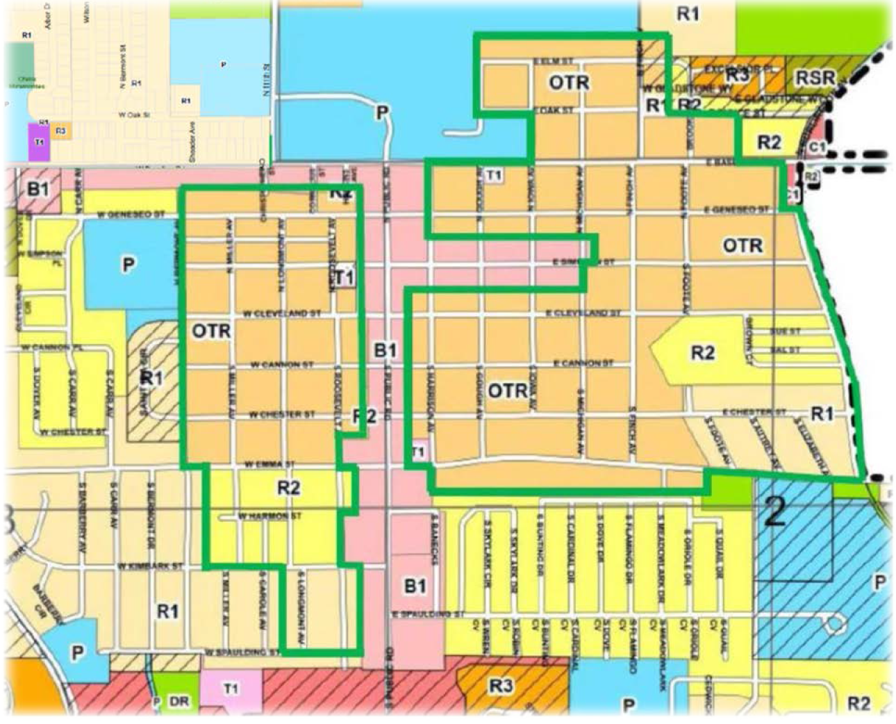
Figure 1
(Ord. No. 2017-30, § 2, 9-5-17)